Brandenberg Nw Topo Map Montana
To zoom in, hover over the map of Brandenberg Nw
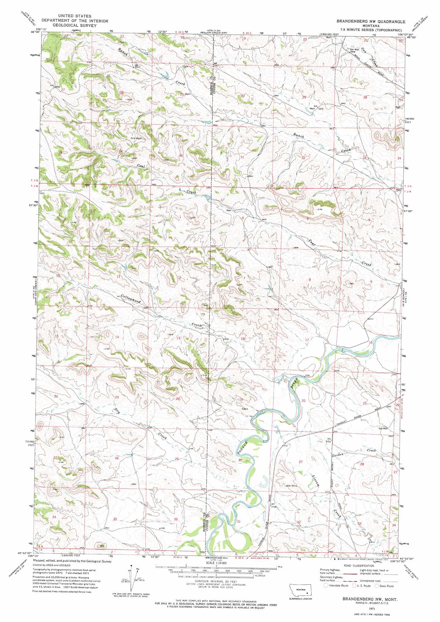
USGS Topo Quad 45106h2 - 1:24,000 scale
| Topo Map Name: | Brandenberg Nw |
| USGS Topo Quad ID: | 45106h2 |
| Print Size: | ca. 21 1/4" wide x 27" high |
| Southeast Coordinates: | 45.875° N latitude / 106.125° W longitude |
| Map Center Coordinates: | 45.9375° N latitude / 106.1875° W longitude |
| U.S. State: | MT |
| Filename: | o45106h2.jpg |
| Download Map JPG Image: | Brandenberg Nw topo map 1:24,000 scale |
| Map Type: | Topographic |
| Topo Series: | 7.5´ |
| Map Scale: | 1:24,000 |
| Source of Map Images: | United States Geological Survey (USGS) |
| Alternate Map Versions: |
Brandenberg NW MT 1971, updated 1974 Download PDF Buy paper map Brandenberg NW MT 2011 Download PDF Buy paper map Brandenberg NW MT 2014 Download PDF Buy paper map |
1:24,000 Topo Quads surrounding Brandenberg Nw
Rosebud Buttes |
Indian Creek |
Miller Creek Nw |
Moon Creek School |
Jack Creek Nw |
Mitchell Coulee |
Crain Place |
Miller Creek Sw |
Miller Creek |
Garland School |
Hammond Draw Nw |
John Hen Creek |
Brandenberg Nw |
H S School |
Fourmile Creek |
Hammond Draw Sw |
Hammond Draw |
Brandenberg |
Hayes Point |
North Stacey School |
Garfield Peak |
Ashland Ne |
Cook Creek Reservoir |
Beaver Creek School |
Stacey |
> Back to 45106e1 at 1:100,000 scale
> Back to 45106a1 at 1:250,000 scale
> Back to U.S. Topo Maps home
Brandenberg Nw topo map: Gazetteer
Brandenberg Nw: Streams
Cottonwood Creek elevation 822m 2696′Dry Creek elevation 827m 2713′
Garden Creek elevation 821m 2693′
Liscom Creek elevation 824m 2703′
Brandenberg Nw: Wells
02N44E13ACBB01 Well elevation 860m 2821′02N44E23DCBA01 Well elevation 859m 2818′
02N44E24CDCC01 Well elevation 922m 3024′
02N45E03BBBA01 Well elevation 841m 2759′
02N45E20CDDC01 Well elevation 827m 2713′
02N45E20CDDD01 Well elevation 828m 2716′
02N45E32CBBB01 Well elevation 837m 2746′
03N44E25ACDC01 Well elevation 896m 2939′
03N44E25ACDC02 Well elevation 896m 2939′
Brandenberg Nw digital topo map on disk
Buy this Brandenberg Nw topo map showing relief, roads, GPS coordinates and other geographical features, as a high-resolution digital map file on DVD:
Eastern Montana & Western North Dakota
Buy digital topo maps: Eastern Montana & Western North Dakota