Miller Creek Topo Map Montana
To zoom in, hover over the map of Miller Creek
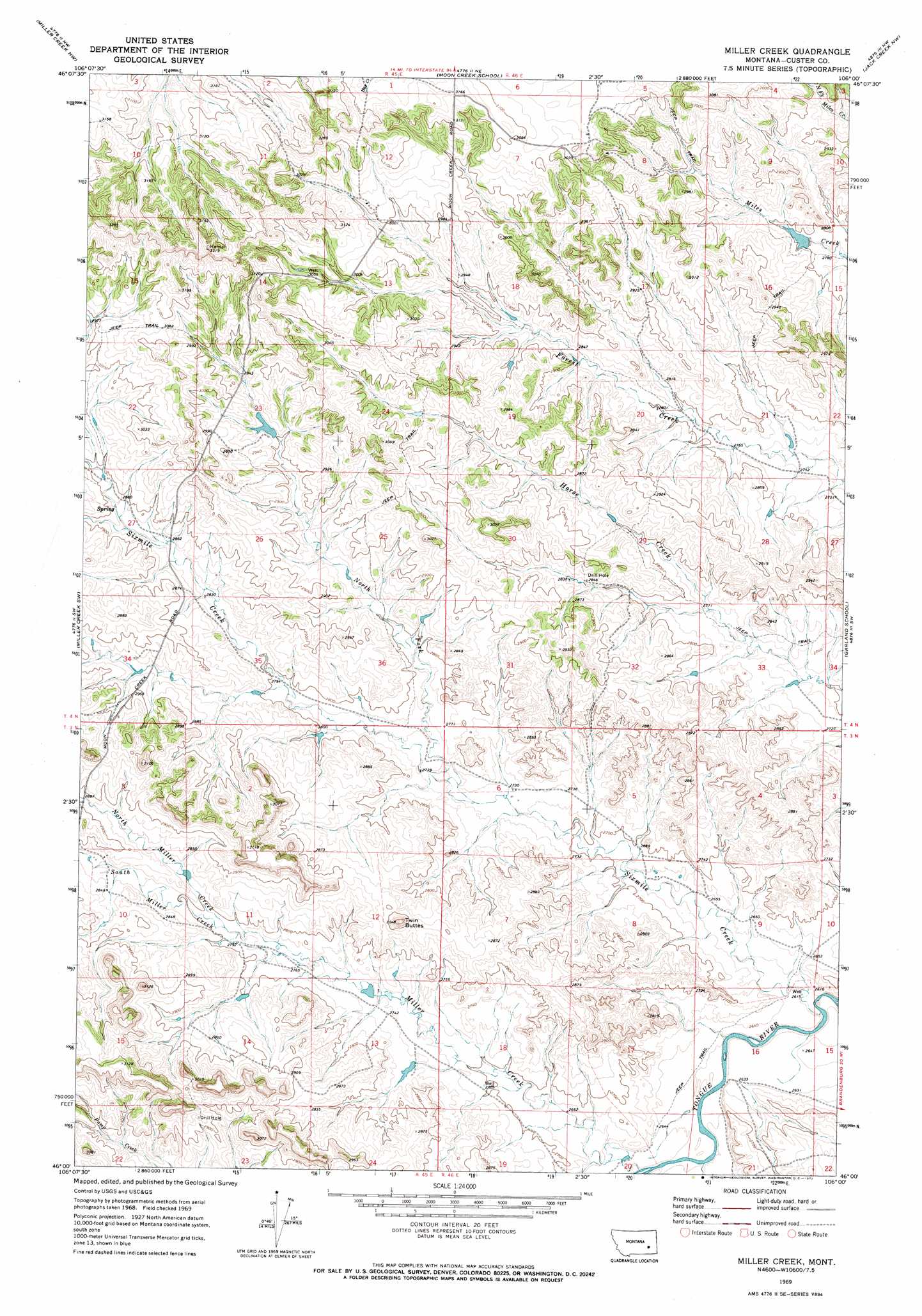
USGS Topo Quad 46106a1 - 1:24,000 scale
| Topo Map Name: | Miller Creek |
| USGS Topo Quad ID: | 46106a1 |
| Print Size: | ca. 21 1/4" wide x 27" high |
| Southeast Coordinates: | 46° N latitude / 106° W longitude |
| Map Center Coordinates: | 46.0625° N latitude / 106.0625° W longitude |
| U.S. State: | MT |
| Filename: | o46106a1.jpg |
| Download Map JPG Image: | Miller Creek topo map 1:24,000 scale |
| Map Type: | Topographic |
| Topo Series: | 7.5´ |
| Map Scale: | 1:24,000 |
| Source of Map Images: | United States Geological Survey (USGS) |
| Alternate Map Versions: |
Miller Creek MT 1969, updated 1972 Download PDF Buy paper map Miller Creek MT 2011 Download PDF Buy paper map Miller Creek MT 2014 Download PDF Buy paper map |
1:24,000 Topo Quads surrounding Miller Creek
Thurlow |
Hathaway |
Horton |
Lignite Creek |
Paddy Fay Creek |
Indian Creek |
Miller Creek Nw |
Moon Creek School |
Jack Creek Nw |
Circle L Creek |
Crain Place |
Miller Creek Sw |
Miller Creek |
Garland School |
Jack Creek |
John Hen Creek |
Brandenberg Nw |
H S School |
Fourmile Creek |
Carey-Malone School |
Hammond Draw |
Brandenberg |
Hayes Point |
North Stacey School |
Foster Creek School |
> Back to 46106a1 at 1:100,000 scale
> Back to 46106a1 at 1:250,000 scale
> Back to U.S. Topo Maps home
Miller Creek topo map: Gazetteer
Miller Creek: Dams
Bumguartner Dam elevation 879m 2883′Chezum Number 1 Dam elevation 890m 2919′
Forest Creek Dam elevation 842m 2762′
Ronning Number 1 Dam elevation 860m 2821′
Miller Creek: Streams
Elk Creek elevation 798m 2618′Miller Creek elevation 800m 2624′
North Fork Sixmile Creek elevation 836m 2742′
North Miller Creek elevation 851m 2791′
Sixmile Creek elevation 797m 2614′
South Miller Creek elevation 851m 2791′
Miller Creek: Summits
Twin Buttes elevation 922m 3024′Miller Creek: Wells
03N45E13ABBC01 Well elevation 835m 2739′04N45E14ADCD01 Well elevation 978m 3208′
04N45E26CCAC01 Well elevation 871m 2857′
Miller Creek digital topo map on disk
Buy this Miller Creek topo map showing relief, roads, GPS coordinates and other geographical features, as a high-resolution digital map file on DVD:
Eastern Montana & Western North Dakota
Buy digital topo maps: Eastern Montana & Western North Dakota