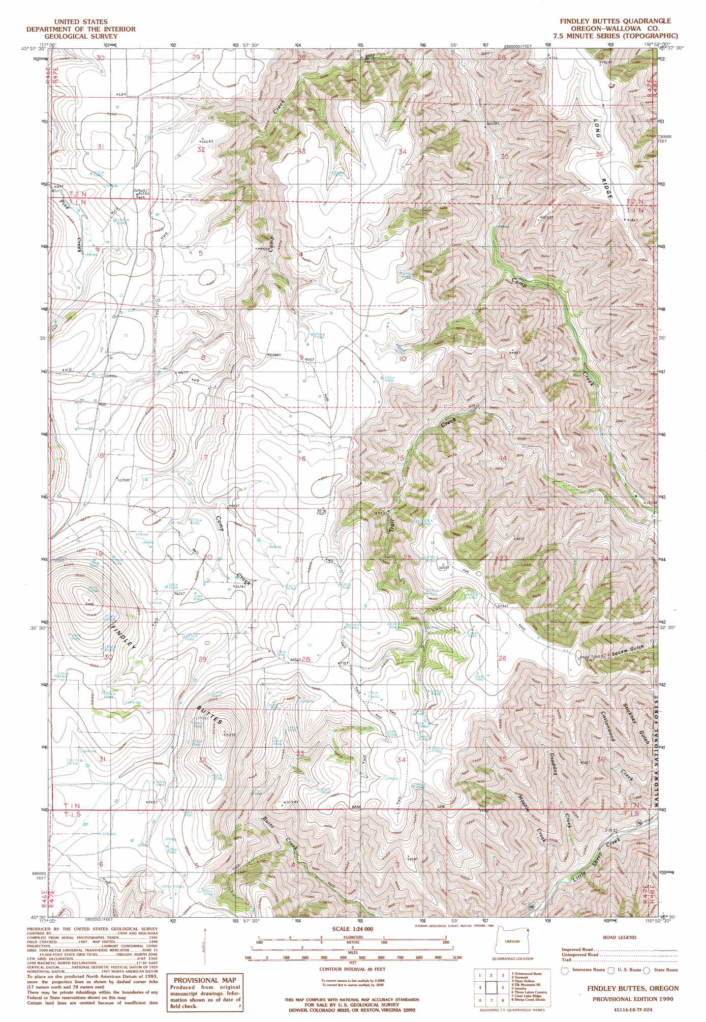
Findley Buttes Topo Map Oregon
To zoom in, hover over the map of Findley Buttes
USGS Topo Quad 45116e8 - 1:24,000 scale
| Topo Map Name: | Findley Buttes |
| USGS Topo Quad ID: | 45116e8 |
| Print Size: | ca. 21 1/4" wide x 27" high |
| Southeast Coordinates: | 45.5° N latitude / 116.875° W longitude |
| Map Center Coordinates: | 45.5625° N latitude / 116.9375° W longitude |
| U.S. State: | OR |
| Filename: | o45116e8.jpg |
| Download Map JPG Image: | Findley Buttes topo map 1:24,000 scale |
| Map Type: | Topographic |
| Topo Series: | 7.5´ |
| Map Scale: | 1:24,000 |
| Source of Map Images: | United States Geological Survey (USGS) |
| Alternate Map Versions: |
Findley Buttes OR 1990, updated 1990 Download PDF Buy paper map Findley Buttes OR 2011 Download PDF Buy paper map Findley Buttes OR 2014 Download PDF Buy paper map |
| FStopo: | US Forest Service topo Findley Buttes is available: Download FStopo PDF Download FStopo TIF |
1:24,000 Topo Quads surrounding Findley Buttes
Table Mountain |
Billy Meadows |
Poison Point |
Deadhorse Ridge |
Cactus Mountain |
Starvation Ridge |
Greenwood Butte |
Zumwalt |
Haas Hollow |
Fingerboard Saddle |
Elk Mountain |
Elk Mountain Se |
Findley Buttes |
Imnaha |
Sleepy Ridge |
Joseph Nw |
Three Lakes Country |
Clear Lake Ridge |
Sheep Creek Divide |
Hat Point |
Joseph |
Kinney Lake |
Harl Butte |
Jaynes Ridge |
Squirrel Prairie |
> Back to 45116e1 at 1:100,000 scale
> Back to 45116a1 at 1:250,000 scale
> Back to U.S. Topo Maps home
Findley Buttes topo map: Gazetteer
Findley Buttes: Ridges
Long Ridge elevation 1450m 4757′Findley Buttes: Streams
Cottonwood Creek elevation 713m 2339′Deaddog Creek elevation 752m 2467′
Magpie Creek elevation 768m 2519′
Findley Buttes: Summits
Findley Buttes elevation 1674m 5492′Findley Buttes digital topo map on disk
Buy this Findley Buttes topo map showing relief, roads, GPS coordinates and other geographical features, as a high-resolution digital map file on DVD: