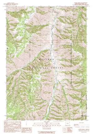
Jaynes Ridge Topo Map Oregon
To zoom in, hover over the map of Jaynes Ridge
USGS Topo Quad 45116c7 - 1:24,000 scale
| Topo Map Name: | Jaynes Ridge |
| USGS Topo Quad ID: | 45116c7 |
| Print Size: | ca. 21 1/4" wide x 27" high |
| Southeast Coordinates: | 45.25° N latitude / 116.75° W longitude |
| Map Center Coordinates: | 45.3125° N latitude / 116.8125° W longitude |
| U.S. State: | OR |
| Filename: | o45116c7.jpg |
| Download Map JPG Image: | Jaynes Ridge topo map 1:24,000 scale |
| Map Type: | Topographic |
| Topo Series: | 7.5´ |
| Map Scale: | 1:24,000 |
| Source of Map Images: | United States Geological Survey (USGS) |
| Alternate Map Versions: |
Jaynes Ridge OR 1990, updated 1990 Download PDF Buy paper map Jaynes Ridge OR 2011 Download PDF Buy paper map Jaynes Ridge OR 2014 Download PDF Buy paper map |
| FStopo: | US Forest Service topo Jaynes Ridge is available: Download FStopo PDF Download FStopo TIF |
1:24,000 Topo Quads surrounding Jaynes Ridge
> Back to 45116a1 at 1:100,000 scale
> Back to 45116a1 at 1:250,000 scale
> Back to U.S. Topo Maps home
Jaynes Ridge topo map: Gazetteer
Jaynes Ridge: Gaps
Saulsberry Saddle elevation 1771m 5810′The Saddle elevation 984m 3228′
Jaynes Ridge: Populated Places
Imnaha River Woods Development elevation 1267m 4156′Jaynes Ridge: Reservoirs
Needham Pond elevation 960m 3149′Jaynes Ridge: Ridges
Jaynes Ridge elevation 1762m 5780′Long Ridge elevation 1877m 6158′
Morgan Ridge elevation 1794m 5885′
Jaynes Ridge: Springs
Himmelwright Spring elevation 1928m 6325′Ralph Spring elevation 1843m 6046′
Tepee Spring elevation 1859m 6099′
Jaynes Ridge: Streams
Balter Creek elevation 894m 2933′Beeler Creek elevation 864m 2834′
Grouse Creek elevation 932m 3057′
Jimmy Creek elevation 1501m 4924′
Johnson Creek elevation 947m 3106′
Lieutenant Creek elevation 1287m 4222′
Line Creek elevation 905m 2969′
Makin Creek elevation 1084m 3556′
Musty Creek elevation 921m 3021′
Neil Creek elevation 958m 3143′
Park Creek elevation 888m 2913′
Rich Creek elevation 1042m 3418′
Shin Creek elevation 929m 3047′
Summit Creek elevation 980m 3215′
Trail Creek elevation 1011m 3316′
Winston Creek elevation 899m 2949′
Jaynes Ridge: Trails
Summit Creek Trail elevation 1208m 3963′Jaynes Ridge: Valleys
Leggett Gulch elevation 1013m 3323′Neil Canyon elevation 960m 3149′
Road Canyon elevation 1116m 3661′
Saddle Gulch elevation 1086m 3562′
Shadow Canyon elevation 1117m 3664′
Jaynes Ridge digital topo map on disk
Buy this Jaynes Ridge topo map showing relief, roads, GPS coordinates and other geographical features, as a high-resolution digital map file on DVD:


