Marsh Sw Topo Map Montana
To zoom in, hover over the map of Marsh Sw
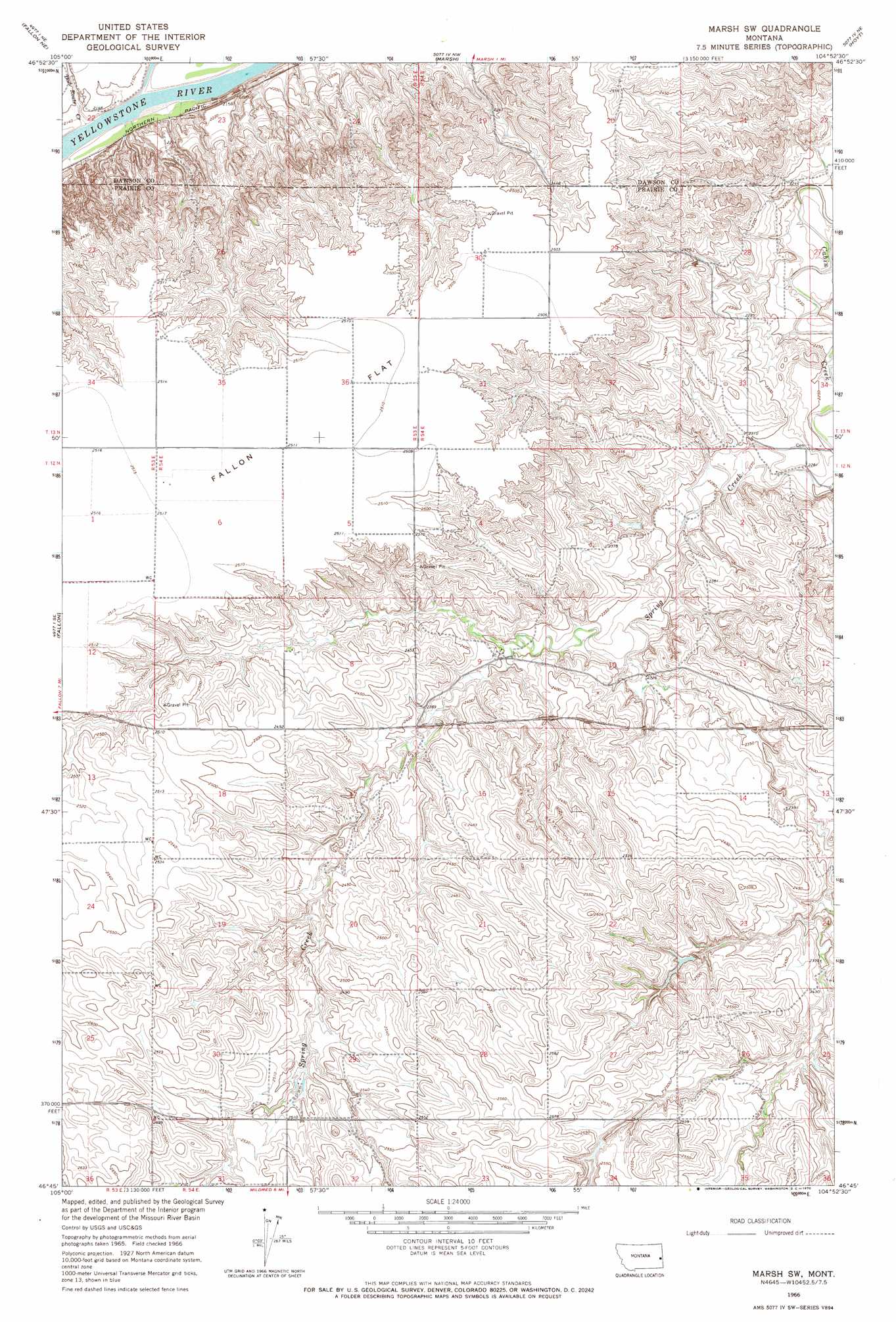
USGS Topo Quad 46104g8 - 1:24,000 scale
| Topo Map Name: | Marsh Sw |
| USGS Topo Quad ID: | 46104g8 |
| Print Size: | ca. 21 1/4" wide x 27" high |
| Southeast Coordinates: | 46.75° N latitude / 104.875° W longitude |
| Map Center Coordinates: | 46.8125° N latitude / 104.9375° W longitude |
| U.S. State: | MT |
| Filename: | o46104g8.jpg |
| Download Map JPG Image: | Marsh Sw topo map 1:24,000 scale |
| Map Type: | Topographic |
| Topo Series: | 7.5´ |
| Map Scale: | 1:24,000 |
| Source of Map Images: | United States Geological Survey (USGS) |
| Alternate Map Versions: |
Marsh SW MT 1966, updated 1970 Download PDF Buy paper map Marsh SW MT 2011 Download PDF Buy paper map Marsh SW MT 2014 Download PDF Buy paper map |
1:24,000 Topo Quads surrounding Marsh Sw
Lindsay Sw |
Upper Cracker Box School |
Pleasant View |
Forest Park |
Glendive |
Hendrickson Coulee |
Fallon Ne |
Marsh |
Hoyt |
Upper Magpie Reservoir |
Fallon Sw |
Fallon |
Marsh Sw |
Simons Butte |
Graveyard Hill Sw |
Flat Top Butte |
Flat Top Butte Ne |
Mildred |
Mildred Ne |
Dorothy Draw |
Flat Top Butte Sw |
Little Whitney Creek |
Loony Hollow |
Ismay North |
Ayer Spring |
> Back to 46104e1 at 1:100,000 scale
> Back to 46104a1 at 1:250,000 scale
> Back to U.S. Topo Maps home
Marsh Sw topo map: Gazetteer
Marsh Sw: Post Offices
Conlin Post Office (historical) elevation 662m 2171′Marsh Sw: Streams
Ash Creek elevation 707m 2319′Bad Route Creek elevation 647m 2122′
Marsh Sw: Wells
12N54E02AA__01 Well elevation 691m 2267′12N54E10DADB01 Well elevation 710m 2329′
12N54E17ACAD01 Well elevation 730m 2395′
13N53E22AAB_01 Well elevation 657m 2155′
13N53E22ABC_01 Well elevation 658m 2158′
13N53E22BAC_02 Well elevation 656m 2152′
Marsh Sw digital topo map on disk
Buy this Marsh Sw topo map showing relief, roads, GPS coordinates and other geographical features, as a high-resolution digital map file on DVD:
Eastern Montana & Western North Dakota
Buy digital topo maps: Eastern Montana & Western North Dakota