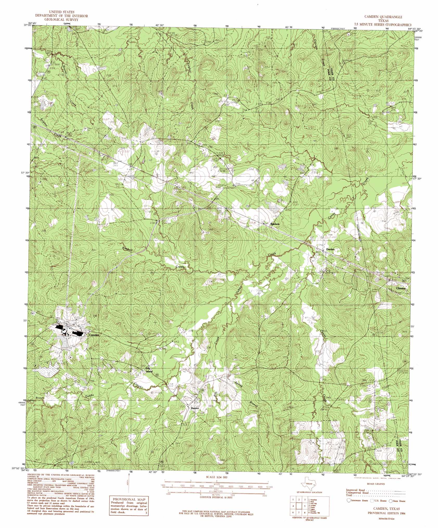
Camden Topo Map Texas
To zoom in, hover over the map of Camden
USGS Topo Quad 30094h6 - 1:24,000 scale
| Topo Map Name: | Camden |
| USGS Topo Quad ID: | 30094h6 |
| Print Size: | ca. 21 1/4" wide x 27" high |
| Southeast Coordinates: | 30.875° N latitude / 94.625° W longitude |
| Map Center Coordinates: | 30.9375° N latitude / 94.6875° W longitude |
| U.S. State: | TX |
| Filename: | o30094h6.jpg |
| Download Map JPG Image: | Camden topo map 1:24,000 scale |
| Map Type: | Topographic |
| Topo Series: | 7.5´ |
| Map Scale: | 1:24,000 |
| Source of Map Images: | United States Geological Survey (USGS) |
| Alternate Map Versions: |
Camden TX 1984, updated 1984 Download PDF Buy paper map Camden TX 2010 Download PDF Buy paper map Camden TX 2013 Download PDF Buy paper map Camden TX 2016 Download PDF Buy paper map |
1:24,000 Topo Quads surrounding Camden
Apple Springs |
Diboll |
Bald Hill |
Manning |
Zavalla |
Trevat |
Wakefield |
Pluck |
Wolf Hill |
Rockland |
Carmona |
Corrigan |
Camden |
Chester |
Colmesneil |
New Willard |
Leggett |
Hortense |
Chambliss Hill |
Woodville |
Livingston |
Soda |
Dallardsville |
Jacks Creek North |
Hillister |
> Back to 30094e1 at 1:100,000 scale
> Back to 30094a1 at 1:250,000 scale
> Back to U.S. Topo Maps home
Camden topo map: Gazetteer
Camden: Dams
Barnum Lake Dam elevation 73m 239′Carter Lake Dam elevation 90m 295′
Pine Pond Dam elevation 90m 295′
Camden: Populated Places
Barnes elevation 89m 291′Barnum elevation 76m 249′
Camden elevation 90m 295′
Lily Island elevation 84m 275′
Camden: Reservoirs
Barnum Lake elevation 73m 239′Carter Lake elevation 90m 295′
Pine Pond elevation 90m 295′
Camden: Streams
Dabbs Branch elevation 61m 200′Dabbs Creek elevation 88m 288′
Elm Creek elevation 67m 219′
Camden digital topo map on disk
Buy this Camden topo map showing relief, roads, GPS coordinates and other geographical features, as a high-resolution digital map file on DVD: