Long Branch Topo Map Texas
To zoom in, hover over the map of Long Branch
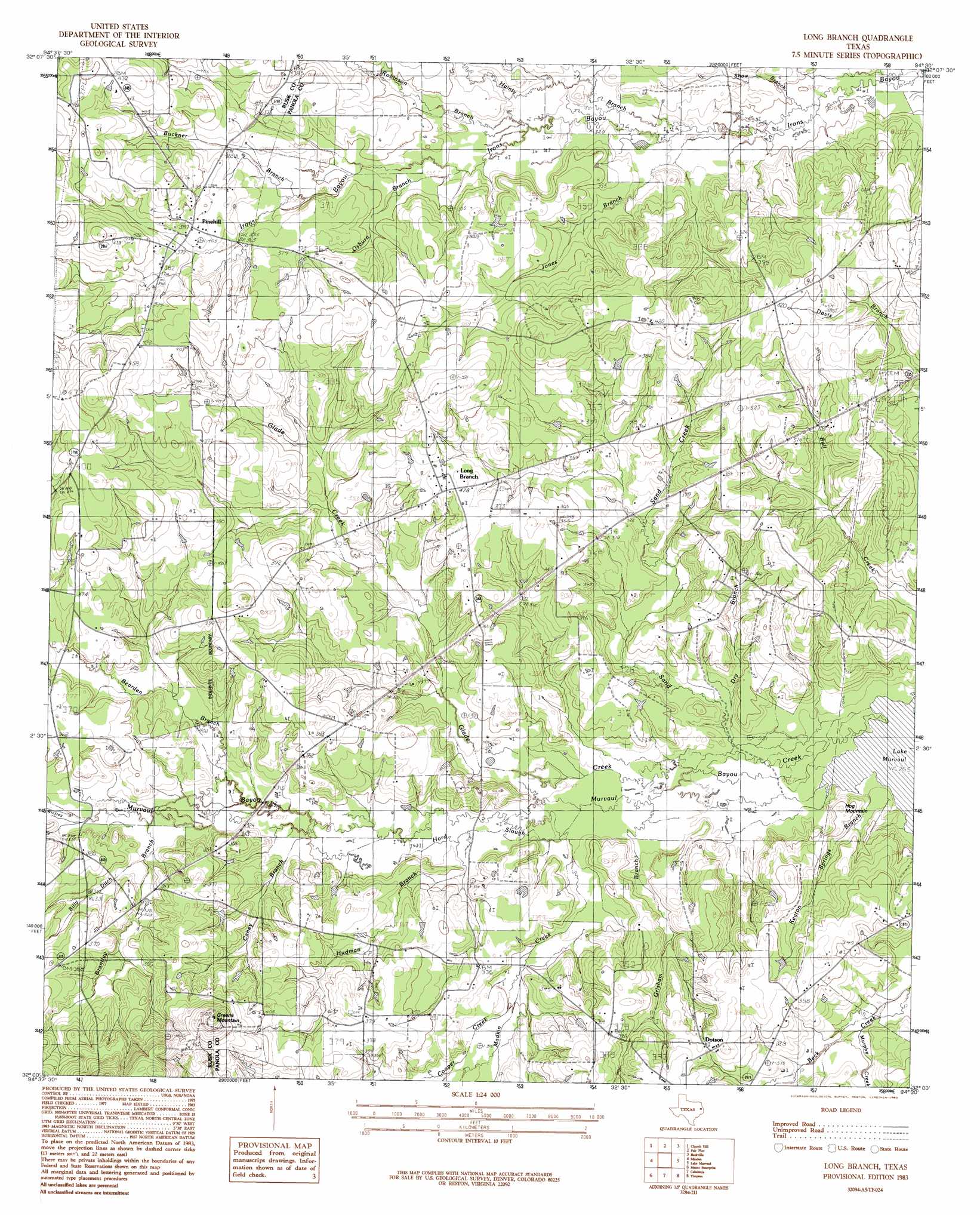
USGS Topo Quad 32094a5 - 1:24,000 scale
| Topo Map Name: | Long Branch |
| USGS Topo Quad ID: | 32094a5 |
| Print Size: | ca. 21 1/4" wide x 27" high |
| Southeast Coordinates: | 32° N latitude / 94.5° W longitude |
| Map Center Coordinates: | 32.0625° N latitude / 94.5625° W longitude |
| U.S. State: | TX |
| Filename: | o32094a5.jpg |
| Download Map JPG Image: | Long Branch topo map 1:24,000 scale |
| Map Type: | Topographic |
| Topo Series: | 7.5´ |
| Map Scale: | 1:24,000 |
| Source of Map Images: | United States Geological Survey (USGS) |
| Alternate Map Versions: |
Long Branch TX 1983, updated 1983 Download PDF Buy paper map Long Branch TX 2010 Download PDF Buy paper map Long Branch TX 2013 Download PDF Buy paper map Long Branch TX 2016 Download PDF Buy paper map |
1:24,000 Topo Quads surrounding Long Branch
Kilgore Se |
Elderville |
Tatum |
Harris Chapel |
Grand Bluff |
Henderson |
Church Hill |
Fair Play |
Beckville |
Carthage |
Berryhill Creek |
Minden |
Long Branch |
Lake Murvaul |
Gary |
Laneville |
Mount Enterprise |
Caledonia |
Timpson |
Tenaha West |
Cushing |
Trawick |
Garrison West |
Garrison East |
Arcadia |
> Back to 32094a1 at 1:100,000 scale
> Back to 32094a1 at 1:250,000 scale
> Back to U.S. Topo Maps home
Long Branch topo map: Gazetteer
Long Branch: Populated Places
Dotson elevation 113m 370′Long Branch elevation 113m 370′
Pinehill elevation 118m 387′
Long Branch: Streams
Bearden Branch elevation 92m 301′Billy Ditch elevation 98m 321′
Brantley Branch elevation 94m 308′
Buckner Branch elevation 107m 351′
Caney Branch elevation 89m 291′
Cooper Creek elevation 93m 305′
Dry Branch elevation 83m 272′
Glade Creek elevation 85m 278′
Grisham Branch elevation 85m 278′
Hainty Branch elevation 96m 314′
Hord Slough elevation 83m 272′
Hudman Branch elevation 88m 288′
Jones Branch elevation 94m 308′
Keaton Springs Branch elevation 82m 269′
Madkin Creek elevation 85m 278′
Murphy Creek elevation 89m 291′
Osburn Branch elevation 99m 324′
Robinson Branch elevation 98m 321′
Sand Creek elevation 82m 269′
Shaw Branch elevation 91m 298′
Long Branch: Summits
Greems Mountain elevation 167m 547′Hog Mountain elevation 90m 295′
Long Branch digital topo map on disk
Buy this Long Branch topo map showing relief, roads, GPS coordinates and other geographical features, as a high-resolution digital map file on DVD: