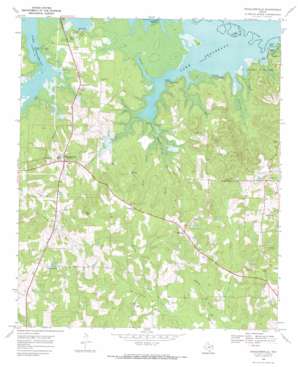
Douglassville Topo Map Texas
To zoom in, hover over the map of Douglassville
USGS Topo Quad 33094b3 - 1:24,000 scale
| Topo Map Name: | Douglassville |
| USGS Topo Quad ID: | 33094b3 |
| Print Size: | ca. 21 1/4" wide x 27" high |
| Southeast Coordinates: | 33.125° N latitude / 94.25° W longitude |
| Map Center Coordinates: | 33.1875° N latitude / 94.3125° W longitude |
| U.S. State: | TX |
| Filename: | o33094b3.jpg |
| Download Map JPG Image: | Douglassville topo map 1:24,000 scale |
| Map Type: | Topographic |
| Topo Series: | 7.5´ |
| Map Scale: | 1:24,000 |
| Source of Map Images: | United States Geological Survey (USGS) |
| Alternate Map Versions: |
Douglassville TX 1969, updated 1972 Download PDF Buy paper map Douglassville TX 2010 Download PDF Buy paper map Douglassville TX 2013 Download PDF Buy paper map Douglassville TX 2016 Download PDF Buy paper map |
1:24,000 Topo Quads surrounding Douglassville
> Back to 33094a1 at 1:100,000 scale
> Back to 33094a1 at 1:250,000 scale
> Back to U.S. Topo Maps home
Douglassville topo map: Gazetteer
Douglassville: Cliffs
Knights Bluff elevation 74m 242′Pine Bluff elevation 72m 236′
Douglassville: Guts
Ballard Creek elevation 69m 226′Douglassville: Parks
Jackson Park elevation 80m 262′Douglassville: Populated Places
Antioch elevation 139m 456′Armstrong Landing elevation 69m 226′
Douglassville elevation 120m 393′
Gum Springs elevation 117m 383′
Knights Bluff Landing elevation 70m 229′
Midway elevation 122m 400′
New Liberty elevation 121m 396′
Overcup Landing elevation 70m 229′
Panhandle elevation 95m 311′
Poorboy Landing elevation 69m 226′
Douglassville: Streams
Armstrong Creek elevation 70m 229′Douglasville Creek elevation 69m 226′
Ellington Creek elevation 76m 249′
Ham Creek elevation 69m 226′
Jackson Creek elevation 70m 229′
Midway Branch elevation 82m 269′
Prairie Branch elevation 88m 288′
Shoal Creek elevation 74m 242′
Webster Creek elevation 69m 226′
Douglassville: Trails
Atlanta State Park Trail elevation 87m 285′Douglassville digital topo map on disk
Buy this Douglassville topo map showing relief, roads, GPS coordinates and other geographical features, as a high-resolution digital map file on DVD:


