Falls Chapel Topo Map Arkansas
To zoom in, hover over the map of Falls Chapel
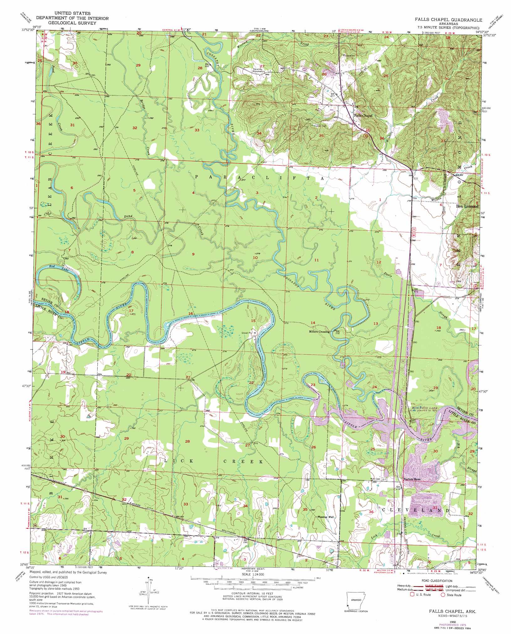
USGS Topo Quad 33094g2 - 1:24,000 scale
| Topo Map Name: | Falls Chapel |
| USGS Topo Quad ID: | 33094g2 |
| Print Size: | ca. 21 1/4" wide x 27" high |
| Southeast Coordinates: | 33.75° N latitude / 94.125° W longitude |
| Map Center Coordinates: | 33.8125° N latitude / 94.1875° W longitude |
| U.S. State: | AR |
| Filename: | o33094g2.jpg |
| Download Map JPG Image: | Falls Chapel topo map 1:24,000 scale |
| Map Type: | Topographic |
| Topo Series: | 7.5´ |
| Map Scale: | 1:24,000 |
| Source of Map Images: | United States Geological Survey (USGS) |
| Alternate Map Versions: |
Falls Chapel AR 1950, updated 1973 Download PDF Buy paper map Falls Chapel AR 1950, updated 1976 Download PDF Buy paper map Falls Chapel AR 1951 Download PDF Buy paper map Falls Chapel AR 2011 Download PDF Buy paper map Falls Chapel AR 2014 Download PDF Buy paper map |
1:24,000 Topo Quads surrounding Falls Chapel
Chapel Hill |
De Queen |
Geneva |
Dierks |
Center Point |
Cerrogordo |
Horatio |
Lockesburg |
Silver Ridge |
Mineral Springs North |
Arkinda |
Winthrop |
Falls Chapel |
Ben Lomond |
Mineral Springs South |
Foreman |
Arden |
Ashdown West |
Ashdown East |
Red Bluff |
Daniels Chapel |
Redbank |
Barkman |
Ogden |
Homan |
> Back to 33094e1 at 1:100,000 scale
> Back to 33094a1 at 1:250,000 scale
> Back to U.S. Topo Maps home
Falls Chapel topo map: Gazetteer
Falls Chapel: Bridges
Little River Bridge elevation 90m 295′Falls Chapel: Crossings
Lanes Ferry (historical) elevation 81m 265′Falls Chapel: Lakes
Red Lake elevation 81m 265′Falls Chapel: Parks
Paraclifta Monument elevation 121m 396′Patterson Shoals Public Use Area elevation 84m 275′
Wilton Landing Public Use Area elevation 81m 265′
Falls Chapel: Populated Places
Millers Crossing elevation 82m 269′Mistletoe (historical) elevation 99m 324′
Paraclifta (historical) elevation 119m 390′
Falls Chapel: Streams
Bridge Creek elevation 88m 288′Cossatot River elevation 82m 269′
Pond Creek elevation 82m 269′
Wards Creek elevation 82m 269′
Wilson Creek elevation 91m 298′
Winters Creek elevation 91m 298′
Woolsey Creek elevation 88m 288′
Falls Chapel digital topo map on disk
Buy this Falls Chapel topo map showing relief, roads, GPS coordinates and other geographical features, as a high-resolution digital map file on DVD: