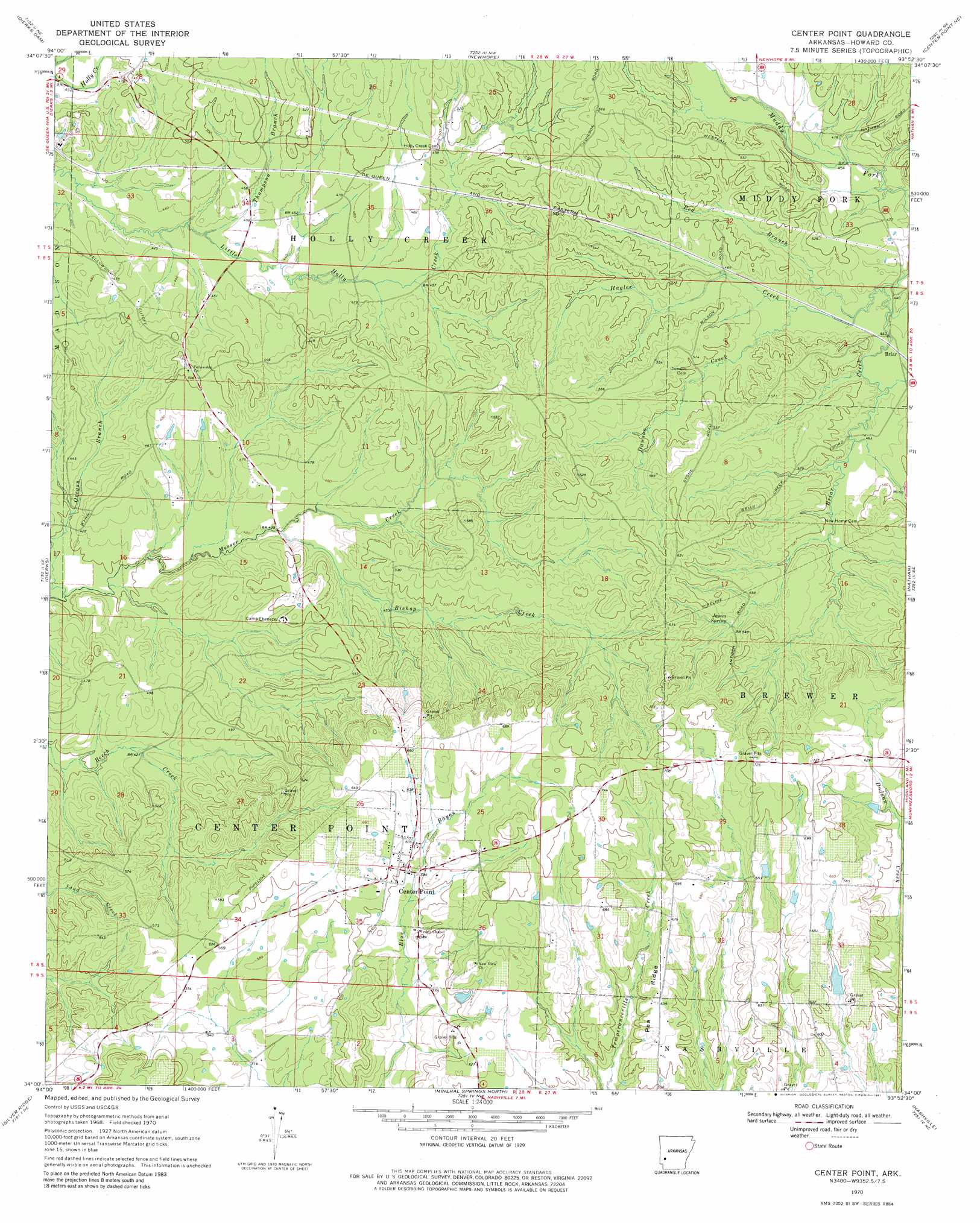
Center Point Topo Map Arkansas
To zoom in, hover over the map of Center Point
USGS Topo Quad 34093a8 - 1:24,000 scale
| Topo Map Name: | Center Point |
| USGS Topo Quad ID: | 34093a8 |
| Print Size: | ca. 21 1/4" wide x 27" high |
| Southeast Coordinates: | 34° N latitude / 93.875° W longitude |
| Map Center Coordinates: | 34.0625° N latitude / 93.9375° W longitude |
| U.S. State: | AR |
| Filename: | o34093a8.jpg |
| Download Map JPG Image: | Center Point topo map 1:24,000 scale |
| Map Type: | Topographic |
| Topo Series: | 7.5´ |
| Map Scale: | 1:24,000 |
| Source of Map Images: | United States Geological Survey (USGS) |
| Alternate Map Versions: |
Center Point AR 1970, updated 1972 Download PDF Buy paper map Center Point AR 1970, updated 1981 Download PDF Buy paper map Center Point AR 2011 Download PDF Buy paper map Center Point AR 2014 Download PDF Buy paper map |
1:24,000 Topo Quads surrounding Center Point
Baker Springs |
Umpire |
Athens |
Langley |
Lodi |
Gillham Dam |
Dierks Dam |
Newhope |
Center Point Ne |
Narrows Dam |
Geneva |
Dierks |
Center Point |
Nathan |
Murfreesboro |
Lockesburg |
Silver Ridge |
Mineral Springs North |
Nashville |
Mccaskill |
Falls Chapel |
Ben Lomond |
Mineral Springs South |
Columbus |
Washington |
> Back to 34093a1 at 1:100,000 scale
> Back to 34092a1 at 1:250,000 scale
> Back to U.S. Topo Maps home
Center Point topo map: Gazetteer
Center Point: Dams
Barnes Lake Dam elevation 178m 583′McAdams Lake Dam elevation 208m 682′
Center Point: Populated Places
Center Point elevation 183m 600′Center Point: Reservoirs
Barnes Lake elevation 178m 583′McAdams Lake elevation 208m 682′
Center Point: Ridges
Pea Ridge elevation 197m 646′Center Point: Springs
James Spring elevation 171m 561′Center Point: Streams
Bishop Creek elevation 128m 419′Dawson Creek elevation 136m 446′
Hagler Creek elevation 142m 465′
Oregon Branch elevation 119m 390′
Red Branch elevation 144m 472′
Thompson Branch elevation 129m 423′
Center Point digital topo map on disk
Buy this Center Point topo map showing relief, roads, GPS coordinates and other geographical features, as a high-resolution digital map file on DVD: