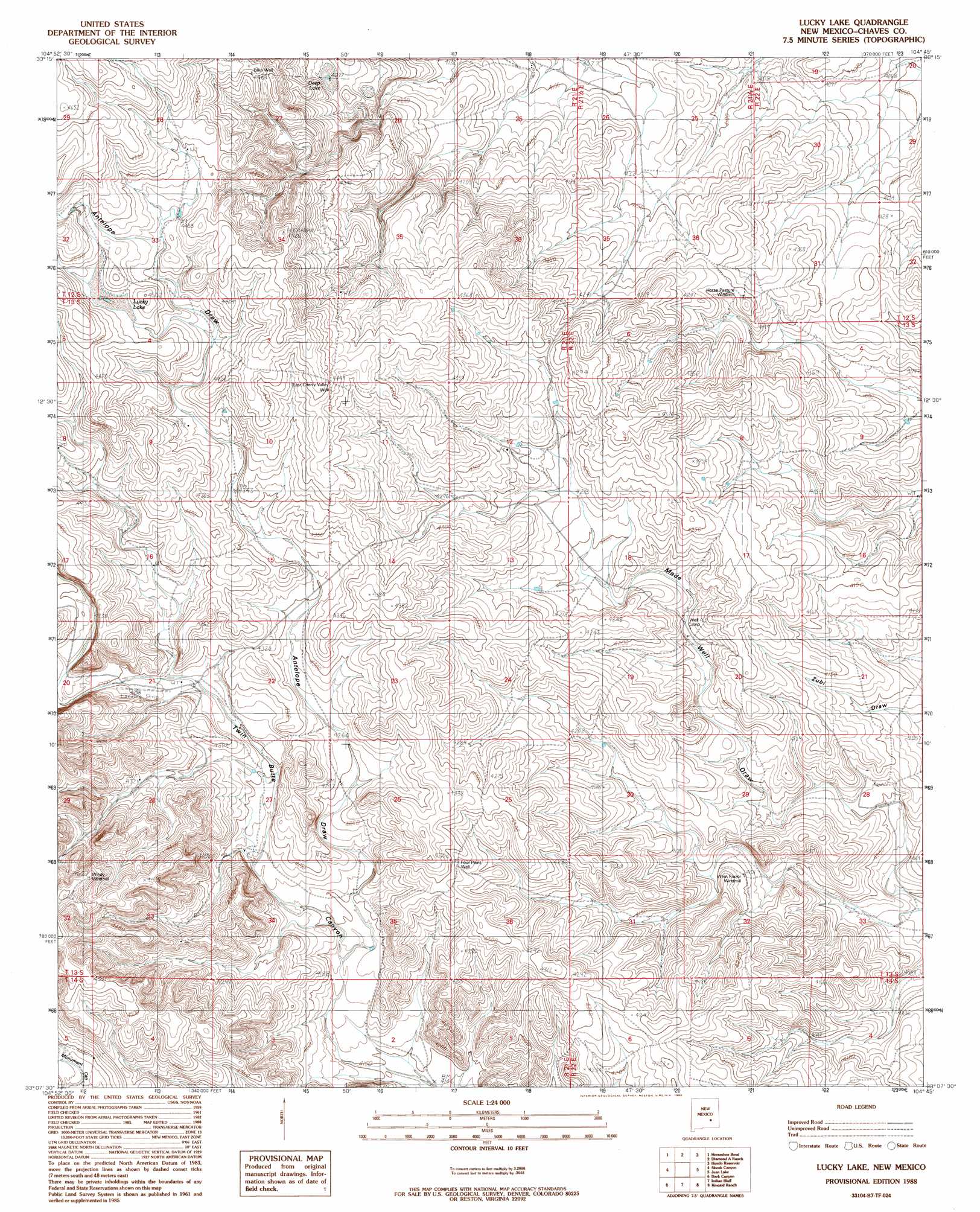
Lucky Lake Topo Map New Mexico
To zoom in, hover over the map of Lucky Lake
USGS Topo Quad 33104b7 - 1:24,000 scale
| Topo Map Name: | Lucky Lake |
| USGS Topo Quad ID: | 33104b7 |
| Print Size: | ca. 21 1/4" wide x 27" high |
| Southeast Coordinates: | 33.125° N latitude / 104.75° W longitude |
| Map Center Coordinates: | 33.1875° N latitude / 104.8125° W longitude |
| U.S. State: | NM |
| Filename: | o33104b7.jpg |
| Download Map JPG Image: | Lucky Lake topo map 1:24,000 scale |
| Map Type: | Topographic |
| Topo Series: | 7.5´ |
| Map Scale: | 1:24,000 |
| Source of Map Images: | United States Geological Survey (USGS) |
| Alternate Map Versions: |
Lucky Lake NM 1988, updated 1989 Download PDF Buy paper map Lucky Lake NM 2010 Download PDF Buy paper map Lucky Lake NM 2013 Download PDF Buy paper map Lucky Lake NM 2017 Download PDF Buy paper map |
1:24,000 Topo Quads surrounding Lucky Lake
Nelson Canyon East |
Horseshoe Bend Nw |
Blackwater Hill |
Corn Ranch |
Roswell North |
Sunset |
Horseshoe Bend |
Diamond A Ranch |
Hondo Reservoir |
Roswell South |
Flying H Ne |
Skunk Canyon |
Lucky Lake |
Juan Lake |
Peters Lake |
Flying H |
Dark Canyon |
Indian Bluff |
Kincaid Ranch |
Hackberry Ranch |
Singer Lake |
Sagebrush Valley W. |
Sagebrush Valley E. |
Hope Nw |
Hope Ne |
> Back to 33104a1 at 1:100,000 scale
> Back to 33104a1 at 1:250,000 scale
> Back to U.S. Topo Maps home
Lucky Lake topo map: Gazetteer
Lucky Lake: Lakes
Deep Lake elevation 1303m 4274′Lucky Lake elevation 1361m 4465′
Lucky Lake: Valleys
Antelope Draw elevation 1276m 4186′Lucky Lake: Wells
East Cherry Valley Well elevation 1361m 4465′Four Point Well elevation 1313m 4307′
Lake Well elevation 1356m 4448′
Lucky Lake digital topo map on disk
Buy this Lucky Lake topo map showing relief, roads, GPS coordinates and other geographical features, as a high-resolution digital map file on DVD: