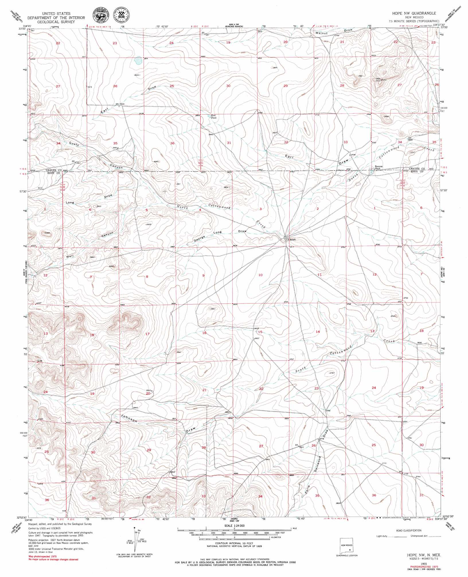
Hope Nw Topo Map New Mexico
To zoom in, hover over the map of Hope Nw
USGS Topo Quad 32104h6 - 1:24,000 scale
| Topo Map Name: | Hope Nw |
| USGS Topo Quad ID: | 32104h6 |
| Print Size: | ca. 21 1/4" wide x 27" high |
| Southeast Coordinates: | 32.875° N latitude / 104.625° W longitude |
| Map Center Coordinates: | 32.9375° N latitude / 104.6875° W longitude |
| U.S. State: | NM |
| Filename: | o32104h6.jpg |
| Download Map JPG Image: | Hope Nw topo map 1:24,000 scale |
| Map Type: | Topographic |
| Topo Series: | 7.5´ |
| Map Scale: | 1:24,000 |
| Source of Map Images: | United States Geological Survey (USGS) |
| Alternate Map Versions: |
Hope NW NM 1955, updated 1956 Download PDF Buy paper map Hope NW NM 2010 Download PDF Buy paper map Hope NW NM 2013 Download PDF Buy paper map Hope NW NM 2017 Download PDF Buy paper map |
1:24,000 Topo Quads surrounding Hope Nw
Skunk Canyon |
Lucky Lake |
Juan Lake |
Peters Lake |
Dexter West |
Dark Canyon |
Indian Bluff |
Kincaid Ranch |
Hackberry Ranch |
Hagerman Sw |
Sagebrush Valley W. |
Sagebrush Valley E. |
Hope Nw |
Hope Ne |
Espuela |
Sixteenmile Draw West |
Sixteenmile Draw East |
Hope |
Hope Se |
Artesia |
Encino Draw |
Holt Tank |
Antelope Sink |
Parish Ranch |
Dayton |
> Back to 32104e1 at 1:100,000 scale
> Back to 32104a1 at 1:250,000 scale
> Back to U.S. Topo Maps home
Hope Nw topo map: Gazetteer
Hope Nw: Arroyos
George Draw elevation 1189m 3900′Hope Nw: Valleys
Earl Draw elevation 1129m 3704′George Long Draw elevation 1154m 3786′
Goaty Canyon elevation 1168m 3832′
Johnson Draw elevation 1155m 3789′
Long Draw elevation 1179m 3868′
Paris Dainwood Draw elevation 1142m 3746′
Well Canyon elevation 1175m 3854′
Hope Nw: Wells
10307 Water Well elevation 1134m 3720′10477 Water Well elevation 1202m 3943′
10480 Water Well elevation 1123m 3684′
Hope Nw digital topo map on disk
Buy this Hope Nw topo map showing relief, roads, GPS coordinates and other geographical features, as a high-resolution digital map file on DVD: