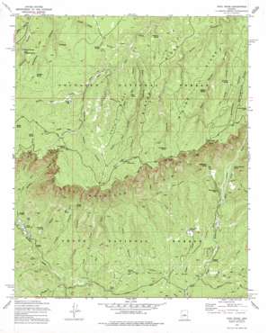
Kehl Ridge Topo Map Arizona
To zoom in, hover over the map of Kehl Ridge
USGS Topo Quad 34111d3 - 1:24,000 scale
| Topo Map Name: | Kehl Ridge |
| USGS Topo Quad ID: | 34111d3 |
| Print Size: | ca. 21 1/4" wide x 27" high |
| Southeast Coordinates: | 34.375° N latitude / 111.25° W longitude |
| Map Center Coordinates: | 34.4375° N latitude / 111.3125° W longitude |
| U.S. State: | AZ |
| Filename: | o34111d3.jpg |
| Download Map JPG Image: | Kehl Ridge topo map 1:24,000 scale |
| Map Type: | Topographic |
| Topo Series: | 7.5´ |
| Map Scale: | 1:24,000 |
| Source of Map Images: | United States Geological Survey (USGS) |
| Alternate Map Versions: |
Kehl Ridge AZ 1972, updated 1974 Download PDF Buy paper map Kehl Ridge AZ 1972, updated 1979 Download PDF Buy paper map Kehl Ridge AZ 2004, updated 2006 Download PDF Buy paper map Kehl Ridge AZ 2011 Download PDF Buy paper map Kehl Ridge AZ 2014 Download PDF Buy paper map |
| FStopo: | US Forest Service topo Kehl Ridge is available: Download FStopo PDF Download FStopo TIF |
1:24,000 Topo Quads surrounding Kehl Ridge
> Back to 34111a1 at 1:100,000 scale
> Back to 34110a1 at 1:250,000 scale
> Back to U.S. Topo Maps home
Kehl Ridge topo map: Gazetteer
Kehl Ridge: Cliffs
Hi View Point elevation 2290m 7513′Kehl Ridge: Flats
Poverty Flat elevation 2193m 7194′Kehl Ridge: Lakes
Potato Lake elevation 2191m 7188′Kehl Ridge: Parks
Battle of Big Dry Wash Historical Marker elevation 2210m 7250′Kehl Ridge: Populated Places
Verde Glen elevation 1687m 5534′Washington Park elevation 1829m 6000′
Kehl Ridge: Reservoirs
Center Tank elevation 1720m 5643′Erosion Tank elevation 1684m 5524′
Estate Tank elevation 1623m 5324′
Fire Tank elevation 1622m 5321′
Jiffer Tank elevation 2218m 7276′
OSO Tank elevation 2208m 7244′
Park Tank elevation 1720m 5643′
Tracy Lynn Tank elevation 2271m 7450′
Webber Tank elevation 1642m 5387′
Kehl Ridge: Ridges
Blazed Ridge elevation 2221m 7286′Kehl Ridge elevation 2280m 7480′
Miller Ridge elevation 2235m 7332′
Kehl Ridge: Springs
Bear Spring elevation 1841m 6040′Coldwater Spring elevation 2145m 7037′
Fortyfour Spring elevation 2146m 7040′
General Springs elevation 2184m 7165′
Geronimo Spring elevation 1720m 5643′
Hi Fuller Spring elevation 2214m 7263′
Immigrant Spring elevation 2269m 7444′
Kehl Spring elevation 2268m 7440′
Lee Johnson Spring elevation 2244m 7362′
Little Fortyfour Spring elevation 2146m 7040′
Mud Spring elevation 2229m 7312′
One Hundred and One Spring elevation 2153m 7063′
Patton Spring elevation 2288m 7506′
Pieper Hatchery Spring elevation 1893m 6210′
Poison Spring elevation 1909m 6263′
Poverty Spring elevation 2193m 7194′
Washington Spring elevation 1933m 6341′
Willow Spring elevation 2195m 7201′
Windfall Spring elevation 2220m 7283′
Kehl Ridge: Streams
Bray Creek elevation 1572m 5157′Chase Creek elevation 1606m 5269′
Dry Dude Creek elevation 1625m 5331′
Dude Creek elevation 1625m 5331′
East Bray Creek elevation 1622m 5321′
Mail Creek elevation 1765m 5790′
North Sycamore Creek elevation 1598m 5242′
West Webber Creek elevation 1683m 5521′
Kehl Ridge: Trails
General George Crook National Recreation Trail elevation 2304m 7559′Kehl Ridge: Tunnels
The Tunnel elevation 1968m 6456′Kehl Ridge: Valleys
Cienega Draw elevation 2230m 7316′Cow Canyon elevation 1585m 5200′
Fortyfour Canyon elevation 2103m 6899′
Hi Fuller Canyon elevation 2167m 7109′
Kehl Canyon elevation 2133m 6998′
Middle Kehl Canyon elevation 2193m 7194′
Patton Spring Draw elevation 1814m 5951′
Poison Canyon elevation 1622m 5321′
Potato Lake Draw elevation 2193m 7194′
Poverty Draw elevation 2139m 7017′
Quaking Aspen Canyon elevation 2195m 7201′
West Kehl Canyon elevation 2145m 7037′
Kehl Ridge digital topo map on disk
Buy this Kehl Ridge topo map showing relief, roads, GPS coordinates and other geographical features, as a high-resolution digital map file on DVD:


