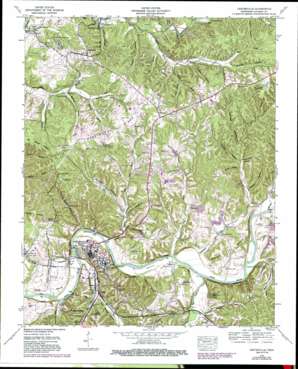
Centerville Topo Map Tennessee
To zoom in, hover over the map of Centerville
USGS Topo Quad 35087g4 - 1:24,000 scale
| Topo Map Name: | Centerville |
| USGS Topo Quad ID: | 35087g4 |
| Print Size: | ca. 21 1/4" wide x 27" high |
| Southeast Coordinates: | 35.75° N latitude / 87.375° W longitude |
| Map Center Coordinates: | 35.8125° N latitude / 87.4375° W longitude |
| U.S. State: | TN |
| Filename: | o35087g4.jpg |
| Download Map JPG Image: | Centerville topo map 1:24,000 scale |
| Map Type: | Topographic |
| Topo Series: | 7.5´ |
| Map Scale: | 1:24,000 |
| Source of Map Images: | United States Geological Survey (USGS) |
| Alternate Map Versions: |
Nunnelly TN 1936 Download PDF Buy paper map Centerville TN 1952, updated 1988 Download PDF Buy paper map Centerville TN 2010 Download PDF Buy paper map Centerville TN 2013 Download PDF Buy paper map Centerville TN 2016 Download PDF Buy paper map |
1:24,000 Topo Quads surrounding Centerville
> Back to 35087e1 at 1:100,000 scale
> Back to 35086a1 at 1:250,000 scale
> Back to U.S. Topo Maps home
Centerville topo map: Gazetteer
Centerville: Airports
Centerville Municipal Airport elevation 230m 754′Centerville: Bends
Eason Bend elevation 147m 482′Grays Bend elevation 185m 606′
Centerville: Cliffs
Grinder Bluff elevation 175m 574′Centerville: Dams
Nickells Dam elevation 181m 593′Centerville: Islands
Paces Island elevation 139m 456′Centerville: Mines
Easley Mines elevation 218m 715′Johnson Mines elevation 263m 862′
Nunnelly Mines elevation 207m 679′
Centerville: Populated Places
Centerville elevation 190m 623′Elkins elevation 237m 777′
Fairfield elevation 236m 774′
Goodrich elevation 169m 554′
Graham elevation 168m 551′
Graytown elevation 164m 538′
Nunnelly elevation 214m 702′
Twomey elevation 151m 495′
Vernon elevation 152m 498′
Woodland Heights elevation 210m 688′
Centerville: Post Offices
Nunnelly Post Office elevation 216m 708′Centerville: Reservoirs
Nickells Lake elevation 181m 593′Centerville: Ridges
Harrington Ridge elevation 218m 715′Centerville: Springs
Blowing Spring elevation 152m 498′Fielder Spring elevation 162m 531′
Goodrich Spring elevation 165m 541′
Hickman Spring elevation 186m 610′
Stillhouse Spring elevation 163m 534′
Twin Oak Spring elevation 151m 495′
Centerville: Streams
Arnold Branch elevation 143m 469′Bell Branch elevation 160m 524′
Big Swan Creek elevation 143m 469′
Defeated Creek elevation 140m 459′
Dry Creek elevation 142m 465′
East Fork Defeated Creek elevation 148m 485′
Fielders Branch elevation 143m 469′
Haley Creek elevation 139m 456′
Indian Creek elevation 139m 456′
Little Piney Creek elevation 140m 459′
Minnow Branch elevation 140m 459′
Morgan Creek elevation 142m 465′
Persimmon Creek elevation 140m 459′
Piney Branch elevation 143m 469′
Reece Branch elevation 158m 518′
West Fork Defeated Creek elevation 148m 485′
Centerville: Summits
Buzzard Roost elevation 236m 774′Centerville: Valleys
Bushwhacker Hollow elevation 165m 541′Conley Hollow elevation 183m 600′
Dry Hollow elevation 175m 574′
Duck Hollow elevation 157m 515′
Duncan Hollow elevation 201m 659′
Fielder Hollow elevation 150m 492′
Flowers Hollow elevation 166m 544′
Franklin Hollow elevation 152m 498′
George Hollow elevation 171m 561′
Gid Hollow elevation 169m 554′
Haw Hollow elevation 190m 623′
Hickman Springs Hollow elevation 141m 462′
Hub Hollow elevation 147m 482′
Moss Spring Hollow elevation 151m 495′
Myer Hollow elevation 148m 485′
Phillips Crossing Hollow elevation 142m 465′
Puckett Hollow elevation 152m 498′
Railroad Hollow elevation 169m 554′
Rochelle Hollow elevation 158m 518′
Rushy Hollow elevation 181m 593′
Sarah Hollow elevation 160m 524′
Skinner Hollow elevation 176m 577′
Stillhouse Hollow elevation 167m 547′
Tanyard Hollow elevation 150m 492′
Washer Hollow elevation 167m 547′
Wildcat Hollow elevation 152m 498′
Williams Hollow elevation 158m 518′
Centerville digital topo map on disk
Buy this Centerville topo map showing relief, roads, GPS coordinates and other geographical features, as a high-resolution digital map file on DVD:


