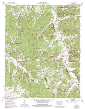
Ruskin Topo Map Tennessee
To zoom in, hover over the map of Ruskin
USGS Topo Quad 36087b5 - 1:24,000 scale
| Topo Map Name: | Ruskin |
| USGS Topo Quad ID: | 36087b5 |
| Print Size: | ca. 21 1/4" wide x 27" high |
| Southeast Coordinates: | 36.125° N latitude / 87.5° W longitude |
| Map Center Coordinates: | 36.1875° N latitude / 87.5625° W longitude |
| U.S. State: | TN |
| Filename: | o36087b5.jpg |
| Download Map JPG Image: | Ruskin topo map 1:24,000 scale |
| Map Type: | Topographic |
| Topo Series: | 7.5´ |
| Map Scale: | 1:24,000 |
| Source of Map Images: | United States Geological Survey (USGS) |
| Alternate Map Versions: |
Ruskin TN 1936 Download PDF Buy paper map Ruskin TN 1953, updated 1958 Download PDF Buy paper map Ruskin TN 1953, updated 1974 Download PDF Buy paper map Ruskin TN 1953, updated 1991 Download PDF Buy paper map Ruskin TN 2010 Download PDF Buy paper map Ruskin TN 2013 Download PDF Buy paper map Ruskin TN 2016 Download PDF Buy paper map |
1:24,000 Topo Quads surrounding Ruskin
> Back to 36087a1 at 1:100,000 scale
> Back to 36086a1 at 1:250,000 scale
> Back to U.S. Topo Maps home
Ruskin topo map: Gazetteer
Ruskin: Dams
Sawmill Branch Dam elevation 241m 790′Ruskin: Populated Places
Adams Crossroads elevation 164m 538′Edgewood elevation 183m 600′
Marthas Chapel elevation 152m 498′
Omega (historical) elevation 156m 511′
Ruskin elevation 175m 574′
Spring Valley elevation 182m 597′
Thompsons Crossroads elevation 231m 757′
Williamsville (historical) elevation 183m 600′
Yellow Creek elevation 181m 593′
Ruskin: Reservoirs
Sawmill Branch Lake elevation 241m 790′Ruskin: Ridges
Nubbin Ridge elevation 224m 734′Ruskin: Springs
Bradford Spring elevation 188m 616′Rogers Spring elevation 173m 567′
Ruskin Cave Spring elevation 179m 587′
Vanhook Spring elevation 187m 613′
Ruskin: Streams
Balthrop Branch elevation 153m 501′Bateman Branch elevation 183m 600′
Bear Creek elevation 147m 482′
Cave Branch elevation 161m 528′
Cedar Creek elevation 154m 505′
Childress Branch elevation 145m 475′
Dodd Branch elevation 176m 577′
East Fork Yellow Creek elevation 171m 561′
Ennis Branch elevation 183m 600′
Freeman Branch elevation 165m 541′
Gravelly Run elevation 176m 577′
Hunt Branch elevation 164m 538′
Jordan Branch elevation 156m 511′
Shoulder Strap Branch elevation 149m 488′
Whiteoak Branch elevation 164m 538′
Ruskin: Valleys
Averitt Hollow elevation 186m 610′Biffle Hollow elevation 153m 501′
Black John Hollow elevation 163m 534′
Brown Hollow elevation 185m 606′
Buckeye Hollow elevation 154m 505′
Burgess Hollow elevation 204m 669′
Dilley Hollow elevation 177m 580′
Dobbins Hollow elevation 187m 613′
Dry Hollow elevation 171m 561′
Fowler Hollow elevation 163m 534′
Freeman Hollow elevation 167m 547′
Hatcher Hollow elevation 193m 633′
Horse Hollow elevation 183m 600′
Jamison Hollow elevation 180m 590′
Jones Hollow elevation 165m 541′
Masterson Hollow elevation 182m 597′
Mayhan Hollow elevation 158m 518′
Murphy Hollow elevation 167m 547′
Newman Hollow elevation 159m 521′
Randolph Hollow elevation 170m 557′
Rock Ditch Hollow elevation 185m 606′
Sheehy Hollow elevation 177m 580′
Smith Hollow elevation 198m 649′
Smith Hollow elevation 161m 528′
Stanfield Hollow elevation 176m 577′
Thompson Hollow elevation 176m 577′
Tubbs Hollow elevation 189m 620′
Union Hollow elevation 181m 593′
Vanhook Hollow elevation 189m 620′
Williams Hollow elevation 189m 620′
Ruskin digital topo map on disk
Buy this Ruskin topo map showing relief, roads, GPS coordinates and other geographical features, as a high-resolution digital map file on DVD:


