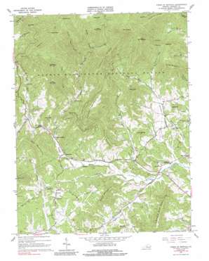
Forks Of Buffalo Topo Map Virginia
To zoom in, hover over the map of Forks Of Buffalo
USGS Topo Quad 37079f2 - 1:24,000 scale
| Topo Map Name: | Forks Of Buffalo |
| USGS Topo Quad ID: | 37079f2 |
| Print Size: | ca. 21 1/4" wide x 27" high |
| Southeast Coordinates: | 37.625° N latitude / 79.125° W longitude |
| Map Center Coordinates: | 37.6875° N latitude / 79.1875° W longitude |
| U.S. State: | VA |
| Filename: | o37079f2.jpg |
| Download Map JPG Image: | Forks Of Buffalo topo map 1:24,000 scale |
| Map Type: | Topographic |
| Topo Series: | 7.5´ |
| Map Scale: | 1:24,000 |
| Source of Map Images: | United States Geological Survey (USGS) |
| Alternate Map Versions: |
Forks Of Buffalo VA 1963, updated 1965 Download PDF Buy paper map Forks Of Buffalo VA 1963, updated 1984 Download PDF Buy paper map Forks of Buffalo VA 1963, updated 1990 Download PDF Buy paper map Forks of Buffalo VA 2011 Download PDF Buy paper map Forks of Buffalo VA 2013 Download PDF Buy paper map Forks of Buffalo VA 2016 Download PDF Buy paper map |
| FStopo: | US Forest Service topo Forks of Buffalo is available: Download FStopo PDF Download FStopo TIF |
1:24,000 Topo Quads surrounding Forks Of Buffalo
> Back to 37079e1 at 1:100,000 scale
> Back to 37078a1 at 1:250,000 scale
> Back to U.S. Topo Maps home
Forks Of Buffalo topo map: Gazetteer
Forks Of Buffalo: Dams
Buffalo River Dam Number Two elevation 218m 715′Mays Dam elevation 228m 748′
Forks Of Buffalo: Gaps
Cowcamp Gap elevation 1060m 3477′Tolley Gap elevation 634m 2080′
Forks Of Buffalo: Populated Places
Allwood elevation 304m 997′Browntown elevation 291m 954′
Fancy Hill elevation 244m 800′
Forks of Buffalo elevation 286m 938′
Sandidges elevation 208m 682′
Willow elevation 337m 1105′
Forks Of Buffalo: Reservoirs
Mays Pond elevation 228m 748′Thrasher Lake elevation 216m 708′
Forks Of Buffalo: Ridges
Cardinal Ridge elevation 857m 2811′Chestnut Ridge elevation 922m 3024′
Forks Of Buffalo: Streams
Cove Creek elevation 342m 1122′Franklin Creek elevation 205m 672′
Little Cove Creek elevation 503m 1650′
Long Branch elevation 231m 757′
North Fork Buffalo River elevation 289m 948′
North Fork Thrashers Creek elevation 316m 1036′
Puppy Creek elevation 208m 682′
Rocky Branch elevation 589m 1932′
South Fork Buffalo River elevation 288m 944′
South Fork Horsley Creek elevation 254m 833′
South Fork Thrashers Creek elevation 316m 1036′
Thrashers Creek elevation 205m 672′
Forks Of Buffalo: Summits
Bald Knob elevation 1232m 4041′Banks Mountain elevation 657m 2155′
Buck Mountain elevation 1025m 3362′
Burks Mountain elevation 500m 1640′
Fletcher Mountain elevation 888m 2913′
Floyds Mountain elevation 1061m 3480′
Fork Mountain elevation 772m 2532′
Glenn Mountain elevation 482m 1581′
Jennings Mountain elevation 372m 1220′
Little Mount Pleasant elevation 946m 3103′
Little Rocky Mountain elevation 1034m 3392′
Mollys Mountain elevation 392m 1286′
Mount Pleasant elevation 496m 1627′
Mount Pleasant elevation 1223m 4012′
Panther Mountain elevation 683m 2240′
Pierce Mountain elevation 614m 2014′
Piney Mountain elevation 712m 2335′
Scott Mountain elevation 738m 2421′
Stinnett Mountain elevation 502m 1646′
Sut Mountain elevation 564m 1850′
Turkey Mountain elevation 465m 1525′
Forks Of Buffalo: Trails
Tolley Gap Trail elevation 518m 1699′Forks Of Buffalo digital topo map on disk
Buy this Forks Of Buffalo topo map showing relief, roads, GPS coordinates and other geographical features, as a high-resolution digital map file on DVD:
Western Virginia & Southern West Virginia
Buy digital topo maps: Western Virginia & Southern West Virginia


