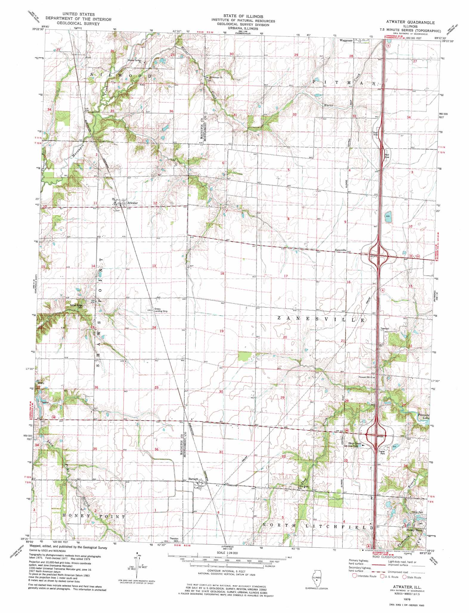
Atwater Topo Map Illinois
To zoom in, hover over the map of Atwater
USGS Topo Quad 39089c6 - 1:24,000 scale
| Topo Map Name: | Atwater |
| USGS Topo Quad ID: | 39089c6 |
| Print Size: | ca. 21 1/4" wide x 27" high |
| Southeast Coordinates: | 39.25° N latitude / 89.625° W longitude |
| Map Center Coordinates: | 39.3125° N latitude / 89.6875° W longitude |
| U.S. State: | IL |
| Filename: | o39089c6.jpg |
| Download Map JPG Image: | Atwater topo map 1:24,000 scale |
| Map Type: | Topographic |
| Topo Series: | 7.5´ |
| Map Scale: | 1:24,000 |
| Source of Map Images: | United States Geological Survey (USGS) |
| Alternate Map Versions: |
Atwater IL 2012 Download PDF Buy paper map Atwater IL 2015 Download PDF Buy paper map |
1:24,000 Topo Quads surrounding Atwater
Waverly |
Virden North |
Divernon |
Pawnee |
Kincaid |
Palmyra |
Virden South |
Farmersville |
Raymond Ne |
Morrisonville |
Carlinville West |
Carlinville East |
Atwater |
Raymond |
Nokomis Sw |
Plainview |
Gillespie North |
Litchfield |
Butler |
Hillsboro |
Bunker Hill |
Gillespie South |
Mount Olive |
Sorento North |
Coffeen |
> Back to 39089a1 at 1:100,000 scale
> Back to 39088a1 at 1:250,000 scale
> Back to U.S. Topo Maps home
Atwater topo map: Gazetteer
Atwater: Airports
Emery Landing Strip elevation 195m 639′Atwater: Crossings
Interchange 60 elevation 195m 639′Interchange 63 elevation 202m 662′
Atwater: Populated Places
Atwater elevation 193m 633′Barnett elevation 200m 656′
Shop Creek elevation 197m 646′
Zanesville elevation 197m 646′
Atwater: Post Offices
Atwater Post Office elevation 193m 633′Atwater: Streams
Deer Branch elevation 181m 593′Horse Creek elevation 178m 583′
Shearles Branch elevation 176m 577′
Shop Creek elevation 184m 603′
Atwater digital topo map on disk
Buy this Atwater topo map showing relief, roads, GPS coordinates and other geographical features, as a high-resolution digital map file on DVD:
Northern Illinois, Northern Indiana & Southwestern Michigan
Buy digital topo maps: Northern Illinois, Northern Indiana & Southwestern Michigan