Stillwell Topo Map Indiana
To zoom in, hover over the map of Stillwell
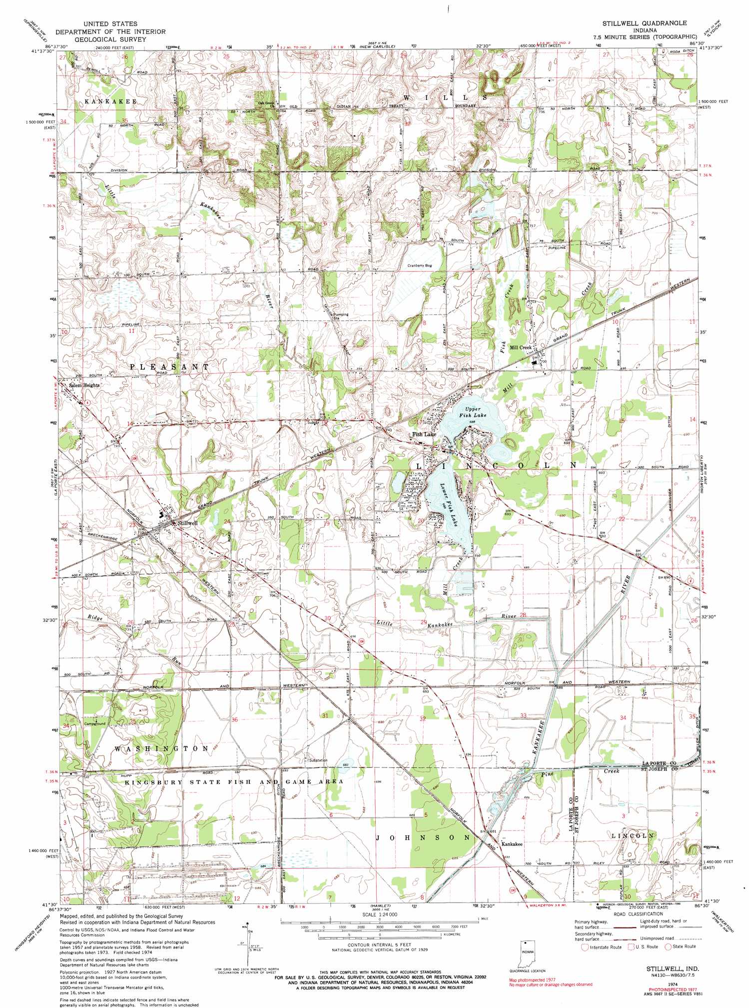
USGS Topo Quad 41086e5 - 1:24,000 scale
| Topo Map Name: | Stillwell |
| USGS Topo Quad ID: | 41086e5 |
| Print Size: | ca. 21 1/4" wide x 27" high |
| Southeast Coordinates: | 41.5° N latitude / 86.5° W longitude |
| Map Center Coordinates: | 41.5625° N latitude / 86.5625° W longitude |
| U.S. State: | IN |
| Filename: | o41086e5.jpg |
| Download Map JPG Image: | Stillwell topo map 1:24,000 scale |
| Map Type: | Topographic |
| Topo Series: | 7.5´ |
| Map Scale: | 1:24,000 |
| Source of Map Images: | United States Geological Survey (USGS) |
| Alternate Map Versions: |
Stillwell IN 1958, updated 1961 Download PDF Buy paper map Stillwell IN 1974, updated 1975 Download PDF Buy paper map Stillwell IN 1974, updated 1990 Download PDF Buy paper map Stillwell IN 2010 Download PDF Buy paper map Stillwell IN 2013 Download PDF Buy paper map Stillwell IN 2016 Download PDF Buy paper map |
1:24,000 Topo Quads surrounding Stillwell
New Buffalo West |
New Buffalo East |
Three Oaks |
Galien |
Niles West |
Michigan City East |
Springville |
New Carlisle |
Lydick |
South Bend West |
Laporte West |
Laporte East |
Stillwell |
North Liberty |
Lakeville |
Hanna |
Kingsford Heights |
Hamlet |
Walkerton |
La Paz |
English Lake |
Knox West |
Knox East |
Donaldson |
Plymouth |
> Back to 41086e1 at 1:100,000 scale
> Back to 41086a1 at 1:250,000 scale
> Back to U.S. Topo Maps home
Stillwell topo map: Gazetteer
Stillwell: Canals
Barringer Ditch elevation 211m 692′Breckenridge Ditch elevation 211m 692′
Stillwell: Lakes
Lower Fish Lake elevation 209m 685′Upper Fish Lake elevation 210m 688′
Stillwell: Parks
Kingsbury State Fish and Game Area elevation 210m 688′Stillwell: Populated Places
Fish Lake elevation 214m 702′Hamlet elevation 215m 705′
Kankakee elevation 210m 688′
Salem Heights elevation 227m 744′
Stillwell elevation 224m 734′
Stillwell: Streams
Fish Creek elevation 210m 688′Little Kankakee River elevation 208m 682′
Mill Creek elevation 208m 682′
Ridge Run elevation 212m 695′
Stillwell digital topo map on disk
Buy this Stillwell topo map showing relief, roads, GPS coordinates and other geographical features, as a high-resolution digital map file on DVD:
Northern Illinois, Northern Indiana & Southwestern Michigan
Buy digital topo maps: Northern Illinois, Northern Indiana & Southwestern Michigan