Rochester Topo Map Michigan
To zoom in, hover over the map of Rochester
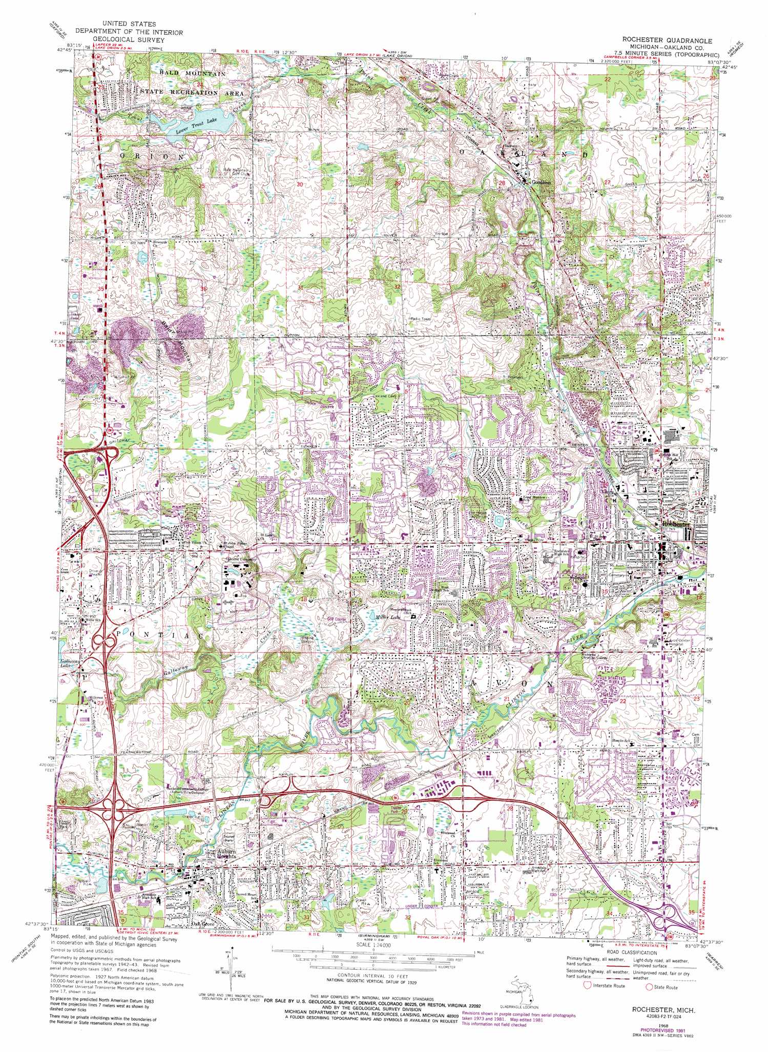
USGS Topo Quad 42083f2 - 1:24,000 scale
| Topo Map Name: | Rochester |
| USGS Topo Quad ID: | 42083f2 |
| Print Size: | ca. 21 1/4" wide x 27" high |
| Southeast Coordinates: | 42.625° N latitude / 83.125° W longitude |
| Map Center Coordinates: | 42.6875° N latitude / 83.1875° W longitude |
| U.S. State: | MI |
| Filename: | o42083f2.jpg |
| Download Map JPG Image: | Rochester topo map 1:24,000 scale |
| Map Type: | Topographic |
| Topo Series: | 7.5´ |
| Map Scale: | 1:24,000 |
| Source of Map Images: | United States Geological Survey (USGS) |
| Alternate Map Versions: |
Rochester MI 1945 Download PDF Buy paper map Rochester MI 1952, updated 1954 Download PDF Buy paper map Rochester MI 1952, updated 1966 Download PDF Buy paper map Rochester MI 1968, updated 1971 Download PDF Buy paper map Rochester MI 1968, updated 1974 Download PDF Buy paper map Rochester MI 1968, updated 1981 Download PDF Buy paper map Rochester MI 1968, updated 1988 Download PDF Buy paper map Rochester MI 1968, updated 1988 Download PDF Buy paper map Rochester MI 1997, updated 2000 Download PDF Buy paper map Rochester MI 2011 Download PDF Buy paper map Rochester MI 2014 Download PDF Buy paper map Rochester MI 2017 Download PDF Buy paper map |
1:24,000 Topo Quads surrounding Rochester
Hadley |
Metamora |
Thornville |
Almont |
Allenton |
Ortonville |
Oxford |
Lake Orion |
Romeo |
Armada |
Clarkston |
Pontiac North |
Rochester |
Utica |
Waldenburg |
Walled Lake |
Pontiac South |
Birmingham |
Warren |
Mount Clemens West |
Northville |
Redford |
Royal Oak |
Highland Park |
Grosse Pointe |
> Back to 42083e1 at 1:100,000 scale
> Back to 42082a1 at 1:250,000 scale
> Back to U.S. Topo Maps home
Rochester topo map: Gazetteer
Rochester: Airports
McPhail Corporation Heliport elevation 236m 774′Rochester: Canals
Dutton Ditch elevation 286m 938′Galloway Ditch elevation 289m 948′
Rochester: Lakes
Miller Lake elevation 254m 833′Rochester: Populated Places
Auburn Heights elevation 263m 862′Auburn Hills elevation 292m 958′
Goodison elevation 256m 839′
Rochester elevation 229m 751′
Rochester Hills elevation 251m 823′
Rochester: Reservoirs
Lower Trout Lake elevation 284m 931′Rochester: Streams
Galloway Creek elevation 247m 810′Paint Creek elevation 219m 718′
Sargent Creek elevation 234m 767′
Trout Creek elevation 266m 872′
Rochester: Summits
Bald Mountain elevation 346m 1135′Rochester digital topo map on disk
Buy this Rochester topo map showing relief, roads, GPS coordinates and other geographical features, as a high-resolution digital map file on DVD:
 map DVD")