Delavan Topo Map Wisconsin
To zoom in, hover over the map of Delavan
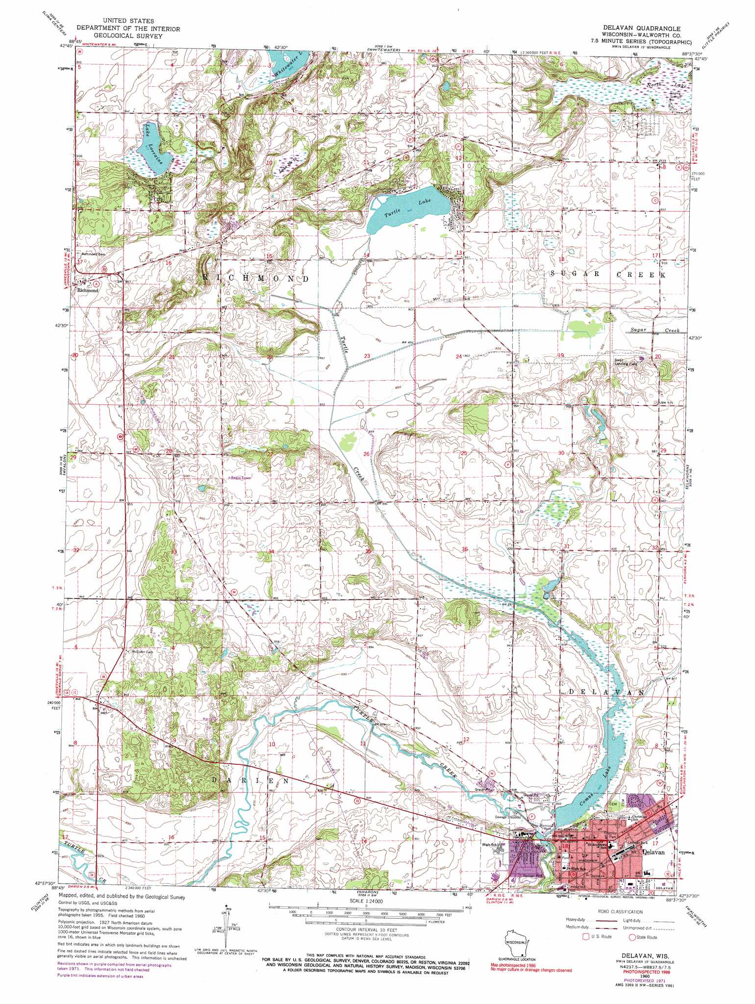
USGS Topo Quad 42088f6 - 1:24,000 scale
| Topo Map Name: | Delavan |
| USGS Topo Quad ID: | 42088f6 |
| Print Size: | ca. 21 1/4" wide x 27" high |
| Southeast Coordinates: | 42.625° N latitude / 88.625° W longitude |
| Map Center Coordinates: | 42.6875° N latitude / 88.6875° W longitude |
| U.S. State: | WI |
| Filename: | o42088f6.jpg |
| Download Map JPG Image: | Delavan topo map 1:24,000 scale |
| Map Type: | Topographic |
| Topo Series: | 7.5´ |
| Map Scale: | 1:24,000 |
| Source of Map Images: | United States Geological Survey (USGS) |
| Alternate Map Versions: |
Delavan WI 1960, updated 1964 Download PDF Buy paper map Delavan WI 1960, updated 1972 Download PDF Buy paper map Delavan WI 1960, updated 1991 Download PDF Buy paper map Delavan WI 2010 Download PDF Buy paper map Delavan WI 2013 Download PDF Buy paper map Delavan WI 2016 Download PDF Buy paper map |
1:24,000 Topo Quads surrounding Delavan
Busseyville |
Fort Atkinson |
Rome |
Palmyra |
Eagle |
Milton |
Lima Center |
Whitewater |
Little Prairie |
East Troy |
Janesville East |
Avalon |
Delavan |
Elkhorn |
Springfield |
Shopiere |
Clinton |
Sharon |
Walworth |
Lake Geneva |
Belvidere Nw |
Belvidere Ne |
Capron |
Harvard |
Hebron |
> Back to 42088e1 at 1:100,000 scale
> Back to 42088a1 at 1:250,000 scale
> Back to U.S. Topo Maps home
Delavan topo map: Gazetteer
Delavan: Airports
Ames Private Airport elevation 289m 948′Swan Airport elevation 277m 908′
Delavan: Dams
Delavan 3WR1282 Dam elevation 271m 889′Delavan: Lakes
Lake Lorraine elevation 279m 915′Lake Number Ten elevation 278m 912′
North Lake elevation 276m 905′
Turtle Lake elevation 274m 898′
Delavan: Parks
Holton Park elevation 272m 892′Latimer Park elevation 286m 938′
New Hollister Wetlands Conservancy elevation 287m 941′
Phoenix Park elevation 284m 931′
Robert H Miller Park elevation 283m 928′
Springs Park elevation 274m 898′
Terrace Park elevation 272m 892′
Veterans Memorial Park elevation 271m 889′
Delavan: Populated Places
Delavan elevation 285m 935′Richmond elevation 302m 990′
Delavan: Post Offices
Delavan Post Office elevation 285m 935′Delavan: Reservoirs
Comus Lake elevation 271m 889′Lake Comus 67 elevation 271m 889′
Delavan digital topo map on disk
Buy this Delavan topo map showing relief, roads, GPS coordinates and other geographical features, as a high-resolution digital map file on DVD:
Northern Illinois, Northern Indiana & Southwestern Michigan
Buy digital topo maps: Northern Illinois, Northern Indiana & Southwestern Michigan