Nickel Mountain Topo Map Oregon
To zoom in, hover over the map of Nickel Mountain
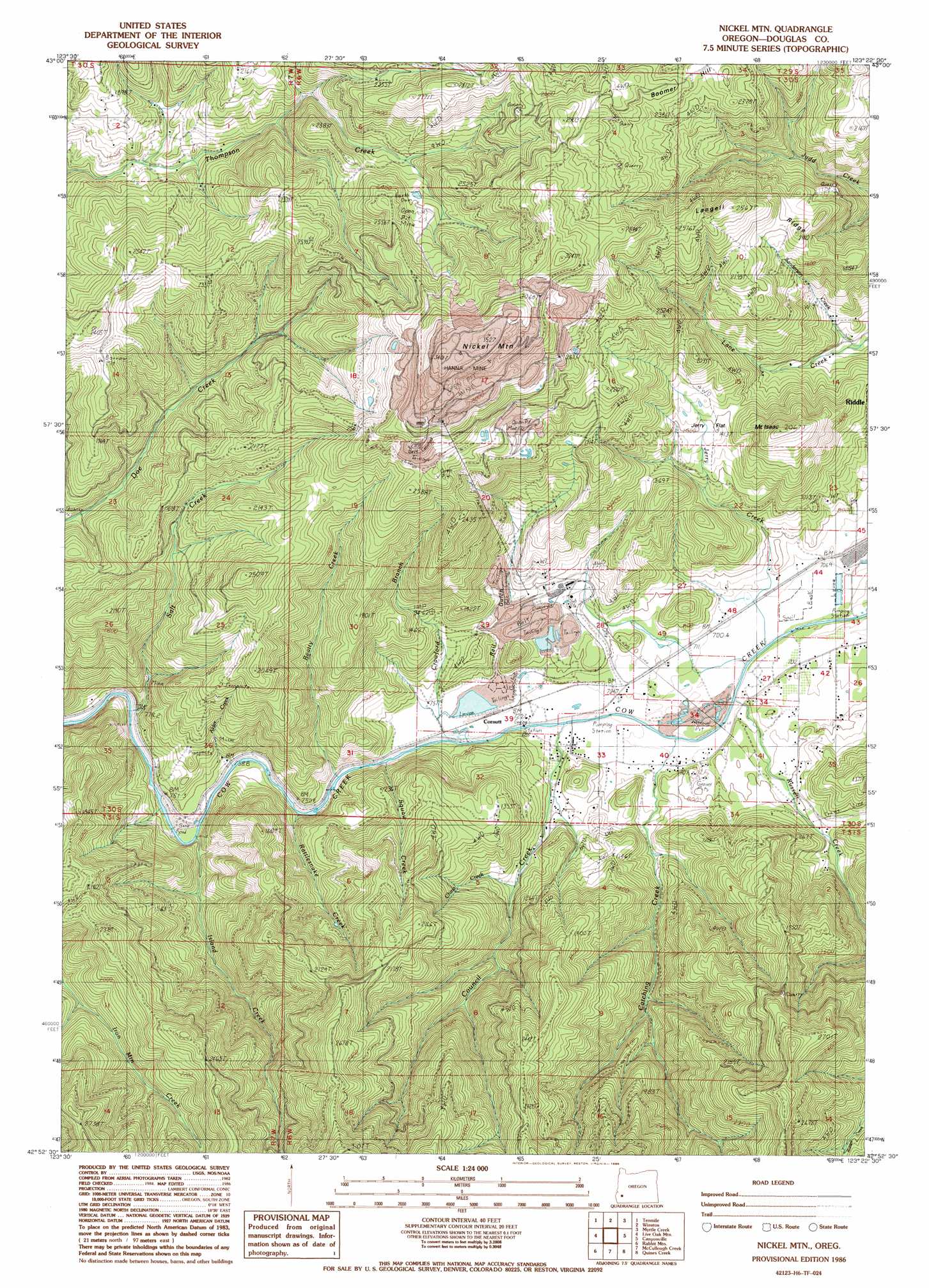
USGS Topo Quad 42123h4 - 1:24,000 scale
| Topo Map Name: | Nickel Mountain |
| USGS Topo Quad ID: | 42123h4 |
| Print Size: | ca. 21 1/4" wide x 27" high |
| Southeast Coordinates: | 42.875° N latitude / 123.375° W longitude |
| Map Center Coordinates: | 42.9375° N latitude / 123.4375° W longitude |
| U.S. State: | OR |
| Filename: | o42123h4.jpg |
| Download Map JPG Image: | Nickel Mountain topo map 1:24,000 scale |
| Map Type: | Topographic |
| Topo Series: | 7.5´ |
| Map Scale: | 1:24,000 |
| Source of Map Images: | United States Geological Survey (USGS) |
| Alternate Map Versions: |
Nickel Mtn OR 1986, updated 1986 Download PDF Buy paper map Nickel Mountain OR 2011 Download PDF Buy paper map Nickel Mountain OR 2014 Download PDF Buy paper map |
1:24,000 Topo Quads surrounding Nickel Mountain
Mount Gurney |
Reston |
Roseburg West |
Roseburg East |
Dixonville |
Camas Valley |
Tenmile |
Winston |
Myrtle Creek |
Dodson Butte |
Chipmunk Ridge |
Live Oak Mountain |
Nickel Mountain |
Canyonville |
Days Creek |
Dutchman Butte |
Rabbit Mountain |
Mccullough Creek |
Quines Creek |
Starvout Creek |
Bunker Creek |
Mount Reuben |
Glendale |
Golden |
King Mountain |
> Back to 42123e1 at 1:100,000 scale
> Back to 42122a1 at 1:250,000 scale
> Back to U.S. Topo Maps home
Nickel Mountain topo map: Gazetteer
Nickel Mountain: Flats
Jerry Flat elevation 423m 1387′Nickel Mountain: Mines
Hanna Mine elevation 1015m 3330′Nickel Mountain: Reservoirs
Lake Stomar Reservoir elevation 214m 702′Nickel Mountain: Ridges
Langell Ridge elevation 635m 2083′Nickel Mountain: Streams
Alder Creek elevation 227m 744′Beatty Creek elevation 225m 738′
Catching Creek elevation 213m 698′
China Creek elevation 308m 1010′
Council Creek elevation 216m 708′
Crawford Branch elevation 203m 666′
Island Creek elevation 228m 748′
Jerry Creek elevation 204m 669′
Little Doe Creek elevation 393m 1289′
Rattlesnake Creek elevation 221m 725′
Russell Creek elevation 214m 702′
Salt Creek elevation 229m 751′
Sanderson Brook elevation 272m 892′
Squaw Creek elevation 264m 866′
Nickel Mountain: Summits
Boomer Hill elevation 689m 2260′Mount Isaac elevation 597m 1958′
Nickel Mountain elevation 1049m 3441′
Nickel Mountain: Valleys
Rail Gulch elevation 226m 741′Nickel Mountain digital topo map on disk
Buy this Nickel Mountain topo map showing relief, roads, GPS coordinates and other geographical features, as a high-resolution digital map file on DVD: