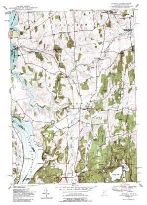
Orwell Topo Map Vermont
To zoom in, hover over the map of Orwell
USGS Topo Quad 43073g3 - 1:24,000 scale
| Topo Map Name: | Orwell |
| USGS Topo Quad ID: | 43073g3 |
| Print Size: | ca. 21 1/4" wide x 27" high |
| Southeast Coordinates: | 43.75° N latitude / 73.25° W longitude |
| Map Center Coordinates: | 43.8125° N latitude / 73.3125° W longitude |
| U.S. States: | VT, NY |
| Filename: | o43073g3.jpg |
| Download Map JPG Image: | Orwell topo map 1:24,000 scale |
| Map Type: | Topographic |
| Topo Series: | 7.5´ |
| Map Scale: | 1:24,000 |
| Source of Map Images: | United States Geological Survey (USGS) |
| Alternate Map Versions: |
Orwell VT 1927 Download PDF Buy paper map Orwell VT 1949 Download PDF Buy paper map Orwell VT 1949, updated 1957 Download PDF Buy paper map Orwell VT 1949, updated 1988 Download PDF Buy paper map Orwell VT 2011 Download PDF Buy paper map Orwell VT 2012 Download PDF Buy paper map Orwell VT 2015 Download PDF Buy paper map |
1:24,000 Topo Quads surrounding Orwell
> Back to 43073e1 at 1:100,000 scale
> Back to 43072a1 at 1:250,000 scale
> Back to U.S. Topo Maps home
Orwell topo map: Gazetteer
Orwell: Bays
Allen Bay elevation 25m 82′Beadles Cove elevation 25m 82′
Benson Bay elevation 25m 82′
Hands Cove elevation 25m 82′
Stevens Bay elevation 25m 82′
Orwell: Bridges
East Shoreham Covered Railroad Bridge elevation 76m 249′Orwell: Capes
Gourlie Point elevation 27m 88′Sixmile Point elevation 30m 98′
Orwell: Cliffs
Arnolds Ledge elevation 165m 541′Blue Ledge elevation 88m 288′
White Ledge elevation 92m 301′
Orwell: Dams
East Creek Site 1 Dam elevation 90m 295′East Creek Site 2 Dam elevation 89m 291′
Sunrise Lake Dam elevation 146m 479′
Orwell: Lakes
Choate Pond elevation 245m 803′Doughty Pond elevation 191m 626′
Mud Pond elevation 204m 669′
Perch Pond elevation 170m 557′
Spruce Pond elevation 191m 626′
Sunset Lake elevation 146m 479′
Orwell: Parks
East Creek Waterfowl Area elevation 27m 88′Pond Woods Wildlife Management Area elevation 258m 846′
Orwell: Pillars
The Pinnacle elevation 306m 1003′Orwell: Populated Places
East Shoreham elevation 82m 269′Hough Crossing elevation 73m 239′
Orwell elevation 114m 374′
Richville elevation 89m 291′
Stacy Crossroads elevation 99m 324′
Orwell: Reservoirs
Sunrise Lake elevation 146m 479′Orwell: Streams
Big Brook elevation 25m 82′Jones Brook elevation 65m 213′
North Fork East Creek elevation 26m 85′
Pepper Brook elevation 63m 206′
Royce Brook elevation 61m 200′
Sanford Brook elevation 89m 291′
South Fork East Creek elevation 89m 291′
Stacy Brook elevation 91m 298′
Orwell: Summits
Barnum Hill elevation 155m 508′Bishop Hill elevation 251m 823′
Blueberry Hill elevation 230m 754′
Conkey Hill elevation 226m 741′
Cutting Hill elevation 155m 508′
Daigneau Hill elevation 192m 629′
Doughty Hill elevation 233m 764′
Hardigan Hill elevation 172m 564′
Hibbard Hill elevation 159m 521′
Hutton Hill elevation 98m 321′
Murray Hill elevation 179m 587′
Needham Hill elevation 214m 702′
Oak Hill elevation 268m 879′
Orwell: Swamps
Conway Swamp elevation 204m 669′Negro Marsh elevation 26m 85′
Orwell digital topo map on disk
Buy this Orwell topo map showing relief, roads, GPS coordinates and other geographical features, as a high-resolution digital map file on DVD:
New York, Vermont, Connecticut & Western Massachusetts
Buy digital topo maps: New York, Vermont, Connecticut & Western Massachusetts


