Diamond Lake Topo Map Oregon
To zoom in, hover over the map of Diamond Lake
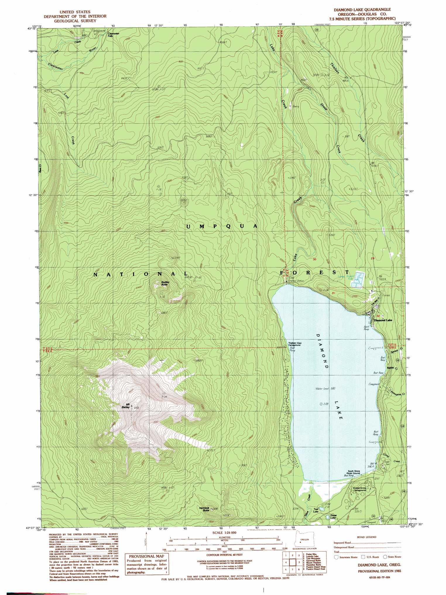
USGS Topo Quad 43122b2 - 1:24,000 scale
| Topo Map Name: | Diamond Lake |
| USGS Topo Quad ID: | 43122b2 |
| Print Size: | ca. 21 1/4" wide x 27" high |
| Southeast Coordinates: | 43.125° N latitude / 122.125° W longitude |
| Map Center Coordinates: | 43.1875° N latitude / 122.1875° W longitude |
| U.S. State: | OR |
| Filename: | o43122b2.jpg |
| Download Map JPG Image: | Diamond Lake topo map 1:24,000 scale |
| Map Type: | Topographic |
| Topo Series: | 7.5´ |
| Map Scale: | 1:24,000 |
| Source of Map Images: | United States Geological Survey (USGS) |
| Alternate Map Versions: |
Diamond Lake OR 1985, updated 1985 Download PDF Buy paper map Diamond Lake OR 1998, updated 2000 Download PDF Buy paper map Diamond Lake OR 2011 Download PDF Buy paper map Diamond Lake OR 2014 Download PDF Buy paper map |
| FStopo: | US Forest Service topo Diamond Lake is available: Download FStopo PDF Download FStopo TIF |
1:24,000 Topo Quads surrounding Diamond Lake
Staley Ridge |
Rigdon Point |
Emigrant Butte |
Cowhorn Mountain |
Crescent Lake |
Toketee Falls |
Potter Mountain |
Lemolo Lake |
Tolo Mountain |
Burn Butte |
Fish Creek Desert |
Garwood Butte |
Diamond Lake |
Mount Thielsen |
Miller Lake |
Fish Mountain |
Hamaker Butte |
Pumice Desert West |
Pumice Desert East |
Welch Butte |
Union Creek |
Thousand Springs |
Crater Lake West |
Crater Lake East |
Pothole Butte |
> Back to 43122a1 at 1:100,000 scale
> Back to 43122a1 at 1:250,000 scale
> Back to U.S. Topo Maps home
Diamond Lake topo map: Gazetteer
Diamond Lake: Beaches
Pumice Beach elevation 1586m 5203′Diamond Lake: Falls
Clearwater Falls elevation 1292m 4238′Diamond Lake: Lakes
Diamond Lake elevation 1581m 5187′Horse Lake elevation 1589m 5213′
Teal Lake elevation 1585m 5200′
Diamond Lake: Parks
Diamond Lake Trailer Camp Area elevation 1592m 5223′Diamond Lake: Populated Places
Diamond Lake elevation 1613m 5291′Diamond Lake: Post Offices
Diamond Lake Post Office elevation 1613m 5291′Diamond Lake: Streams
Camp Creek elevation 1581m 5187′Dry Creek elevation 1581m 5187′
Lost Creek elevation 1238m 4061′
Porcupine Creek elevation 1581m 5187′
Rabbit Creek elevation 1581m 5187′
Sheep Creek elevation 1430m 4691′
Short Creek elevation 1581m 5187′
Silent Creek elevation 1582m 5190′
Spruce Creek elevation 1581m 5187′
Two Bear Creek elevation 1581m 5187′
Diamond Lake: Summits
Hemlock Butte elevation 1894m 6213′Mount Bailey elevation 2537m 8323′
Rodley Butte elevation 2057m 6748′
Diamond Lake: Trails
Beartrap Trail elevation 1647m 5403′Mount Bailey Trail elevation 1909m 6263′
Rodley Butte Trail elevation 1574m 5164′
Diamond Lake digital topo map on disk
Buy this Diamond Lake topo map showing relief, roads, GPS coordinates and other geographical features, as a high-resolution digital map file on DVD: