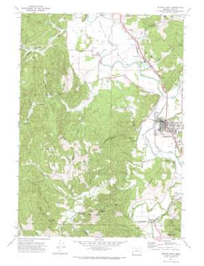
Myrtle Point Topo Map Oregon
To zoom in, hover over the map of Myrtle Point
USGS Topo Quad 43124a2 - 1:24,000 scale
| Topo Map Name: | Myrtle Point |
| USGS Topo Quad ID: | 43124a2 |
| Print Size: | ca. 21 1/4" wide x 27" high |
| Southeast Coordinates: | 43° N latitude / 124.125° W longitude |
| Map Center Coordinates: | 43.0625° N latitude / 124.1875° W longitude |
| U.S. State: | OR |
| Filename: | o43124a2.jpg |
| Download Map JPG Image: | Myrtle Point topo map 1:24,000 scale |
| Map Type: | Topographic |
| Topo Series: | 7.5´ |
| Map Scale: | 1:24,000 |
| Source of Map Images: | United States Geological Survey (USGS) |
| Alternate Map Versions: |
Myrtle Point OR 1971, updated 1973 Download PDF Buy paper map Myrtle Point OR 2011 Download PDF Buy paper map Myrtle Point OR 2014 Download PDF Buy paper map |
1:24,000 Topo Quads surrounding Myrtle Point
> Back to 43124a1 at 1:100,000 scale
> Back to 43124a1 at 1:250,000 scale
> Back to U.S. Topo Maps home
Myrtle Point topo map: Gazetteer
Myrtle Point: Airports
Norway Airstrip elevation 8m 26′Myrtle Point: Areas
Hall Prairie elevation 17m 55′Myrtle Point: Dams
Myrtle Point Veneer Company Log Dam elevation 9m 29′Myrtle Point: Parks
Arago Boat Ramp elevation 4m 13′Lions Memorial Park elevation 62m 203′
Rotary Park elevation 31m 101′
Sunset Park elevation 42m 137′
Myrtle Point: Pillars
Marsters Rock elevation 297m 974′Myrtle Point: Populated Places
Arago elevation 9m 29′Broadbent elevation 24m 78′
Estabrook elevation 14m 45′
Myrtle Point elevation 34m 111′
Norway elevation 16m 52′
Myrtle Point: Post Offices
Arago Post Office (historical) elevation 9m 29′Broadbent Post Office elevation 24m 78′
Elliott Post Office (historical) elevation 37m 121′
Myrtle Point Post Office elevation 34m 111′
Norway Post Office elevation 16m 52′
Myrtle Point: Reservoirs
Myrtle Point Log Pond elevation 9m 29′Myrtle Point: Streams
Catching Creek elevation 5m 16′Coal Creek elevation 25m 82′
Cove Creek elevation 39m 127′
Fishtrap Creek elevation 4m 13′
Gettys Creek elevation 37m 121′
Grady Creek elevation 6m 19′
Gray Creek elevation 7m 22′
Hall Creek elevation 5m 16′
Kausen Creek elevation 134m 439′
Knight Creek elevation 73m 239′
Little Fishtrap Creek elevation 11m 36′
Llewellyn Creek elevation 8m 26′
Matheny Creek elevation 4m 13′
North Fork Coquille River elevation 4m 13′
Rhoda Creek elevation 12m 39′
Rich Creek elevation 12m 39′
Rock Robinson Creek elevation 36m 118′
Rollan Creek elevation 21m 68′
South Fork Coquille River elevation 4m 13′
Ward Creek elevation 33m 108′
Warner Creek elevation 11m 36′
Wolf Creek elevation 37m 121′
Myrtle Point: Summits
Cribbins Hill elevation 172m 564′Robbins Butte elevation 242m 793′
Myrtle Point: Valleys
Chicken Gulch elevation 37m 121′Four Bit Gulch elevation 16m 52′
Horse Hollow elevation 33m 108′
Pleasant Valley elevation 22m 72′
Myrtle Point digital topo map on disk
Buy this Myrtle Point topo map showing relief, roads, GPS coordinates and other geographical features, as a high-resolution digital map file on DVD:


