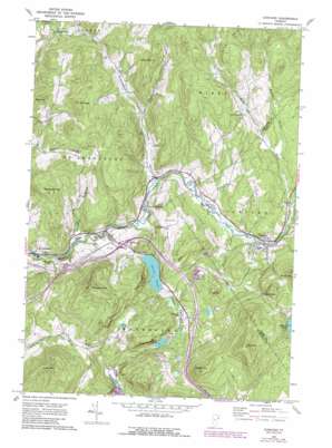
Concord Topo Map Vermont
To zoom in, hover over the map of Concord
USGS Topo Quad 44071d8 - 1:24,000 scale
| Topo Map Name: | Concord |
| USGS Topo Quad ID: | 44071d8 |
| Print Size: | ca. 21 1/4" wide x 27" high |
| Southeast Coordinates: | 44.375° N latitude / 71.875° W longitude |
| Map Center Coordinates: | 44.4375° N latitude / 71.9375° W longitude |
| U.S. State: | VT |
| Filename: | o44071d8.jpg |
| Download Map JPG Image: | Concord topo map 1:24,000 scale |
| Map Type: | Topographic |
| Topo Series: | 7.5´ |
| Map Scale: | 1:24,000 |
| Source of Map Images: | United States Geological Survey (USGS) |
| Alternate Map Versions: |
Concord VT 1967, updated 1973 Download PDF Buy paper map Concord VT 1967, updated 1989 Download PDF Buy paper map Concord VT 2012 Download PDF Buy paper map Concord VT 2015 Download PDF Buy paper map |
1:24,000 Topo Quads surrounding Concord
> Back to 44071a1 at 1:100,000 scale
> Back to 44070a1 at 1:250,000 scale
> Back to U.S. Topo Maps home
Concord topo map: Gazetteer
Concord: Crossings
Interchange 1 elevation 264m 866′Concord: Dams
Stiles Pond Dam elevation 267m 875′Concord: Forests
Saint Johnsbury Municipal Forest elevation 276m 905′Concord: Lakes
Duck Pond elevation 288m 944′Grays Pond elevation 218m 715′
Concord: Mines
Kirby Mountain Quarries elevation 538m 1765′Concord: Populated Places
Concord elevation 271m 889′East Saint Johnsbury elevation 242m 793′
South Kirby elevation 374m 1227′
Whites Corner elevation 509m 1669′
Concord: Reservoirs
Stiles Pond elevation 267m 875′Concord: Streams
Duck Pond Brook elevation 267m 875′Kirby Brook elevation 288m 944′
Ranney Brook elevation 298m 977′
Spaulding Brook elevation 203m 666′
Stiles Brook elevation 219m 718′
Stockwell Brook elevation 257m 843′
Concord: Summits
Badger Mountain elevation 538m 1765′Bible Hill elevation 375m 1230′
Fuller Hill elevation 621m 2037′
Mount Pisgah elevation 439m 1440′
Saddleback Mountain elevation 423m 1387′
Silsby Mountain elevation 563m 1847′
Sugar Hill elevation 469m 1538′
Concord: Valleys
Chesterfield Valley elevation 240m 787′Mud Hollow elevation 268m 879′
Concord digital topo map on disk
Buy this Concord topo map showing relief, roads, GPS coordinates and other geographical features, as a high-resolution digital map file on DVD:
Maine, New Hampshire, Rhode Island & Eastern Massachusetts
Buy digital topo maps: Maine, New Hampshire, Rhode Island & Eastern Massachusetts


