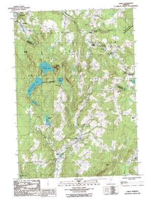
Cabot Topo Map Vermont
To zoom in, hover over the map of Cabot
USGS Topo Quad 44072d3 - 1:24,000 scale
| Topo Map Name: | Cabot |
| USGS Topo Quad ID: | 44072d3 |
| Print Size: | ca. 21 1/4" wide x 27" high |
| Southeast Coordinates: | 44.375° N latitude / 72.25° W longitude |
| Map Center Coordinates: | 44.4375° N latitude / 72.3125° W longitude |
| U.S. State: | VT |
| Filename: | o44072d3.jpg |
| Download Map JPG Image: | Cabot topo map 1:24,000 scale |
| Map Type: | Topographic |
| Topo Series: | 7.5´ |
| Map Scale: | 1:24,000 |
| Source of Map Images: | United States Geological Survey (USGS) |
| Alternate Map Versions: |
Cabot VT 1986, updated 1987 Download PDF Buy paper map Cabot VT 1986, updated 1987 Download PDF Buy paper map Cabot VT 2012 Download PDF Buy paper map Cabot VT 2015 Download PDF Buy paper map |
1:24,000 Topo Quads surrounding Cabot
> Back to 44072a1 at 1:100,000 scale
> Back to 44072a1 at 1:250,000 scale
> Back to U.S. Topo Maps home
Cabot topo map: Gazetteer
Cabot: Benches
Nichols Ledge elevation 426m 1397′Cabot: Dams
East Long Pond Dam elevation 367m 1204′Mackville Dam elevation 277m 908′
Nichols Pond Dam elevation 367m 1204′
West Hill Pond Dam elevation 348m 1141′
Cabot: Lakes
Coits Pond elevation 404m 1325′Mud Pond elevation 367m 1204′
Cabot: Parks
Steam Mill Brook Wildlife Management Area elevation 503m 1650′Cabot: Populated Places
Cabot elevation 323m 1059′East Cabot elevation 486m 1594′
Lower Cabot elevation 286m 938′
Mackville elevation 284m 931′
Smith Corner elevation 445m 1459′
South Walden elevation 372m 1220′
Taylor Bridge elevation 364m 1194′
Walden Heights elevation 514m 1686′
Cabot: Post Offices
Cabot Post Office elevation 317m 1040′Cabot: Reservoirs
East Long Pond elevation 367m 1204′Mackville Pond elevation 277m 908′
Mackville Pond elevation 278m 912′
Nichols Pond elevation 344m 1128′
West Hill Pond elevation 348m 1141′
Cabot: Streams
Jug Brook elevation 285m 935′Morrill Brook elevation 328m 1076′
Nichols Brook elevation 243m 797′
Perkins Meadow Brook elevation 329m 1079′
Cabot: Summits
Burbank Hill elevation 601m 1971′Danville Hill elevation 665m 2181′
Cabot: Swamps
Martell Swamp elevation 345m 1131′Cabot digital topo map on disk
Buy this Cabot topo map showing relief, roads, GPS coordinates and other geographical features, as a high-resolution digital map file on DVD:
New York, Vermont, Connecticut & Western Massachusetts
Buy digital topo maps: New York, Vermont, Connecticut & Western Massachusetts


