Three Rivers Peak Topo Map Wyoming
To zoom in, hover over the map of Three Rivers Peak
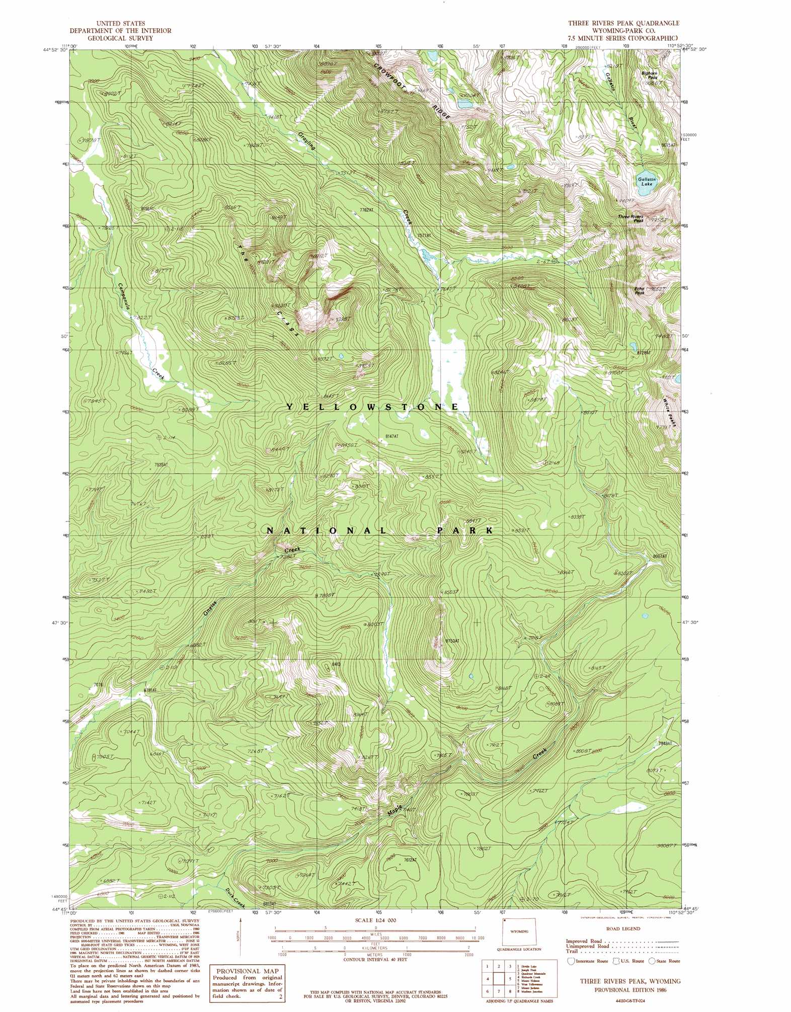
USGS Topo Quad 44110g8 - 1:24,000 scale
| Topo Map Name: | Three Rivers Peak |
| USGS Topo Quad ID: | 44110g8 |
| Print Size: | ca. 21 1/4" wide x 27" high |
| Southeast Coordinates: | 44.75° N latitude / 110.875° W longitude |
| Map Center Coordinates: | 44.8125° N latitude / 110.9375° W longitude |
| U.S. State: | WY |
| Filename: | o44110g8.jpg |
| Download Map JPG Image: | Three Rivers Peak topo map 1:24,000 scale |
| Map Type: | Topographic |
| Topo Series: | 7.5´ |
| Map Scale: | 1:24,000 |
| Source of Map Images: | United States Geological Survey (USGS) |
| Alternate Map Versions: |
Three Rivers Peak WY 1986, updated 1986 Download PDF Buy paper map Three Rivers Peak WY 2012 Download PDF Buy paper map Three Rivers Peak WY 2015 Download PDF Buy paper map |
1:24,000 Topo Quads surrounding Three Rivers Peak
Sunshine Point |
Big Horn Peak |
Sportsman Lake |
Electric Peak |
Gardiner |
Upper Tepee Basin |
Divide Lake |
Joseph Peak |
Quadrant Mountain |
Mammoth |
Mount Hebgen |
Richards Creek |
Three Rivers Peak |
Mount Holmes |
Obsidian Cliff |
Madison Arm |
West Yellowstone |
Mount Jackson |
Madison Junction |
Norris Junction |
Reas Pass |
Jack Straw Basin |
Buffalo Meadows |
Lower Geyser Basin |
Mary Lake |
> Back to 44110e1 at 1:100,000 scale
> Back to 44110a1 at 1:250,000 scale
> Back to U.S. Topo Maps home
Three Rivers Peak topo map: Gazetteer
Three Rivers Peak: Gaps
Bighorn Pass elevation 2770m 9087′Three Rivers Peak: Lakes
Gallatin Lake elevation 2690m 8825′Three Rivers Peak: Ridges
Crowfoot Ridge elevation 2885m 9465′Three Rivers Peak: Summits
Echo Peak elevation 2917m 9570′The Crags elevation 2776m 9107′
Three Rivers Peak elevation 2976m 9763′
Three Rivers Peak digital topo map on disk
Buy this Three Rivers Peak topo map showing relief, roads, GPS coordinates and other geographical features, as a high-resolution digital map file on DVD: