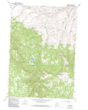
Antone Topo Map Oregon
To zoom in, hover over the map of Antone
USGS Topo Quad 44119d7 - 1:24,000 scale
| Topo Map Name: | Antone |
| USGS Topo Quad ID: | 44119d7 |
| Print Size: | ca. 21 1/4" wide x 27" high |
| Southeast Coordinates: | 44.375° N latitude / 119.75° W longitude |
| Map Center Coordinates: | 44.4375° N latitude / 119.8125° W longitude |
| U.S. State: | OR |
| Filename: | o44119d7.jpg |
| Download Map JPG Image: | Antone topo map 1:24,000 scale |
| Map Type: | Topographic |
| Topo Series: | 7.5´ |
| Map Scale: | 1:24,000 |
| Source of Map Images: | United States Geological Survey (USGS) |
| Alternate Map Versions: |
Antone OR 1966, updated 1968 Download PDF Buy paper map Antone OR 1966, updated 1985 Download PDF Buy paper map Antone OR 1992, updated 1997 Download PDF Buy paper map Antone OR 2011 Download PDF Buy paper map Antone OR 2014 Download PDF Buy paper map |
| FStopo: | US Forest Service topo Antone is available: Download FStopo PDF Download FStopo TIF |
1:24,000 Topo Quads surrounding Antone
> Back to 44119a1 at 1:100,000 scale
> Back to 44118a1 at 1:250,000 scale
> Back to U.S. Topo Maps home
Antone topo map: Gazetteer
Antone: Canals
Erickson Ditch elevation 1315m 4314′Philling-McFadden Ditch elevation 1141m 3743′
Antone: Dams
Rock Creek Lake Dam elevation 1346m 4416′Antone: Flats
Buck Pasture elevation 1496m 4908′Antone: Lakes
Fred Creek Lake elevation 1151m 3776′Antone: Mines
Andrews Mine elevation 1373m 4504′Waterman Mine elevation 1294m 4245′
Antone: Populated Places
Antone (historical) elevation 1054m 3458′Antone: Post Offices
Antone Post Office (historical) elevation 1054m 3458′Antone: Reservoirs
Rock Creek Lake elevation 1346m 4416′Antone: Springs
Cottonwood Spring elevation 1757m 5764′Edmonson Spring elevation 1325m 4347′
Leggins Spring elevation 1592m 5223′
Saddle Spring elevation 1685m 5528′
Tate Spring elevation 1501m 4924′
Ted Glover Spring elevation 1245m 4084′
Triplet Spring elevation 1947m 6387′
Vehrs Spring elevation 1765m 5790′
Antone: Streams
Balm Creek elevation 1387m 4550′Bear Creek elevation 1437m 4714′
Cockleburr Creek elevation 1069m 3507′
Fir Tree Creek elevation 1442m 4730′
First Creek elevation 1310m 4297′
Fred Creek elevation 1049m 3441′
High Creek elevation 1133m 3717′
Joe Creek elevation 1122m 3681′
Maley Creek elevation 1182m 3877′
Second Creek elevation 1362m 4468′
Shingle Creek elevation 1114m 3654′
West Branch Rock Creek elevation 1288m 4225′
Antone: Summits
Spanish Peak elevation 2092m 6863′Antone: Valleys
Hope Gulch elevation 1031m 3382′Pine Gulch elevation 972m 3188′
Pine Hollow elevation 1163m 3815′
Antone digital topo map on disk
Buy this Antone topo map showing relief, roads, GPS coordinates and other geographical features, as a high-resolution digital map file on DVD:


