Johnson Heights Topo Map Oregon
To zoom in, hover over the map of Johnson Heights
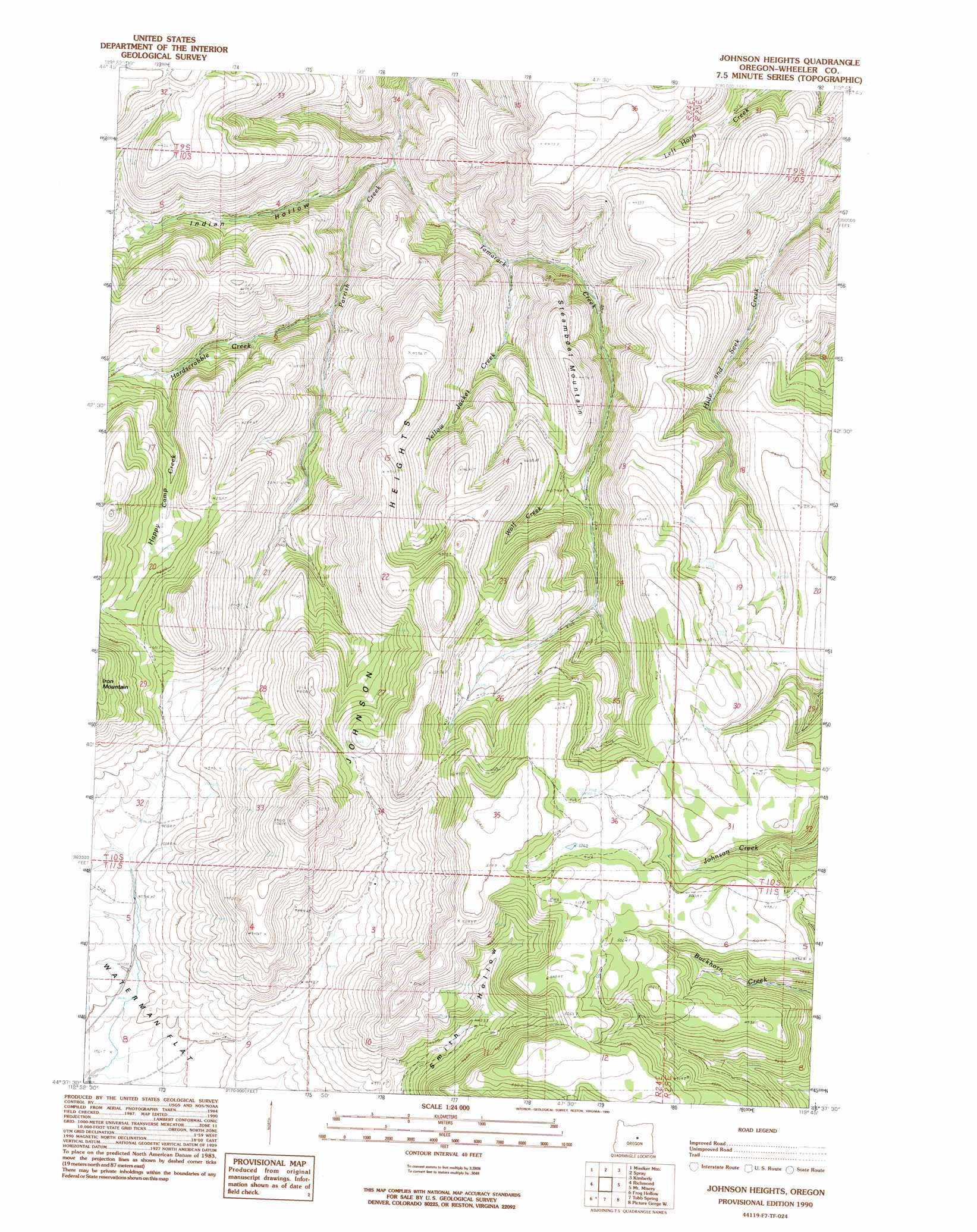
USGS Topo Quad 44119f7 - 1:24,000 scale
| Topo Map Name: | Johnson Heights |
| USGS Topo Quad ID: | 44119f7 |
| Print Size: | ca. 21 1/4" wide x 27" high |
| Southeast Coordinates: | 44.625° N latitude / 119.75° W longitude |
| Map Center Coordinates: | 44.6875° N latitude / 119.8125° W longitude |
| U.S. State: | OR |
| Filename: | o44119f7.jpg |
| Download Map JPG Image: | Johnson Heights topo map 1:24,000 scale |
| Map Type: | Topographic |
| Topo Series: | 7.5´ |
| Map Scale: | 1:24,000 |
| Source of Map Images: | United States Geological Survey (USGS) |
| Alternate Map Versions: |
Johnson Heights OR 1990, updated 1990 Download PDF Buy paper map Johnson Heights OR 2011 Download PDF Buy paper map Johnson Heights OR 2014 Download PDF Buy paper map |
1:24,000 Topo Quads surrounding Johnson Heights
Kinzua |
Wheeler Point |
Collins Butte |
Whitetail Butte |
Turner Mountain |
Service Creek |
Massacre Mountain |
Spray |
Kimberly |
Bologna Basin |
Toney Butte |
Richmond |
Johnson Heights |
Mount Misery |
Miller Flat |
Keyes Mountain |
Frog Hollow |
Tubb Spring |
Picture Gorge West |
Picture Gorge East |
Peterson Point |
Derr Meadows |
Antone |
Day Basin |
Dayville |
> Back to 44119e1 at 1:100,000 scale
> Back to 44118a1 at 1:250,000 scale
> Back to U.S. Topo Maps home
Johnson Heights topo map: Gazetteer
Johnson Heights: Ridges
Johnson Heights elevation 1603m 5259′Johnson Heights: Streams
Happy Camp Creek elevation 1148m 3766′Hardscrabble Creek elevation 1006m 3300′
Straube Creek elevation 1233m 4045′
Tamarack Creek elevation 910m 2985′
Wolf Creek elevation 1230m 4035′
Yellow Jacket Creek elevation 1028m 3372′
Johnson Heights: Summits
Steamboat Mountain elevation 1353m 4438′Johnson Heights: Valleys
Indian Hollow elevation 903m 2962′Smith Hollow elevation 1296m 4251′
Johnson Heights digital topo map on disk
Buy this Johnson Heights topo map showing relief, roads, GPS coordinates and other geographical features, as a high-resolution digital map file on DVD: