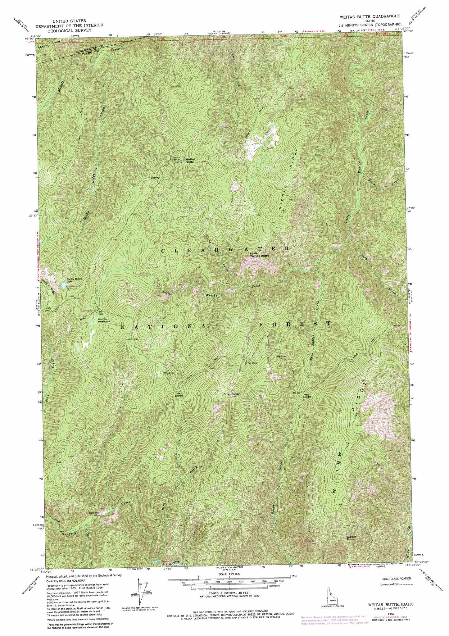
Weitas Butte Topo Map Idaho
To zoom in, hover over the map of Weitas Butte
USGS Topo Quad 46115d4 - 1:24,000 scale
| Topo Map Name: | Weitas Butte |
| USGS Topo Quad ID: | 46115d4 |
| Print Size: | ca. 21 1/4" wide x 27" high |
| Southeast Coordinates: | 46.375° N latitude / 115.375° W longitude |
| Map Center Coordinates: | 46.4375° N latitude / 115.4375° W longitude |
| U.S. State: | ID |
| Filename: | o46115d4.jpg |
| Download Map JPG Image: | Weitas Butte topo map 1:24,000 scale |
| Map Type: | Topographic |
| Topo Series: | 7.5´ |
| Map Scale: | 1:24,000 |
| Source of Map Images: | United States Geological Survey (USGS) |
| Alternate Map Versions: |
Weitas Butte ID 1966, updated 1968 Download PDF Buy paper map Weitas Butte ID 1966, updated 1984 Download PDF Buy paper map Weitas Butte ID 1994, updated 1997 Download PDF Buy paper map Weitas Butte ID 2011 Download PDF Buy paper map Weitas Butte ID 2013 Download PDF Buy paper map |
| FStopo: | US Forest Service topo Weitas Butte is available: Download FStopo PDF Download FStopo TIF |
1:24,000 Topo Quads surrounding Weitas Butte
Browns Rock |
Clarke Mountain |
Pot Mountain |
Junction Mountain |
Scurvy Mountain |
French Mountain |
Larch Butte |
Lean-To Point |
Cook Mountain |
Lookout Peak |
Hemlock Butte |
Snowy Summit |
Weitas Butte |
Liz Butte |
Holly Creek |
Musselshell |
Boundary Peak |
Mclendon Butte |
Huckleberry Butte |
Greenside Butte |
Syringa |
Lowell |
Coolwater Mountain |
Chimney Peak |
Fenn Mountain |
> Back to 46115a1 at 1:100,000 scale
> Back to 46114a1 at 1:250,000 scale
> Back to U.S. Topo Maps home
Weitas Butte topo map: Gazetteer
Weitas Butte: Capes
Willow Point elevation 1589m 5213′Weitas Butte: Flats
Weitas Meadows elevation 1652m 5419′Weitas Butte: Gaps
Deep Saddle elevation 1534m 5032′Green Saddle elevation 1651m 5416′
Weitas Butte: Lakes
Rocky Ridge Lake elevation 1728m 5669′Weitas Butte: Ridges
Middle Ridge elevation 1638m 5374′Weitas Butte: Streams
Bowl Creek elevation 1049m 3441′Burn Creek elevation 1091m 3579′
Deep Saddle Creek elevation 1156m 3792′
Flame Creek elevation 1019m 3343′
Rocky Ridge Creek elevation 1096m 3595′
Salix Creek elevation 1025m 3362′
Stove Creek elevation 1290m 4232′
Weitas Butte: Summits
Bowl Butte elevation 1943m 6374′Little Weitas Butte elevation 1736m 5695′
Weitas Butte elevation 1814m 5951′
Weitas Butte digital topo map on disk
Buy this Weitas Butte topo map showing relief, roads, GPS coordinates and other geographical features, as a high-resolution digital map file on DVD: