Coppei Topo Map Washington
To zoom in, hover over the map of Coppei
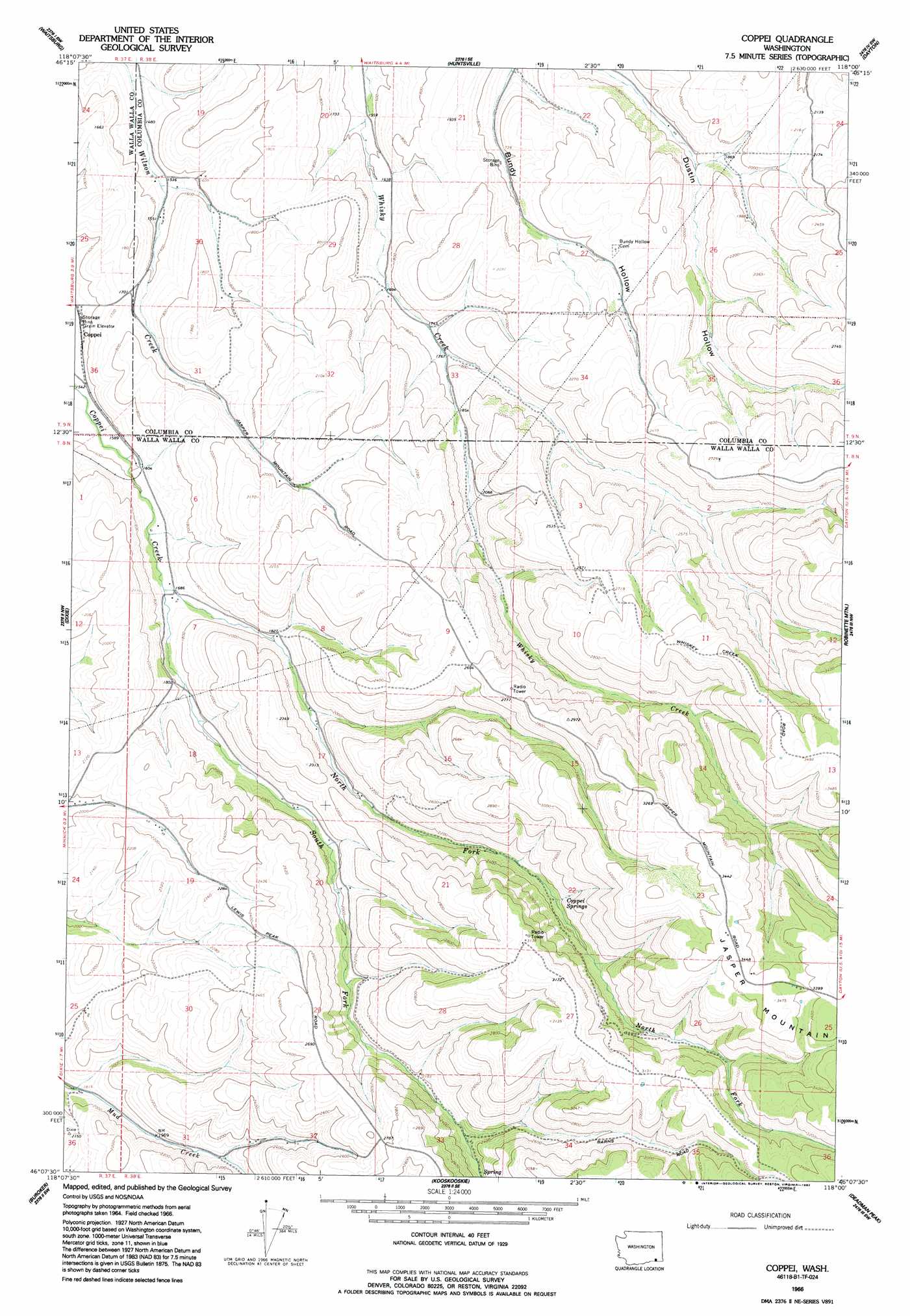
USGS Topo Quad 46118b1 - 1:24,000 scale
| Topo Map Name: | Coppei |
| USGS Topo Quad ID: | 46118b1 |
| Print Size: | ca. 21 1/4" wide x 27" high |
| Southeast Coordinates: | 46.125° N latitude / 118° W longitude |
| Map Center Coordinates: | 46.1875° N latitude / 118.0625° W longitude |
| U.S. State: | WA |
| Filename: | o46118b1.jpg |
| Download Map JPG Image: | Coppei topo map 1:24,000 scale |
| Map Type: | Topographic |
| Topo Series: | 7.5´ |
| Map Scale: | 1:24,000 |
| Source of Map Images: | United States Geological Survey (USGS) |
| Alternate Map Versions: |
Coppei WA 1966, updated 1967 Download PDF Buy paper map Coppei WA 1966, updated 1992 Download PDF Buy paper map Coppei WA 2011 Download PDF Buy paper map Coppei WA 2013 Download PDF Buy paper map |
1:24,000 Topo Quads surrounding Coppei
Pleasant View |
Waitsburg Nw |
Kellogg Creek |
Tucannon |
Turner |
Prescott |
Waitsburg |
Huntsville |
Dayton |
Cahill Mountain |
Valley Grove |
Dixie |
Coppei |
Robinette Mountain |
Eckler Mountain |
Walla Walla |
Buroker |
Kooskooskie |
Deadman Peak |
Godman Spring |
Bowlus Hill |
Peterson Ridge |
Big Meadows |
Bone Spring |
Wenaha Forks |
> Back to 46118a1 at 1:100,000 scale
> Back to 46118a1 at 1:250,000 scale
> Back to U.S. Topo Maps home
Coppei topo map: Gazetteer
Coppei: Populated Places
Coppei elevation 468m 1535′Coppei: Springs
Coppei Springs elevation 772m 2532′Coppei: Streams
North Fork Coppei Creek elevation 512m 1679′South Fork Coppei Creek elevation 511m 1676′
Coppei: Summits
Jasper Mountain elevation 1050m 3444′Coppei digital topo map on disk
Buy this Coppei topo map showing relief, roads, GPS coordinates and other geographical features, as a high-resolution digital map file on DVD: