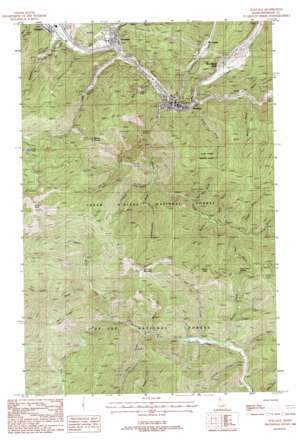
Wallace Topo Map Idaho
To zoom in, hover over the map of Wallace
USGS Topo Quad 47115d8 - 1:24,000 scale
| Topo Map Name: | Wallace |
| USGS Topo Quad ID: | 47115d8 |
| Print Size: | ca. 21 1/4" wide x 27" high |
| Southeast Coordinates: | 47.375° N latitude / 115.875° W longitude |
| Map Center Coordinates: | 47.4375° N latitude / 115.9375° W longitude |
| U.S. State: | ID |
| Filename: | o47115d8.jpg |
| Download Map JPG Image: | Wallace topo map 1:24,000 scale |
| Map Type: | Topographic |
| Topo Series: | 7.5´ |
| Map Scale: | 1:24,000 |
| Source of Map Images: | United States Geological Survey (USGS) |
| Alternate Map Versions: |
Wallace ID 1988, updated 1988 Download PDF Buy paper map Wallace ID 1995, updated 1998 Download PDF Buy paper map Wallace ID 2011 Download PDF Buy paper map Wallace ID 2013 Download PDF Buy paper map |
| FStopo: | US Forest Service topo Wallace is available: Download FStopo PDF Download FStopo TIF |
1:24,000 Topo Quads surrounding Wallace
> Back to 47115a1 at 1:100,000 scale
> Back to 47114a1 at 1:250,000 scale
> Back to U.S. Topo Maps home
Wallace topo map: Gazetteer
Wallace: Airports
Wallace Ranger Station Heliport elevation 804m 2637′Wallace: Dams
Galena Mill Number One-Upper Dam elevation 875m 2870′Galena Mill Number Three-Lower Dam elevation 906m 2972′
Galena Mill Number Two-Middle Dam elevation 875m 2870′
Osborn Tailings Dam elevation 845m 2772′
Star Tailings Number Five Dam elevation 947m 3106′
Star Tailings Number Four Dam elevation 1034m 3392′
Star Tailings Number One Dam elevation 927m 3041′
Star Tailings Number Six Dam elevation 1106m 3628′
Star Tailings Number Three Dam elevation 993m 3257′
Star Tailings Number Two Dam elevation 915m 3001′
Wallace: Gaps
Slate Creek Saddle elevation 1456m 4776′Wallace: Lakes
Lost Lake elevation 1533m 5029′Wallace: Mines
Argentine Mine (historical) elevation 996m 3267′Elmo Mine elevation 848m 2782′
Galena Mine elevation 1038m 3405′
Wallace: Populated Places
Gentry elevation 866m 2841′McCarthy elevation 908m 2979′
Silverton elevation 807m 2647′
Wallace elevation 832m 2729′
Webb elevation 904m 2965′
Woodland Park elevation 887m 2910′
Wallace: Ranges
St. Joe Mountains elevation 1666m 5465′Wallace: Ridges
Dam Ridge elevation 1544m 5065′Wallace: Streams
Argentine Creek elevation 805m 2641′Canyon Creek elevation 845m 2772′
Corvus Creek elevation 972m 3188′
Dam Creek elevation 1094m 3589′
Flume Creek elevation 1055m 3461′
Foolhen Creek elevation 1124m 3687′
Horseshoe Creek elevation 982m 3221′
Lake Creek elevation 806m 2644′
Murray Creek elevation 1055m 3461′
Ninemile Creek elevation 830m 2723′
Placer Creek elevation 827m 2713′
Pond Creek elevation 1204m 3950′
Red Top Creek elevation 1001m 3284′
Summit Creek elevation 990m 3248′
West Fork Placer Creek elevation 901m 2956′
Wallace: Summits
Bad Tom Mountain elevation 1698m 5570′Mount Pulaski elevation 1630m 5347′
Placer Peak elevation 1591m 5219′
Striped Peak elevation 1921m 6302′
Wallace: Trails
Bad Tom Trail elevation 1400m 4593′Upper Slate Creek Trail elevation 1124m 3687′
Wallace: Valleys
Cranky Gulch elevation 963m 3159′Daly Gulch elevation 859m 2818′
Dexter Gulch elevation 886m 2906′
Dry Gulch elevation 819m 2687′
Dry Gulch elevation 1037m 3402′
Elbow Gulch elevation 1165m 3822′
Experimental Draw elevation 968m 3175′
Flora Gulch elevation 1128m 3700′
Hord Gulch elevation 1035m 3395′
Line Gulch elevation 1124m 3687′
Red Oak Gulch elevation 1009m 3310′
Revenue Gulch elevation 841m 2759′
Shields Gulch elevation 802m 2631′
Trowel Gulch elevation 1093m 3585′
Watson Gulch elevation 964m 3162′
Weyer Gulch elevation 888m 2913′
Wallace digital topo map on disk
Buy this Wallace topo map showing relief, roads, GPS coordinates and other geographical features, as a high-resolution digital map file on DVD:


