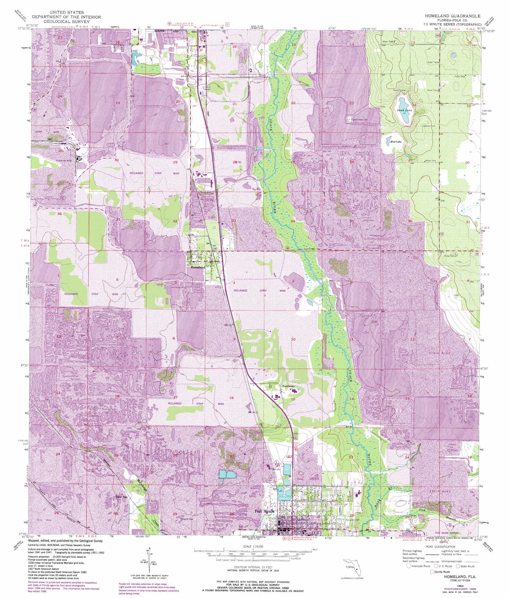
Homeland Topo Map Florida
To zoom in, hover over the map of Homeland
USGS Topo Quad 27081g7 - 1:24,000 scale
| Topo Map Name: | Homeland |
| USGS Topo Quad ID: | 27081g7 |
| Print Size: | ca. 21 1/4" wide x 27" high |
| Southeast Coordinates: | 27.75° N latitude / 81.75° W longitude |
| Map Center Coordinates: | 27.8125° N latitude / 81.8125° W longitude |
| U.S. State: | FL |
| Filename: | O27081G7.jpg |
| Download Map JPG Image: | Homeland topo map 1:24,000 scale |
| Map Type: | Topographic |
| Topo Series: | 7.5´ |
| Map Scale: | 1:24,000 |
| Source of Map Images: | United States Geological Survey (USGS) |
| Alternate Map Versions: |
Homeland FL 1952, updated 1953 Download PDF Buy paper map Homeland FL 1952, updated 1968 Download PDF Buy paper map Homeland FL 1952, updated 1973 Download PDF Buy paper map Homeland FL 1952, updated 1984 Download PDF Buy paper map Homeland FL 1952, updated 1987 Download PDF Buy paper map Homeland FL 2012 Download PDF Buy paper map Homeland FL 2015 Download PDF Buy paper map |
1:24,000 Topo Quads surrounding Homeland
Plant City East |
Lakeland |
Auburndale |
Winter Haven |
Dundee |
Nichols |
Mulberry |
Bartow |
Eloise |
Lake Wales |
Keysville |
Bradley Junction |
Homeland |
Alturas |
Babson Park |
Duette Ne |
Baird |
Bowling Green |
Bereah |
Frostproof |
Duette |
Fort Green |
Wauchula |
Griffins Corner |
Avon Park |
> Back to 27081e1 at 1:100,000 scale
> Back to 27080a1 at 1:250,000 scale
> Back to U.S. Topo Maps home
Homeland topo map: Gazetteer
Homeland: Bridges
John Singletary Bridge elevation 26m 85′Homeland: Lakes
Mud Lake elevation 38m 124′Noralyn Mine Lake elevation 40m 131′
Sand Lake elevation 35m 114′
Homeland: Mines
Clear Springs Mine elevation 34m 111′Peace Valley Mine elevation 35m 114′
Homeland: Populated Places
Dalley Town Park Mobile Home Park elevation 44m 144′Fort Meade elevation 42m 137′
Hendersons Mobile Home Park elevation 38m 124′
Homeland elevation 41m 134′
Oponys Town (historical) elevation 36m 118′
Pembroke elevation 38m 124′
Tiger Bay elevation 42m 137′
Homeland: Post Offices
Fort Meade Post Office elevation 42m 137′Homeland: Streams
Barber Branch elevation 26m 85′Camp Branch elevation 30m 98′
Rocky Branch elevation 22m 72′
Sink Branch elevation 23m 75′
Homeland digital topo map on disk
Buy this Homeland topo map showing relief, roads, GPS coordinates and other geographical features, as a high-resolution digital map file on DVD: