Mcqueeney Topo Map Texas
To zoom in, hover over the map of Mcqueeney
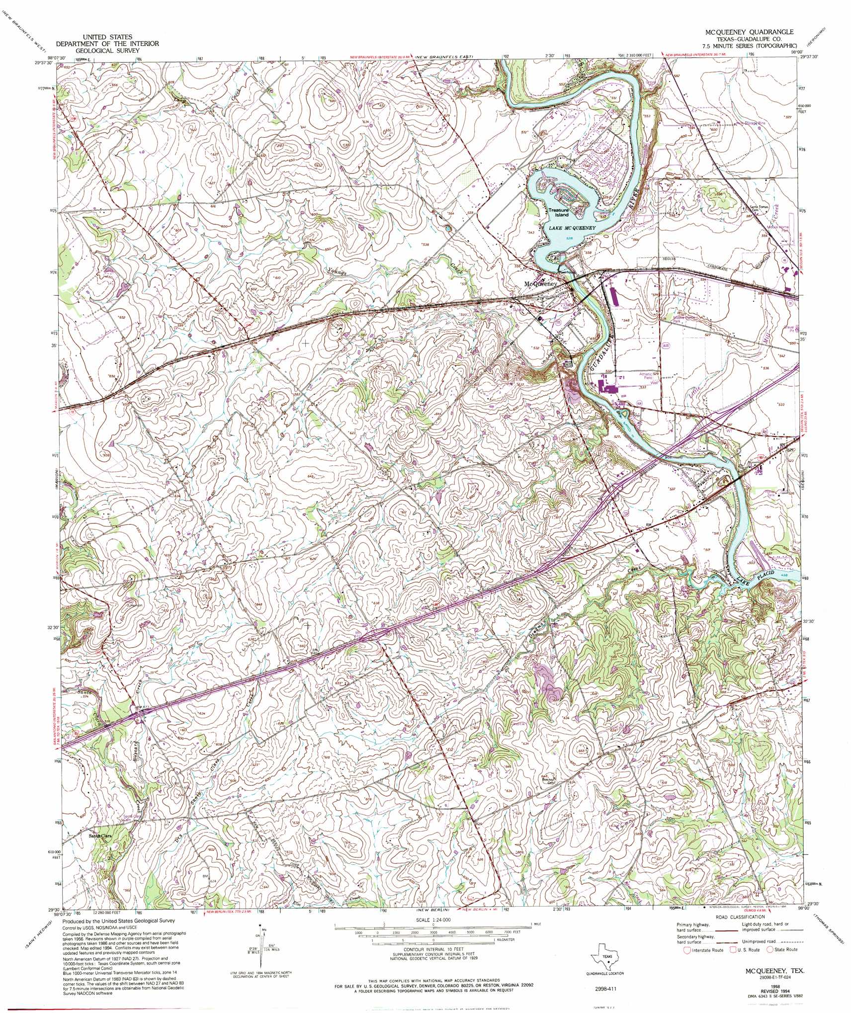
USGS Topo Quad 29098e1 - 1:24,000 scale
| Topo Map Name: | Mcqueeney |
| USGS Topo Quad ID: | 29098e1 |
| Print Size: | ca. 21 1/4" wide x 27" high |
| Southeast Coordinates: | 29.5° N latitude / 98° W longitude |
| Map Center Coordinates: | 29.5625° N latitude / 98.0625° W longitude |
| U.S. State: | TX |
| Filename: | o29098e1.jpg |
| Download Map JPG Image: | Mcqueeney topo map 1:24,000 scale |
| Map Type: | Topographic |
| Topo Series: | 7.5´ |
| Map Scale: | 1:24,000 |
| Source of Map Images: | United States Geological Survey (USGS) |
| Alternate Map Versions: |
McQueeney TX 1958, updated 1961 Download PDF Buy paper map McQueeney TX 1958, updated 1975 Download PDF Buy paper map McQueeney TX 1958, updated 1994 Download PDF Buy paper map McQueeney TX 2010 Download PDF Buy paper map McQueeney TX 2013 Download PDF Buy paper map McQueeney TX 2016 Download PDF Buy paper map |
1:24,000 Topo Quads surrounding Mcqueeney
Smithson Valley |
Sattler |
Hunter |
San Marcos South |
Martindale |
Bat Cave |
New Braunfels West |
New Braunfels East |
Geronimo |
Kingsbury |
Schertz |
Marion |
Mcqueeney |
Seguin |
Darst Creek |
Martinez |
Saint Hedwig |
New Berlin |
Thomas Springs |
Dewville |
Elmendorf |
La Vernia Sw |
La Vernia |
Alum |
Nixon |
> Back to 29098e1 at 1:100,000 scale
> Back to 29098a1 at 1:250,000 scale
> Back to U.S. Topo Maps home
Mcqueeney topo map: Gazetteer
Mcqueeney: Airports
Garys Airport elevation 200m 656′Saints Strip elevation 192m 629′
Mcqueeney: Crossings
Interchange 601 elevation 175m 574′Interchange 602 elevation 190m 623′
Interchange 603 elevation 183m 600′
Interchange 604 elevation 171m 561′
Interchange 605 elevation 165m 541′
Mcqueeney: Dams
Guadalupe-Blanco River Authority Tp-3 Dam elevation 153m 501′Mcqueeney: Islands
Treasure Island elevation 161m 528′Mcqueeney: Populated Places
Hilda Siding elevation 173m 567′McQueeney elevation 167m 547′
Morrison Falls elevation 159m 521′
Muehlsville elevation 185m 606′
Nolte elevation 161m 528′
Santa Clara elevation 181m 593′
Zipp elevation 159m 521′
Mcqueeney: Reservoirs
Lake McQueeney elevation 153m 501′Mcqueeney: Streams
Buzzard Creek elevation 168m 551′Deadman Creek elevation 152m 498′
Long Creek elevation 161m 528′
Youngs Creek elevation 152m 498′
Mcqueeney digital topo map on disk
Buy this Mcqueeney topo map showing relief, roads, GPS coordinates and other geographical features, as a high-resolution digital map file on DVD: