Doerun Topo Map Georgia
To zoom in, hover over the map of Doerun
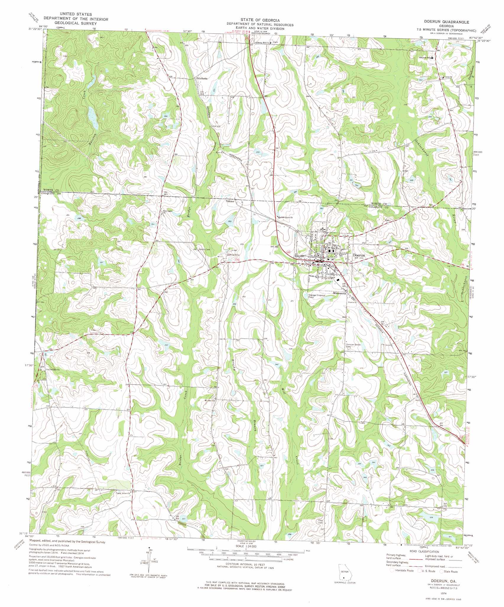
USGS Topo Quad 31083c8 - 1:24,000 scale
| Topo Map Name: | Doerun |
| USGS Topo Quad ID: | 31083c8 |
| Print Size: | ca. 21 1/4" wide x 27" high |
| Southeast Coordinates: | 31.25° N latitude / 83.875° W longitude |
| Map Center Coordinates: | 31.3125° N latitude / 83.9375° W longitude |
| U.S. State: | GA |
| Filename: | o31083c8.jpg |
| Download Map JPG Image: | Doerun topo map 1:24,000 scale |
| Map Type: | Topographic |
| Topo Series: | 7.5´ |
| Map Scale: | 1:24,000 |
| Source of Map Images: | United States Geological Survey (USGS) |
| Alternate Map Versions: |
Doerun GA 1974, updated 1976 Download PDF Buy paper map Doerun GA 2011 Download PDF Buy paper map Doerun GA 2014 Download PDF Buy paper map |
1:24,000 Topo Quads surrounding Doerun
Albany West |
Albany East |
Acree |
Sylvester |
Sumner |
Baconton North |
Putney |
Bridgeboro |
Tempy |
Ty Ty |
Baconton South |
Sale City |
Doerun |
Sigsbee |
Norman Park |
Camilla |
Cotton |
Hartsfield |
Moultrie |
Pineboro |
Pelham |
Meigs |
Chastain |
Coolidge |
Berlin West |
> Back to 31083a1 at 1:100,000 scale
> Back to 31082a1 at 1:250,000 scale
> Back to U.S. Topo Maps home
Doerun topo map: Gazetteer
Doerun: Dams
Sanders Lake Dam elevation 110m 360′Sells Lake Dam elevation 101m 331′
Doerun: Populated Places
Doerun elevation 119m 390′Minnesota elevation 117m 383′
Pritchetts elevation 114m 374′
Terrace (historical) elevation 90m 295′
Ticknor elevation 118m 387′
Doerun: Post Offices
Doerun Post Office elevation 120m 393′Doerun: Reservoirs
Sanders Lake elevation 110m 360′Sells Lake elevation 101m 331′
Doerun: Streams
Little Ochlockonee River elevation 90m 295′Doerun digital topo map on disk
Buy this Doerun topo map showing relief, roads, GPS coordinates and other geographical features, as a high-resolution digital map file on DVD: