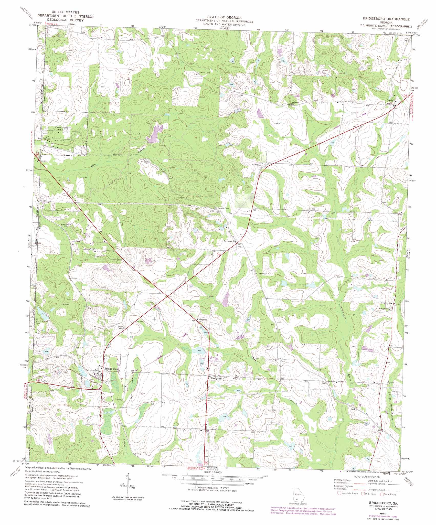
Bridgeboro Topo Map Georgia
To zoom in, hover over the map of Bridgeboro
USGS Topo Quad 31083d8 - 1:24,000 scale
| Topo Map Name: | Bridgeboro |
| USGS Topo Quad ID: | 31083d8 |
| Print Size: | ca. 21 1/4" wide x 27" high |
| Southeast Coordinates: | 31.375° N latitude / 83.875° W longitude |
| Map Center Coordinates: | 31.4375° N latitude / 83.9375° W longitude |
| U.S. State: | GA |
| Filename: | o31083d8.jpg |
| Download Map JPG Image: | Bridgeboro topo map 1:24,000 scale |
| Map Type: | Topographic |
| Topo Series: | 7.5´ |
| Map Scale: | 1:24,000 |
| Source of Map Images: | United States Geological Survey (USGS) |
| Alternate Map Versions: |
Bridgeboro GA 1974, updated 1976 Download PDF Buy paper map Bridgeboro GA 1974, updated 1988 Download PDF Buy paper map Bridgeboro GA 2011 Download PDF Buy paper map Bridgeboro GA 2014 Download PDF Buy paper map |
1:24,000 Topo Quads surrounding Bridgeboro
Leesburg |
Albany Ne |
Doles |
Cuffietown |
Ashburn |
Albany West |
Albany East |
Acree |
Sylvester |
Sumner |
Baconton North |
Putney |
Bridgeboro |
Tempy |
Ty Ty |
Baconton South |
Sale City |
Doerun |
Sigsbee |
Norman Park |
Camilla |
Cotton |
Hartsfield |
Moultrie |
Pineboro |
> Back to 31083a1 at 1:100,000 scale
> Back to 31082a1 at 1:250,000 scale
> Back to U.S. Topo Maps home
Bridgeboro topo map: Gazetteer
Bridgeboro: Dams
Jenkins Lake Dam elevation 113m 370′Pritchard Lake Dam elevation 112m 367′
Sears Lake Dam elevation 85m 278′
Varnadoe Lake Dam elevation 108m 354′
Varnadoe North Lake Dam elevation 116m 380′
Bridgeboro: Populated Places
Alfords elevation 132m 433′Bridgeboro elevation 127m 416′
Crestwood elevation 76m 249′
Dry Creek Subdivision elevation 90m 295′
Gintown (historical) elevation 87m 285′
Gordy elevation 136m 446′
Groveland Estates elevation 86m 282′
Indian Cove (historical) elevation 116m 380′
Liberty Hill elevation 122m 400′
Livingston elevation 122m 400′
Parkerville elevation 134m 439′
Bridgeboro: Reservoirs
Jenkins Lake elevation 113m 370′Pritchard Lake elevation 112m 367′
Sears Lake elevation 85m 278′
Varnadoe Lake elevation 108m 354′
Varnadoe North Lake elevation 116m 380′
Bridgeboro: Streams
Bay Branch elevation 100m 328′Bridgeboro digital topo map on disk
Buy this Bridgeboro topo map showing relief, roads, GPS coordinates and other geographical features, as a high-resolution digital map file on DVD: