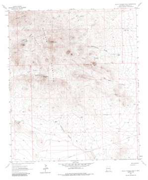
South Pyramid Peak Topo Map New Mexico
To zoom in, hover over the map of South Pyramid Peak
USGS Topo Quad 32108a6 - 1:24,000 scale
| Topo Map Name: | South Pyramid Peak |
| USGS Topo Quad ID: | 32108a6 |
| Print Size: | ca. 21 1/4" wide x 27" high |
| Southeast Coordinates: | 32° N latitude / 108.625° W longitude |
| Map Center Coordinates: | 32.0625° N latitude / 108.6875° W longitude |
| U.S. State: | NM |
| Filename: | o32108a6.jpg |
| Download Map JPG Image: | South Pyramid Peak topo map 1:24,000 scale |
| Map Type: | Topographic |
| Topo Series: | 7.5´ |
| Map Scale: | 1:24,000 |
| Source of Map Images: | United States Geological Survey (USGS) |
| Alternate Map Versions: |
South Pyramid Peak NM 1964, updated 1966 Download PDF Buy paper map South Pyramid Peak NM 1964, updated 1984 Download PDF Buy paper map South Pyramid Peak NM 2010 Download PDF Buy paper map South Pyramid Peak NM 2013 Download PDF Buy paper map South Pyramid Peak NM 2017 Download PDF Buy paper map |
1:24,000 Topo Quads surrounding South Pyramid Peak
> Back to 32108a1 at 1:100,000 scale
> Back to 32108a1 at 1:250,000 scale
> Back to U.S. Topo Maps home
South Pyramid Peak topo map: Gazetteer
South Pyramid Peak: Ranges
Russel Hills elevation 1627m 5337′South Pyramid Peak: Reservoirs
Bigote Tank elevation 1419m 4655′China Pond elevation 1406m 4612′
Double Tanks elevation 1429m 4688′
Ira Tank elevation 1441m 4727′
Middle Tank elevation 1424m 4671′
West Center Tank elevation 1408m 4619′
South Pyramid Peak: Summits
Elephant Back Hill elevation 1600m 5249′Kirk Peak elevation 1628m 5341′
Pinkey Wright Mountain elevation 1642m 5387′
South Pyramid Peak elevation 1782m 5846′
South Pyramid Peak: Wells
Cinco Well elevation 1503m 4931′Hidden Well elevation 1569m 5147′
Hightower Well elevation 1490m 4888′
Hill Well elevation 1540m 5052′
New Well elevation 1543m 5062′
Piedra Wells elevation 1540m 5052′
Pinkey Wright Well elevation 1506m 4940′
Rainbow Well elevation 1512m 4960′
Rattler Well elevation 1462m 4796′
West Baker Well elevation 1395m 4576′
South Pyramid Peak digital topo map on disk
Buy this South Pyramid Peak topo map showing relief, roads, GPS coordinates and other geographical features, as a high-resolution digital map file on DVD:


