Butlers Bay Topo Map South Carolina
To zoom in, hover over the map of Butlers Bay
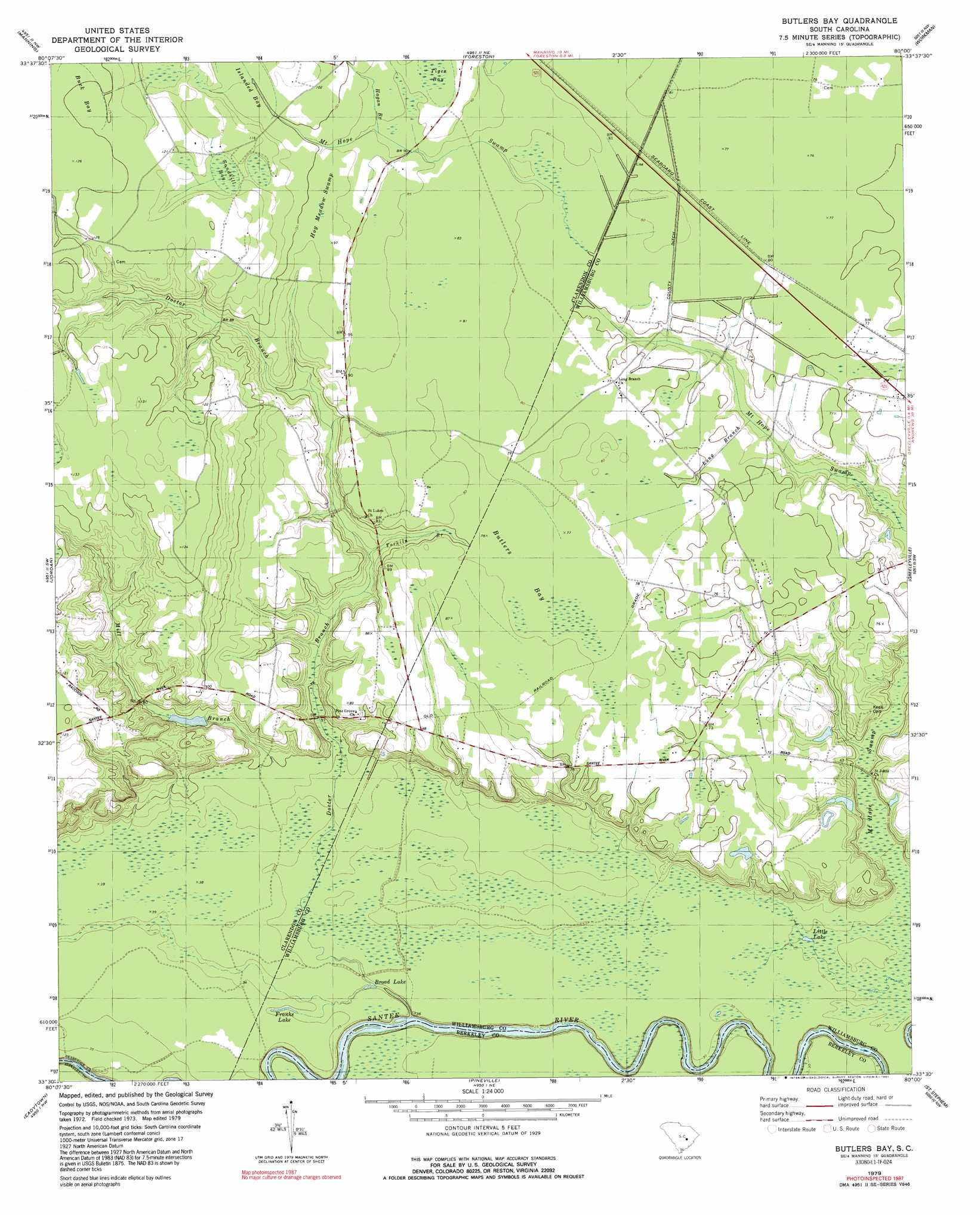
USGS Topo Quad 33080e1 - 1:24,000 scale
| Topo Map Name: | Butlers Bay |
| USGS Topo Quad ID: | 33080e1 |
| Print Size: | ca. 21 1/4" wide x 27" high |
| Southeast Coordinates: | 33.5° N latitude / 80° W longitude |
| Map Center Coordinates: | 33.5625° N latitude / 80.0625° W longitude |
| U.S. State: | SC |
| Filename: | o33080e1.jpg |
| Download Map JPG Image: | Butlers Bay topo map 1:24,000 scale |
| Map Type: | Topographic |
| Topo Series: | 7.5´ |
| Map Scale: | 1:24,000 |
| Source of Map Images: | United States Geological Survey (USGS) |
| Alternate Map Versions: |
Butlers Bay SC 1979, updated 1980 Download PDF Buy paper map Butlers Bay SC 1979, updated 1991 Download PDF Buy paper map Butlers Bay SC 2011 Download PDF Buy paper map Butlers Bay SC 2014 Download PDF Buy paper map |
1:24,000 Topo Quads surrounding Butlers Bay
Brogdon |
Tearcoat Branch |
Sardinia |
Hebron Crossroads |
Lake City West |
Paxville |
Manning |
Foreston |
Workman |
Kingstree |
Summerton |
Jordan |
Butlers Bay |
Greeleyville |
Salters |
Eutawville |
Eadytown |
Pineville |
Saint Stephens |
Blakely |
Sandridge |
Cross |
Chicora |
Bonneau |
Wedboo Creek |
> Back to 33080e1 at 1:100,000 scale
> Back to 33080a1 at 1:250,000 scale
> Back to U.S. Topo Maps home
Butlers Bay topo map: Gazetteer
Butlers Bay: Dams
Riggs Pond Dam D-3507 elevation 37m 121′Butlers Bay: Lakes
Broad Lake elevation 10m 32′Doctor Hole elevation 10m 32′
Franks Lake elevation 10m 32′
Little Lake elevation 9m 29′
Butlers Bay: Reservoirs
Riggs Pond elevation 37m 121′Butlers Bay: Streams
Doctor Branch elevation 6m 19′Highland Creek elevation 9m 29′
Long Branch elevation 19m 62′
Mill Branch elevation 15m 49′
Mount Hope Swamp elevation 10m 32′
Tarkiln Branch elevation 18m 59′
Torkiln Branch elevation 18m 59′
Butlers Bay: Swamps
Buck Bay elevation 38m 124′Butlers Bay elevation 24m 78′
Doctor Hole elevation 10m 32′
Hog Meadow Swamp elevation 29m 95′
Islanded Bay elevation 30m 98′
Sandhill Bay elevation 34m 111′
Tiger Bay elevation 28m 91′
Butlers Bay digital topo map on disk
Buy this Butlers Bay topo map showing relief, roads, GPS coordinates and other geographical features, as a high-resolution digital map file on DVD:
South Carolina, Western North Carolina & Northeastern Georgia
Buy digital topo maps: South Carolina, Western North Carolina & Northeastern Georgia