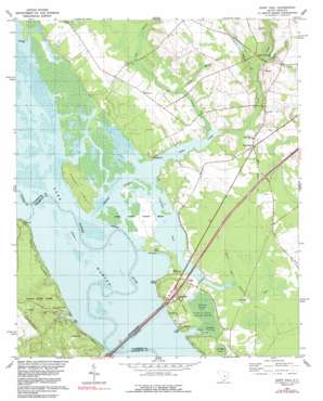
Saint Paul Topo Map South Carolina
To zoom in, hover over the map of Saint Paul
USGS Topo Quad 33080e4 - 1:24,000 scale
| Topo Map Name: | Saint Paul |
| USGS Topo Quad ID: | 33080e4 |
| Print Size: | ca. 21 1/4" wide x 27" high |
| Southeast Coordinates: | 33.5° N latitude / 80.375° W longitude |
| Map Center Coordinates: | 33.5625° N latitude / 80.4375° W longitude |
| U.S. State: | SC |
| Filename: | o33080e4.jpg |
| Download Map JPG Image: | Saint Paul topo map 1:24,000 scale |
| Map Type: | Topographic |
| Topo Series: | 7.5´ |
| Map Scale: | 1:24,000 |
| Source of Map Images: | United States Geological Survey (USGS) |
| Alternate Map Versions: |
Saint Paul SC 1980, updated 1980 Download PDF Buy paper map Saint Paul SC 1980, updated 1991 Download PDF Buy paper map Saint Paul SC 1994, updated 1999 Download PDF Buy paper map Saint Paul SC 2011 Download PDF Buy paper map Saint Paul SC 2014 Download PDF Buy paper map |
1:24,000 Topo Quads surrounding Saint Paul
> Back to 33080e1 at 1:100,000 scale
> Back to 33080a1 at 1:250,000 scale
> Back to U.S. Topo Maps home
Saint Paul topo map: Gazetteer
Saint Paul: Bays
Cantey Bay elevation 23m 75′Saint Paul: Bridges
Francis Marion Bridge elevation 23m 75′W J Gooding Bridge elevation 24m 78′
Saint Paul: Capes
Paradise Point elevation 24m 78′Saint Paul: Crossings
Interchange 102 elevation 31m 101′Pinckneys Old Ferry (historical) elevation 23m 75′
Saint Paul: Dams
South Carolina Noname 14007 D-3500 Dam elevation 40m 131′South Carolina Noname 38081 D-3744 Dam elevation 30m 98′
South Carolina Noname 38082 D-3745 Dam elevation 28m 91′
Saint Paul: Islands
Persanti Island elevation 26m 85′Stave Island (historical) elevation 23m 75′
Saint Paul: Lakes
Brown Lake (historical) elevation 23m 75′Goshing Pond elevation 23m 75′
Polly Cantey Pond elevation 23m 75′
Scotts Lake (historical) elevation 23m 75′
Saint Paul: Parks
Santee State Park elevation 38m 124′Saint Paul: Populated Places
Adams Landing elevation 26m 85′Belser Crossroads elevation 37m 121′
Polly Landing elevation 24m 78′
Saint Paul elevation 28m 91′
Saint Paul: Reservoirs
Dingle Pond elevation 23m 75′Stukes Pond elevation 40m 131′
Saint Paul: Streams
Big Branch elevation 23m 75′Chapel Branch elevation 23m 75′
Jacks Creek elevation 23m 75′
Spring Branch elevation 28m 91′
Spring Branch elevation 24m 78′
Sullivans Branch elevation 27m 88′
Saint Paul: Swamps
Doctor Bay elevation 24m 78′Monkey Bay elevation 24m 78′
Saint Paul digital topo map on disk
Buy this Saint Paul topo map showing relief, roads, GPS coordinates and other geographical features, as a high-resolution digital map file on DVD:
South Carolina, Western North Carolina & Northeastern Georgia
Buy digital topo maps: South Carolina, Western North Carolina & Northeastern Georgia


