Handy Topo Map North Carolina
To zoom in, hover over the map of Handy
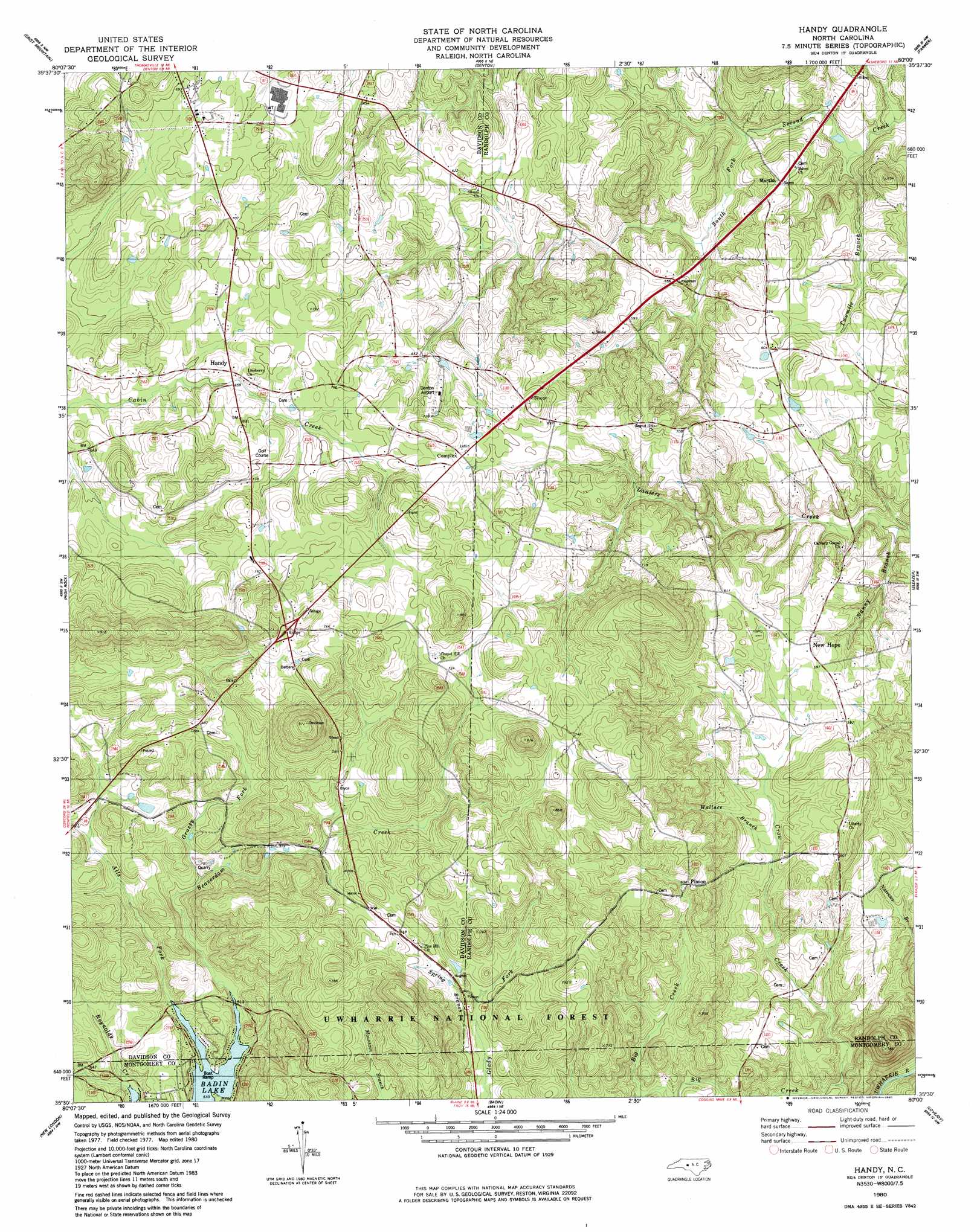
USGS Topo Quad 35080e1 - 1:24,000 scale
| Topo Map Name: | Handy |
| USGS Topo Quad ID: | 35080e1 |
| Print Size: | ca. 21 1/4" wide x 27" high |
| Southeast Coordinates: | 35.5° N latitude / 80° W longitude |
| Map Center Coordinates: | 35.5625° N latitude / 80.0625° W longitude |
| U.S. State: | NC |
| Filename: | o35080e1.jpg |
| Download Map JPG Image: | Handy topo map 1:24,000 scale |
| Map Type: | Topographic |
| Topo Series: | 7.5´ |
| Map Scale: | 1:24,000 |
| Source of Map Images: | United States Geological Survey (USGS) |
| Alternate Map Versions: |
Handy NC 1980, updated 1980 Download PDF Buy paper map Handy NC 1994, updated 1996 Download PDF Buy paper map Handy NC 2011 Download PDF Buy paper map Handy NC 2013 Download PDF Buy paper map Handy NC 2016 Download PDF Buy paper map |
| FStopo: | US Forest Service topo Handy is available: Download FStopo PDF Download FStopo TIF |
1:24,000 Topo Quads surrounding Handy
Lexington West |
Lexington East |
Fair Grove |
Glenola |
Randleman |
Southmont |
Denton Nw |
Denton |
Farmer |
Asheboro |
Gold Hill |
High Rock |
Handy |
Eleazer |
Seagrove |
Richfield |
New London |
Badin |
Lovejoy |
Star |
Frog Pond |
Albemarle |
Morrow Mountain |
Troy |
Biscoe |
> Back to 35080e1 at 1:100,000 scale
> Back to 35080a1 at 1:250,000 scale
> Back to U.S. Topo Maps home
Handy topo map: Gazetteer
Handy: Airports
Denton Airport elevation 217m 711′Handy: Mines
Russels Mine (historical) elevation 157m 515′Handy: Plains
Piedmont Upland elevation 161m 528′Handy: Populated Places
Complex elevation 218m 715′Handy elevation 204m 669′
Martha elevation 172m 564′
New Hope elevation 181m 593′
Pinson elevation 193m 633′
Wind Hill (historical) elevation 212m 695′
Handy: Streams
Alls Fork elevation 154m 505′Beaverdam Creek elevation 154m 505′
Big Creek elevation 118m 387′
Grassy Fork elevation 167m 547′
Nanny Branch elevation 135m 442′
South Fork Second Creek elevation 139m 456′
Spring Branch elevation 178m 583′
Twomile Branch elevation 134m 439′
Vanny Branch elevation 134m 439′
Wallace Branch elevation 158m 518′
Handy digital topo map on disk
Buy this Handy topo map showing relief, roads, GPS coordinates and other geographical features, as a high-resolution digital map file on DVD:
South Carolina, Western North Carolina & Northeastern Georgia
Buy digital topo maps: South Carolina, Western North Carolina & Northeastern Georgia