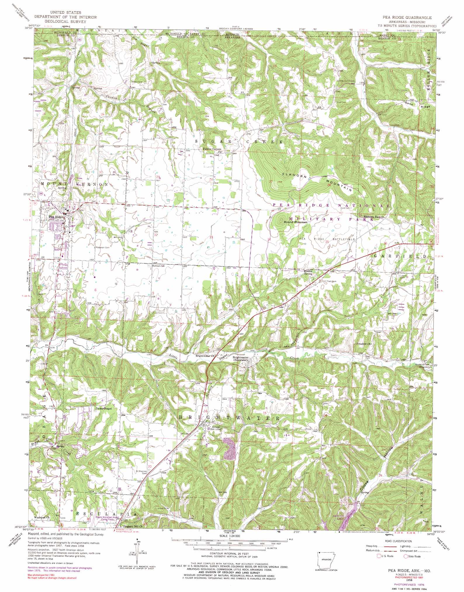
Pea Ridge Topo Map Arkansas
To zoom in, hover over the map of Pea Ridge
USGS Topo Quad 36094d1 - 1:24,000 scale
| Topo Map Name: | Pea Ridge |
| USGS Topo Quad ID: | 36094d1 |
| Print Size: | ca. 21 1/4" wide x 27" high |
| Southeast Coordinates: | 36.375° N latitude / 94° W longitude |
| Map Center Coordinates: | 36.4375° N latitude / 94.0625° W longitude |
| U.S. States: | AR, MO |
| Filename: | o36094d1.jpg |
| Download Map JPG Image: | Pea Ridge topo map 1:24,000 scale |
| Map Type: | Topographic |
| Topo Series: | 7.5´ |
| Map Scale: | 1:24,000 |
| Source of Map Images: | United States Geological Survey (USGS) |
| Alternate Map Versions: |
Pea Ridge AR 1958, updated 1959 Download PDF Buy paper map Pea Ridge AR 1958, updated 1973 Download PDF Buy paper map Pea Ridge AR 1958, updated 1977 Download PDF Buy paper map Pea Ridge AR 1958, updated 1990 Download PDF Buy paper map Pea Ridge AR 2011 Download PDF Buy paper map Pea Ridge AR 2014 Download PDF Buy paper map |
1:24,000 Topo Quads surrounding Pea Ridge
Mcnatt |
Bethpage |
Rocky Comfort |
Exeter |
Cassville |
Jane |
Powell |
Jacket |
Seligman |
Eagle Rock |
Hiwasse |
Bentonville North |
Pea Ridge |
Garfield |
Beaver |
Centerton |
Bentonville South |
Rogers |
War Eagle |
Sandstone Mountain |
Robinson |
Springdale |
Sonora |
Spring Valley |
Hindsville |
> Back to 36094a1 at 1:100,000 scale
> Back to 36094a1 at 1:250,000 scale
> Back to U.S. Topo Maps home
Pea Ridge topo map: Gazetteer
Pea Ridge: Bridges
Brightwater Bridge elevation 368m 1207′Pea Ridge: Parks
Pea Ridge National Military Park elevation 414m 1358′Pea Ridge: Populated Places
Avoca elevation 415m 1361′Brightwater elevation 374m 1227′
Buttry (historical) elevation 420m 1377′
Elkhorn Tavern elevation 453m 1486′
Leetown elevation 424m 1391′
Line Store (historical) elevation 367m 1204′
Pea Ridge elevation 393m 1289′
Pippin (historical) elevation 368m 1207′
Pleasant Hill elevation 407m 1335′
Pea Ridge: Post Offices
Pea Ridge Post Office elevation 393m 1289′Pea Ridge: Springs
Winton Spring elevation 411m 1348′Pea Ridge: Streams
Carden Branch elevation 346m 1135′Pea Ridge: Summits
Elkhorn Mountain elevation 481m 1578′Round Mountain elevation 465m 1525′
Pea Ridge digital topo map on disk
Buy this Pea Ridge topo map showing relief, roads, GPS coordinates and other geographical features, as a high-resolution digital map file on DVD: