Whitesville Topo Map Kentucky
To zoom in, hover over the map of Whitesville
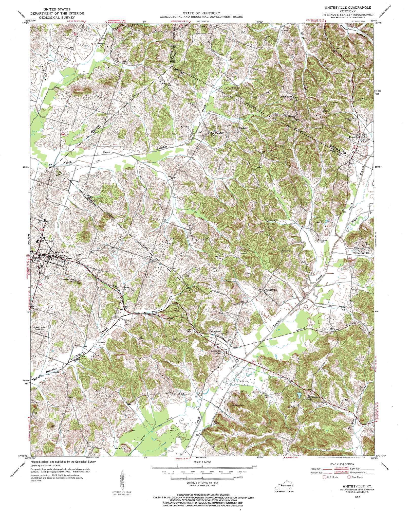
USGS Topo Quad 37086f7 - 1:24,000 scale
| Topo Map Name: | Whitesville |
| USGS Topo Quad ID: | 37086f7 |
| Print Size: | ca. 21 1/4" wide x 27" high |
| Southeast Coordinates: | 37.625° N latitude / 86.75° W longitude |
| Map Center Coordinates: | 37.6875° N latitude / 86.8125° W longitude |
| U.S. State: | KY |
| Filename: | o37086f7.jpg |
| Download Map JPG Image: | Whitesville topo map 1:24,000 scale |
| Map Type: | Topographic |
| Topo Series: | 7.5´ |
| Map Scale: | 1:24,000 |
| Source of Map Images: | United States Geological Survey (USGS) |
| Alternate Map Versions: |
Whitesville KY 1953, updated 1955 Download PDF Buy paper map Whitesville KY 2010 Download PDF Buy paper map Whitesville KY 2013 Download PDF Buy paper map Whitesville KY 2016 Download PDF Buy paper map |
1:24,000 Topo Quads surrounding Whitesville
Rockport |
Lewisport |
Tell City |
Cannelton |
Rome |
Owensboro East |
Maceo |
Pellville |
Cloverport |
Mattingly |
Sutherland |
Philpot |
Whitesville |
Fordsville |
Glen Dean |
Utica |
Pleasant Ridge |
Dundee |
Olaton |
Falls Of Rough |
Equality |
Hartford |
Horton |
Rosine |
Spring Lick |
> Back to 37086e1 at 1:100,000 scale
> Back to 37086a1 at 1:250,000 scale
> Back to U.S. Topo Maps home
Whitesville topo map: Gazetteer
Whitesville: Canals
Carter Ditch elevation 131m 429′Whitesville: Populated Places
Aetnaville elevation 147m 482′Deanefield elevation 138m 452′
Haynesville elevation 145m 475′
Herbert elevation 162m 531′
Roseville elevation 156m 511′
Whitesville elevation 152m 498′
Whitesville: Streams
North Branch South Fork Panther Creek elevation 138m 452′South Branch South Fork Panther Creek elevation 138m 452′
Whitesville digital topo map on disk
Buy this Whitesville topo map showing relief, roads, GPS coordinates and other geographical features, as a high-resolution digital map file on DVD: