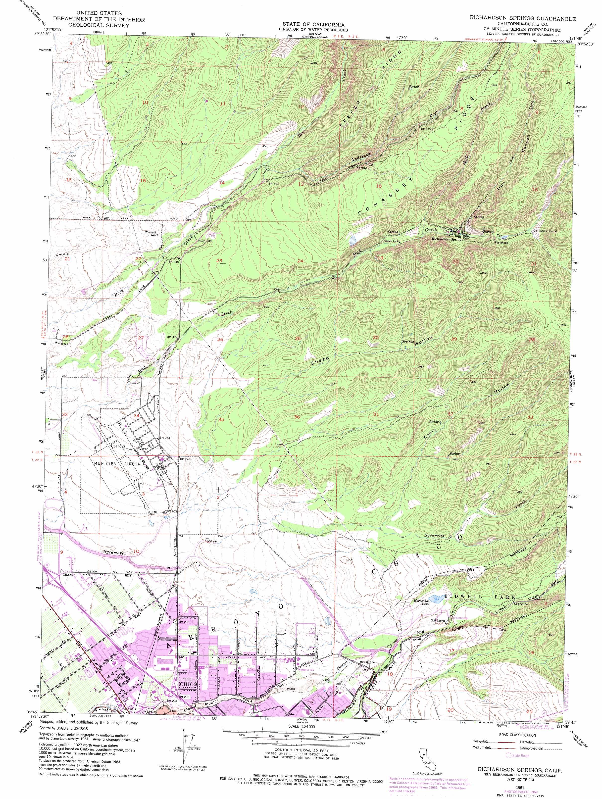
Richardson Springs Topo Map California
To zoom in, hover over the map of Richardson Springs
USGS Topo Quad 39121g7 - 1:24,000 scale
| Topo Map Name: | Richardson Springs |
| USGS Topo Quad ID: | 39121g7 |
| Print Size: | ca. 21 1/4" wide x 27" high |
| Southeast Coordinates: | 39.75° N latitude / 121.75° W longitude |
| Map Center Coordinates: | 39.8125° N latitude / 121.8125° W longitude |
| U.S. State: | CA |
| Filename: | o39121g7.jpg |
| Download Map JPG Image: | Richardson Springs topo map 1:24,000 scale |
| Map Type: | Topographic |
| Topo Series: | 7.5´ |
| Map Scale: | 1:24,000 |
| Source of Map Images: | United States Geological Survey (USGS) |
| Alternate Map Versions: |
Richardson Springs CA 1951, updated 1953 Download PDF Buy paper map Richardson Springs CA 1951, updated 1962 Download PDF Buy paper map Richardson Springs CA 1951, updated 1970 Download PDF Buy paper map Richardson Springs CA 1951, updated 1985 Download PDF Buy paper map Richardson Springs CA 1951, updated 1985 Download PDF Buy paper map Richardson Springs CA 2012 Download PDF Buy paper map Richardson Springs CA 2015 Download PDF Buy paper map |
1:24,000 Topo Quads surrounding Richardson Springs
Los Molinos |
Acorn Hollow |
Ishi Caves |
Devils Parade Ground |
Butte Meadows |
Vina |
Richardson Springs Nw |
Campbell Mound |
Cohasset |
Stirling City |
Foster Island |
Nord |
Richardson Springs |
Paradise West |
Paradise East |
Hamilton City |
Ord Ferry |
Chico |
Hamlin Canyon |
Cherokee |
Glenn |
Llano Seco |
Nelson |
Shippee |
Oroville |
> Back to 39121e1 at 1:100,000 scale
> Back to 39120a1 at 1:250,000 scale
> Back to U.S. Topo Maps home
Richardson Springs topo map: Gazetteer
Richardson Springs: Airports
Chico Municipal Airport elevation 67m 219′Richardson Springs: Lakes
Horseshoe Lake elevation 101m 331′Richardson Springs: Parks
Bidwell Park elevation 127m 416′Bidwell River Park elevation 68m 223′
Richardson Springs: Populated Places
Richardson Springs elevation 189m 620′Richardson Springs: Ridges
Cohasset Ridge elevation 432m 1417′Keefer Ridge elevation 361m 1184′
Richardson Springs: Springs
Cohasset Pioneers Spring elevation 279m 915′Richardson Springs: Streams
Anderson Fork elevation 132m 433′Cave Creek elevation 177m 580′
Maple Branch elevation 150m 492′
Richardson Springs: Valleys
Cabin Hollow elevation 98m 321′Iron Canyon elevation 177m 580′
Sheep Hollow elevation 68m 223′
Richardson Springs digital topo map on disk
Buy this Richardson Springs topo map showing relief, roads, GPS coordinates and other geographical features, as a high-resolution digital map file on DVD: