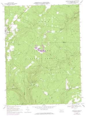
Marienville East Topo Map Pennsylvania
To zoom in, hover over the map of Marienville East
USGS Topo Quad 41079d1 - 1:24,000 scale
| Topo Map Name: | Marienville East |
| USGS Topo Quad ID: | 41079d1 |
| Print Size: | ca. 21 1/4" wide x 27" high |
| Southeast Coordinates: | 41.375° N latitude / 79° W longitude |
| Map Center Coordinates: | 41.4375° N latitude / 79.0625° W longitude |
| U.S. State: | PA |
| Filename: | o41079d1.jpg |
| Download Map JPG Image: | Marienville East topo map 1:24,000 scale |
| Map Type: | Topographic |
| Topo Series: | 7.5´ |
| Map Scale: | 1:24,000 |
| Source of Map Images: | United States Geological Survey (USGS) |
| Alternate Map Versions: |
Marienville East PA 1967, updated 1971 Download PDF Buy paper map Marienville East PA 1967, updated 1973 Download PDF Buy paper map Marienville East PA 1967, updated 1984 Download PDF Buy paper map Marienville East PA 2011 Download PDF Buy paper map Marienville East PA 2013 Download PDF Buy paper map Marienville East PA 2016 Download PDF Buy paper map |
| FStopo: | US Forest Service topo Marienville East is available: Download FStopo PDF Download FStopo TIF |
1:24,000 Topo Quads surrounding Marienville East
> Back to 41079a1 at 1:100,000 scale
> Back to 41078a1 at 1:250,000 scale
> Back to U.S. Topo Maps home
Marienville East topo map: Gazetteer
Marienville East: Dams
Penelec Retention Dam elevation 474m 1555′Marienville East: Parks
Buzzard Swamp Coop Wildlife Management Area elevation 497m 1630′Marienville East: Populated Places
Lamonaville elevation 513m 1683′Loleta elevation 411m 1348′
Marienville elevation 528m 1732′
McCrays elevation 538m 1765′
Marienville East: Streams
Brush Creek elevation 413m 1354′Crooked Run elevation 495m 1624′
Dry Run elevation 407m 1335′
Gurgling Run elevation 477m 1564′
Jakes Run elevation 435m 1427′
Jakes Run elevation 426m 1397′
Laurel Run elevation 398m 1305′
Lick Run elevation 420m 1377′
Log Run elevation 410m 1345′
McCray Run elevation 500m 1640′
Muddy Fork elevation 450m 1476′
Scott Run elevation 494m 1620′
Shippen Run elevation 389m 1276′
Steck Run elevation 462m 1515′
Sugarcamp Run elevation 407m 1335′
Trout Run elevation 469m 1538′
Marienville East: Swamps
Buzzard Swamp elevation 491m 1610′Marienville East: Trails
Loleta Interpretive Trail elevation 479m 1571′Songbird Station Interpretive Trail elevation 527m 1729′
Marienville East digital topo map on disk
Buy this Marienville East topo map showing relief, roads, GPS coordinates and other geographical features, as a high-resolution digital map file on DVD:


