Andover Topo Map Iowa
To zoom in, hover over the map of Andover
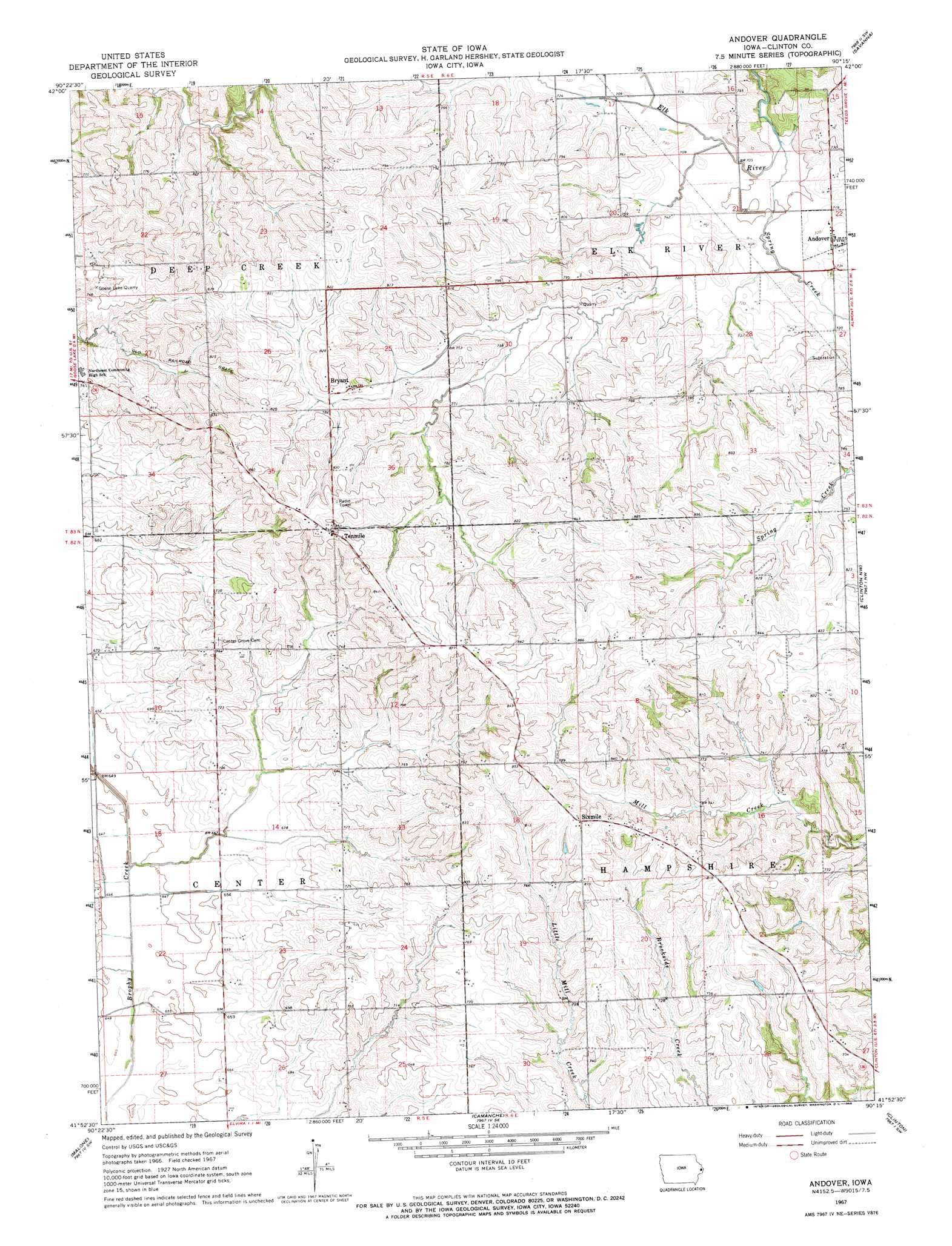
USGS Topo Quad 41090h3 - 1:24,000 scale
| Topo Map Name: | Andover |
| USGS Topo Quad ID: | 41090h3 |
| Print Size: | ca. 21 1/4" wide x 27" high |
| Southeast Coordinates: | 41.875° N latitude / 90.25° W longitude |
| Map Center Coordinates: | 41.9375° N latitude / 90.3125° W longitude |
| U.S. State: | IA |
| Filename: | o41090h3.jpg |
| Download Map JPG Image: | Andover topo map 1:24,000 scale |
| Map Type: | Topographic |
| Topo Series: | 7.5´ |
| Map Scale: | 1:24,000 |
| Source of Map Images: | United States Geological Survey (USGS) |
| Alternate Map Versions: |
Andover IA 1967, updated 1969 Download PDF Buy paper map Andover IA 2010 Download PDF Buy paper map Andover IA 2013 Download PDF Buy paper map Andover IA 2015 Download PDF Buy paper map |
1:24,000 Topo Quads surrounding Andover
Andrew |
Springbrook |
Green Island |
Blackhawk |
Pleasant Valley |
Delmar North |
Preston |
Miles |
Savanna |
Wacker |
Delmar South |
Goose Lake |
Andover |
Clinton Nw |
Thomson |
De Witt |
Malone |
Camanche |
Clinton |
Union Grove |
Eldridge |
Mccausland |
Cordova |
Erie Nw |
Erie |
> Back to 41090e1 at 1:100,000 scale
> Back to 41090a1 at 1:250,000 scale
> Back to U.S. Topo Maps home
Andover topo map: Gazetteer
Andover: Mines
Goose Lake Quarry elevation 219m 718′Andover: Populated Places
Andover elevation 222m 728′Bryant elevation 245m 803′
Sixmile elevation 252m 826′
Tenmile elevation 263m 862′
Andover: Post Offices
Andover Post Office elevation 222m 728′Bryant Post Office elevation 245m 803′
Andover digital topo map on disk
Buy this Andover topo map showing relief, roads, GPS coordinates and other geographical features, as a high-resolution digital map file on DVD: