Le Dout Creek Topo Map Washington
To zoom in, hover over the map of Le Dout Creek
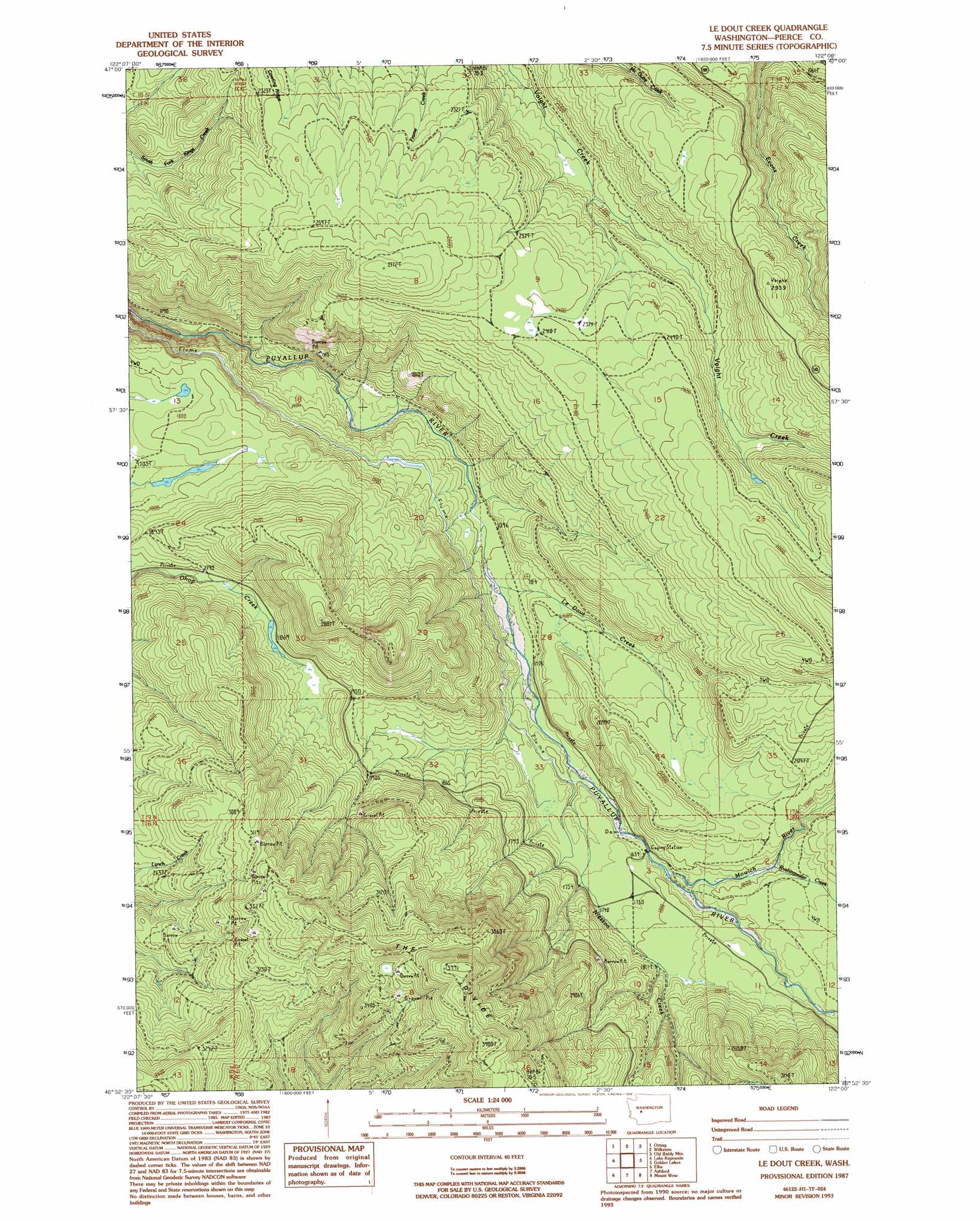
USGS Topo Quad 46122h1 - 1:24,000 scale
| Topo Map Name: | Le Dout Creek |
| USGS Topo Quad ID: | 46122h1 |
| Print Size: | ca. 21 1/4" wide x 27" high |
| Southeast Coordinates: | 46.875° N latitude / 122° W longitude |
| Map Center Coordinates: | 46.9375° N latitude / 122.0625° W longitude |
| U.S. State: | WA |
| Filename: | o46122h1.jpg |
| Download Map JPG Image: | Le Dout Creek topo map 1:24,000 scale |
| Map Type: | Topographic |
| Topo Series: | 7.5´ |
| Map Scale: | 1:24,000 |
| Source of Map Images: | United States Geological Survey (USGS) |
| Alternate Map Versions: |
Le Dout Creek WA 1987, updated 1987 Download PDF Buy paper map Le Dout Creek WA 1987, updated 1994 Download PDF Buy paper map Le Dout Creek WA 2011 Download PDF Buy paper map Le Dout Creek WA 2013 Download PDF Buy paper map |
1:24,000 Topo Quads surrounding Le Dout Creek
Puyallup |
Sumner |
Buckley |
Enumclaw |
Cyclone Creek |
Frederickson |
Orting |
Wilkeson |
Old Baldy Mountain |
Bearhead Mountain |
Tanwax Lake |
Lake Kapowsin |
Le Dout Creek |
Golden Lakes |
Mowich Lake |
Eatonville |
Elbe |
Ashford |
Mount Wow |
Mount Rainier West |
The Rockies |
Mineral |
Anderson Lake |
Sawtooth Ridge |
Wahpenayo Peak |
> Back to 46122e1 at 1:100,000 scale
> Back to 46122a1 at 1:250,000 scale
> Back to U.S. Topo Maps home
Le Dout Creek topo map: Gazetteer
Le Dout Creek: Canals
Electron Flume elevation 478m 1568′Le Dout Creek: Dams
Electron Diversion Dam elevation 492m 1614′Le Dout Creek: Lakes
Ohop Creek Ponds elevation 572m 1876′Le Dout Creek: Ridges
The Divide elevation 1220m 4002′Le Dout Creek: Streams
Kellog Creek elevation 434m 1423′Le Dout Creek elevation 434m 1423′
Mowich River elevation 511m 1676′
Niesson Creek elevation 478m 1568′
Rushingwater Creek elevation 546m 1791′
Le Dout Creek digital topo map on disk
Buy this Le Dout Creek topo map showing relief, roads, GPS coordinates and other geographical features, as a high-resolution digital map file on DVD: