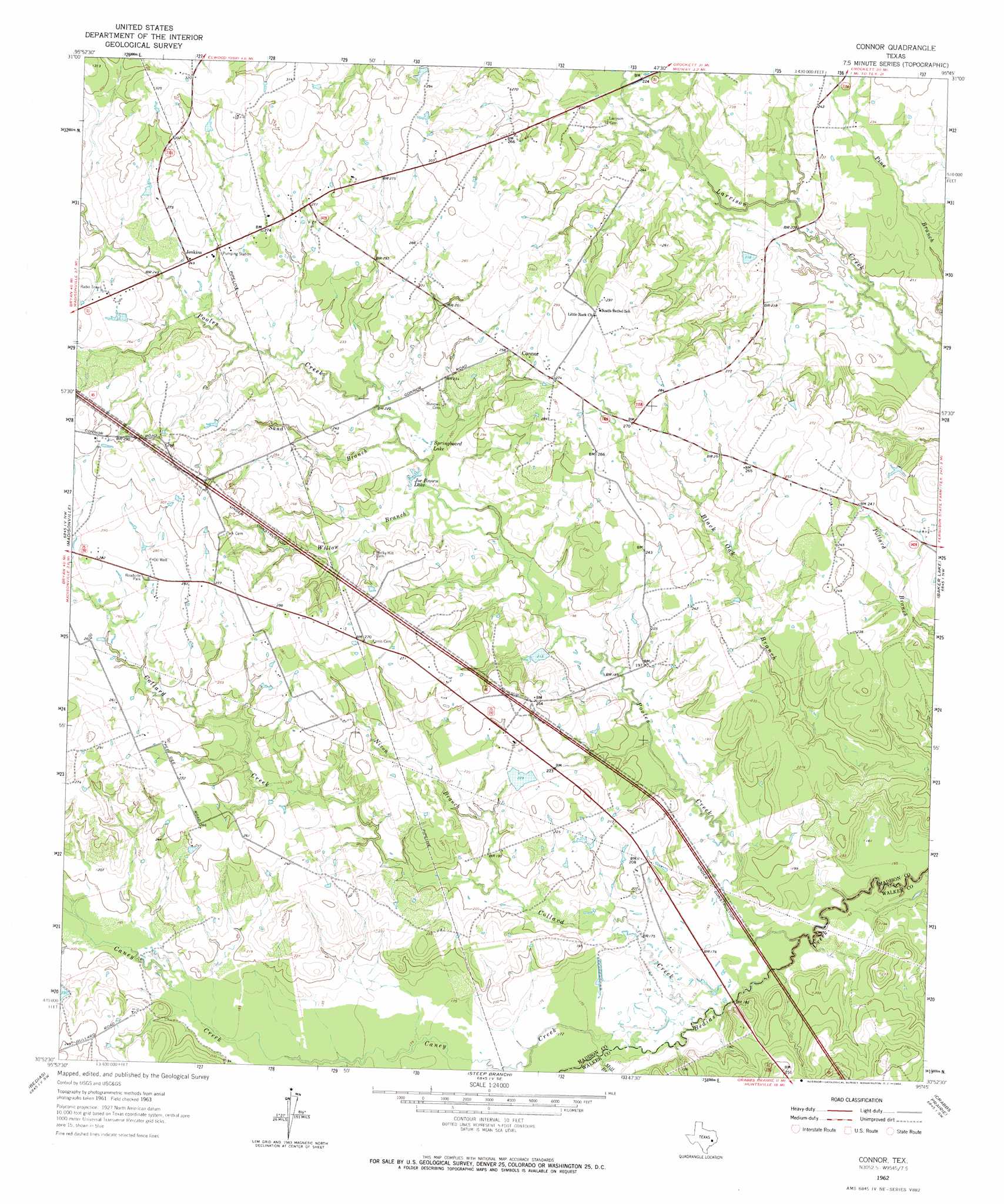
Connor Topo Map Texas
To zoom in, hover over the map of Connor
USGS Topo Quad 30095h7 - 1:24,000 scale
| Topo Map Name: | Connor |
| USGS Topo Quad ID: | 30095h7 |
| Print Size: | ca. 21 1/4" wide x 27" high |
| Southeast Coordinates: | 30.875° N latitude / 95.75° W longitude |
| Map Center Coordinates: | 30.9375° N latitude / 95.8125° W longitude |
| U.S. State: | TX |
| Filename: | o30095h7.jpg |
| Download Map JPG Image: | Connor topo map 1:24,000 scale |
| Map Type: | Topographic |
| Topo Series: | 7.5´ |
| Map Scale: | 1:24,000 |
| Source of Map Images: | United States Geological Survey (USGS) |
| Alternate Map Versions: |
Connor TX 1962, updated 1964 Download PDF Buy paper map Connor TX 2010 Download PDF Buy paper map Connor TX 2013 Download PDF Buy paper map Connor TX 2016 Download PDF Buy paper map |
1:24,000 Topo Quads surrounding Connor
Spring Seat |
Leona |
Middleton |
Austonio |
Pearsons Chapel |
Normangee |
Leona Sw |
Elwood |
Sand Ridge |
Weldon |
North Zulch |
Madisonville |
Connor |
Baker Lake |
Wyser Bottom |
Iola |
Bedias |
Steep Branch |
Crabbs Prairie |
Pine Prairie |
Keith |
Singleton |
Loma |
Galilee |
Huntsville |
> Back to 30095e1 at 1:100,000 scale
> Back to 30094a1 at 1:250,000 scale
> Back to U.S. Topo Maps home
Connor topo map: Gazetteer
Connor: Dams
Burke-Sullivan Lake Dam elevation 63m 206′Spurlock Lake Dam elevation 70m 229′
Connor: Lakes
Joe Brown Lake elevation 64m 209′Springboard Lake elevation 66m 216′
Connor: Populated Places
Connor elevation 79m 259′Jenkins elevation 76m 249′
Connor: Reservoirs
Burke-Sullivan Lake elevation 63m 206′Spurlock Lake elevation 70m 229′
Connor: Streams
Caney Creek elevation 50m 164′Collard Creek elevation 49m 160′
Mill Branch elevation 50m 164′
Nixon Branch elevation 58m 190′
Pooles Creek elevation 45m 147′
Sand Branch elevation 64m 209′
Willow Branch elevation 63m 206′
Connor digital topo map on disk
Buy this Connor topo map showing relief, roads, GPS coordinates and other geographical features, as a high-resolution digital map file on DVD: