Middleton Topo Map Texas
To zoom in, hover over the map of Middleton
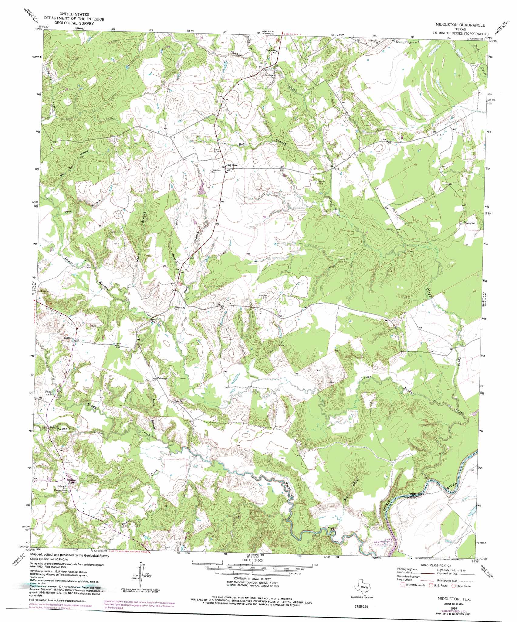
USGS Topo Quad 31095b7 - 1:24,000 scale
| Topo Map Name: | Middleton |
| USGS Topo Quad ID: | 31095b7 |
| Print Size: | ca. 21 1/4" wide x 27" high |
| Southeast Coordinates: | 31.125° N latitude / 95.75° W longitude |
| Map Center Coordinates: | 31.1875° N latitude / 95.8125° W longitude |
| U.S. State: | TX |
| Filename: | o31095b7.jpg |
| Download Map JPG Image: | Middleton topo map 1:24,000 scale |
| Map Type: | Topographic |
| Topo Series: | 7.5´ |
| Map Scale: | 1:24,000 |
| Source of Map Images: | United States Geological Survey (USGS) |
| Alternate Map Versions: |
Middleton TX 1964, updated 1967 Download PDF Buy paper map Middleton TX 1964, updated 1974 Download PDF Buy paper map Middleton TX 1964, updated 1992 Download PDF Buy paper map Middleton TX 2010 Download PDF Buy paper map Middleton TX 2013 Download PDF Buy paper map Middleton TX 2016 Download PDF Buy paper map |
1:24,000 Topo Quads surrounding Middleton
Buffalo |
Flo |
Lake Leon |
Stanmire Lake |
Hays Spring |
Robbins |
Centerville |
Eunice |
Halls Bluff |
Porter Springs |
Spring Seat |
Leona |
Middleton |
Austonio |
Pearsons Chapel |
Normangee |
Leona Sw |
Elwood |
Sand Ridge |
Weldon |
North Zulch |
Madisonville |
Connor |
Baker Lake |
Wyser Bottom |
> Back to 31095a1 at 1:100,000 scale
> Back to 31094a1 at 1:250,000 scale
> Back to U.S. Topo Maps home
Middleton topo map: Gazetteer
Middleton: Airports
Moore Ranch Airport elevation 91m 298′Middleton: Dams
Taylor Lake Dam elevation 86m 282′Middleton: Lakes
Grass Lake elevation 62m 203′Middleton: Populated Places
Guys Store elevation 89m 291′Middleton elevation 81m 265′
Spillers Store elevation 87m 285′
Middleton: Reservoirs
Taylor Lake elevation 86m 282′Middleton: Streams
Bear Branch elevation 58m 190′Bob Branch elevation 64m 209′
Caney Creek elevation 52m 170′
Clapps Creek elevation 44m 144′
Dry Branch elevation 73m 239′
Flat Branch elevation 64m 209′
Haley Branch elevation 61m 200′
Jones Branch elevation 52m 170′
Lower Keechi Creek elevation 40m 131′
Pine Branch elevation 64m 209′
Turkey Lake Branch elevation 78m 255′
Twomile Creek elevation 54m 177′
Middleton: Valleys
Red Hollow elevation 44m 144′Red Oak Hollow elevation 65m 213′
Middleton digital topo map on disk
Buy this Middleton topo map showing relief, roads, GPS coordinates and other geographical features, as a high-resolution digital map file on DVD: