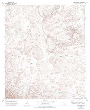
Emory Corral Topo Map Texas
To zoom in, hover over the map of Emory Corral
USGS Topo Quad 31104e5 - 1:24,000 scale
| Topo Map Name: | Emory Corral |
| USGS Topo Quad ID: | 31104e5 |
| Print Size: | ca. 21 1/4" wide x 27" high |
| Southeast Coordinates: | 31.5° N latitude / 104.5° W longitude |
| Map Center Coordinates: | 31.5625° N latitude / 104.5625° W longitude |
| U.S. State: | TX |
| Filename: | o31104e5.jpg |
| Download Map JPG Image: | Emory Corral topo map 1:24,000 scale |
| Map Type: | Topographic |
| Topo Series: | 7.5´ |
| Map Scale: | 1:24,000 |
| Source of Map Images: | United States Geological Survey (USGS) |
| Alternate Map Versions: |
Emory Corral TX 1973, updated 1976 Download PDF Buy paper map Emory Corral TX 2010 Download PDF Buy paper map Emory Corral TX 2012 Download PDF Buy paper map Emory Corral TX 2016 Download PDF Buy paper map |
1:24,000 Topo Quads surrounding Emory Corral
> Back to 31104e1 at 1:100,000 scale
> Back to 31104a1 at 1:250,000 scale
> Back to U.S. Topo Maps home
Emory Corral topo map: Gazetteer
Emory Corral: Ranges
Delaware Mountains elevation 1588m 5209′Emory Corral: Reservoirs
Antelope Tank elevation 1451m 4760′Barstow Tank elevation 1422m 4665′
Big Tank elevation 1389m 4557′
Broke Tank elevation 1357m 4452′
Cargile Tank elevation 1495m 4904′
Carr Tanks elevation 1482m 4862′
Dog Tank elevation 1338m 4389′
Frijole Tank elevation 1391m 4563′
JD Tank elevation 1500m 4921′
Lower Calhoun Tank elevation 1488m 4881′
Pecos Tank elevation 1473m 4832′
Sifford Tank elevation 1453m 4767′
Stevens Tank elevation 1378m 4520′
White Tank elevation 1518m 4980′
Emory Corral: Valleys
Emory Draw elevation 1489m 4885′Emory Corral digital topo map on disk
Buy this Emory Corral topo map showing relief, roads, GPS coordinates and other geographical features, as a high-resolution digital map file on DVD:


