Delaware Ranch Topo Map Texas
To zoom in, hover over the map of Delaware Ranch
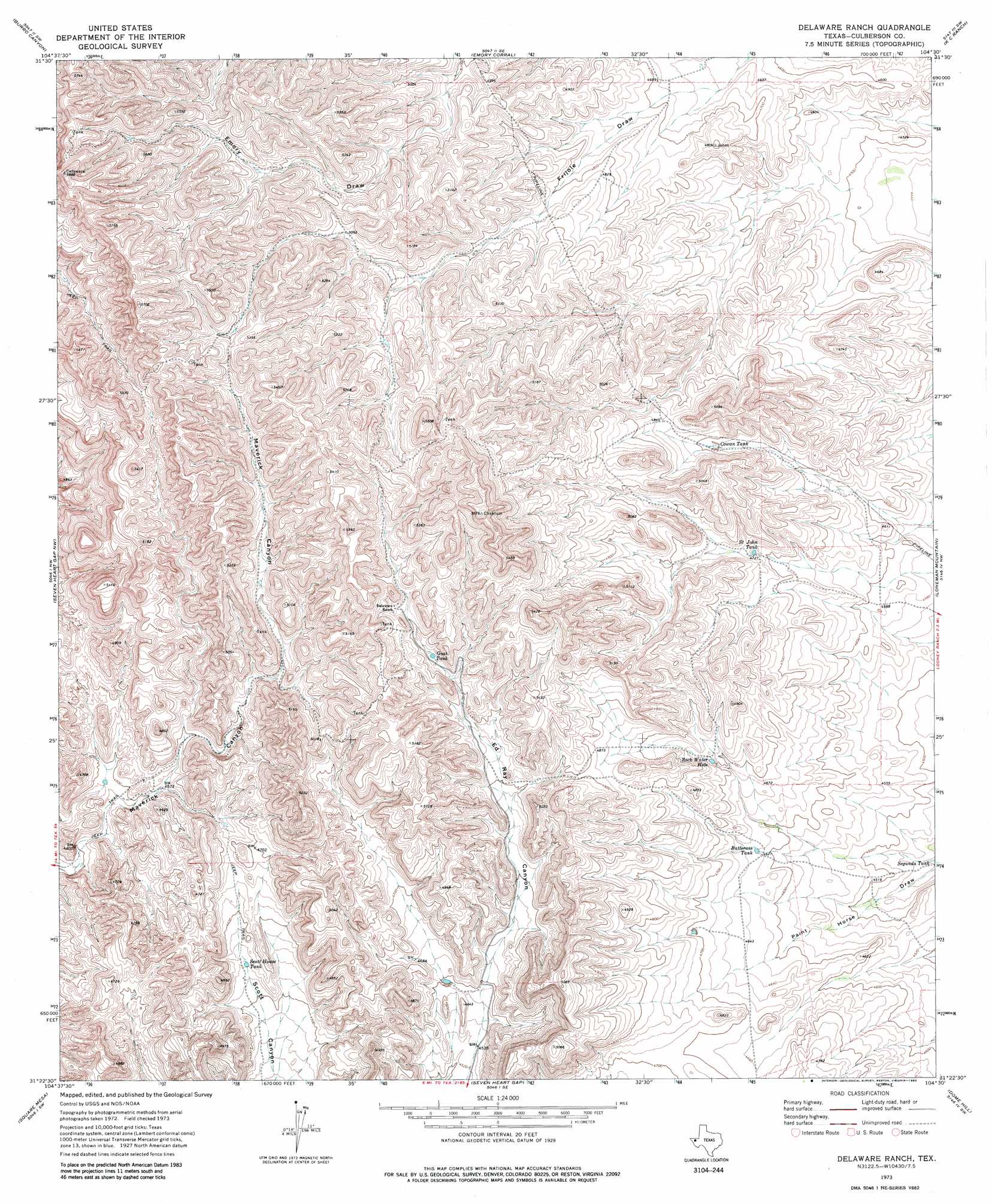
USGS Topo Quad 31104d5 - 1:24,000 scale
| Topo Map Name: | Delaware Ranch |
| USGS Topo Quad ID: | 31104d5 |
| Print Size: | ca. 21 1/4" wide x 27" high |
| Southeast Coordinates: | 31.375° N latitude / 104.5° W longitude |
| Map Center Coordinates: | 31.4375° N latitude / 104.5625° W longitude |
| U.S. State: | TX |
| Filename: | o31104d5.jpg |
| Download Map JPG Image: | Delaware Ranch topo map 1:24,000 scale |
| Map Type: | Topographic |
| Topo Series: | 7.5´ |
| Map Scale: | 1:24,000 |
| Source of Map Images: | United States Geological Survey (USGS) |
| Alternate Map Versions: |
Delaware Ranch TX 1973, updated 1976 Download PDF Buy paper map Delaware Ranch TX 2010 Download PDF Buy paper map Delaware Ranch TX 2013 Download PDF Buy paper map Delaware Ranch TX 2016 Download PDF Buy paper map |
1:24,000 Topo Quads surrounding Delaware Ranch
Six Bar Ranch |
Chico Draw West |
Chico Draw East |
Seven L Peak |
Seven L Peak Ne |
Bitter Well Mountain |
Burro Canyon |
Emory Corral |
Kc Ranch |
Two Mill Draw West |
Figure Two Ranch |
Seven Heart Gap Nw |
Delaware Ranch |
Loneman Mountain |
Dellahunt Draw West |
Victorio Peak |
Square Mesa |
Seven Heart Gap |
Dome Hill |
Hopper Draw West |
Nutt Ranch |
Watson Ranch |
Goat Canyon |
East Hunter Canyon |
Panther Canyon |
> Back to 31104a1 at 1:100,000 scale
> Back to 31104a1 at 1:250,000 scale
> Back to U.S. Topo Maps home
Delaware Ranch topo map: Gazetteer
Delaware Ranch: Bays
Rock Water Hole elevation 1439m 4721′Delaware Ranch: Reservoirs
Butterass Tank elevation 1408m 4619′Cowan Tank elevation 1464m 4803′
Delaware Ranch Tank elevation 1540m 5052′
Goat Tank elevation 1510m 4954′
Saint John Tank elevation 1437m 4714′
Scott House Tank elevation 1387m 4550′
Segunda Tank elevation 1354m 4442′
Delaware Ranch digital topo map on disk
Buy this Delaware Ranch topo map showing relief, roads, GPS coordinates and other geographical features, as a high-resolution digital map file on DVD: